Voll, Akershus | |
---|---|
Village | |
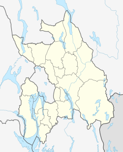
Location in Akershus | |
Coordinates: 59°55′49″N10°37′19″E / 59.9302°N 10.6219°E | |
Country | Norway |
Region | Østlandet |
County | Akershus |
Municipality | Bærum |
Time zone | UTC+01:00 (CET) |
• Summer (DST) | UTC+02:00 (CEST) |
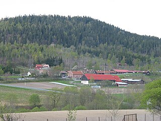
Voll is a district in eastern Bærum, Norway.
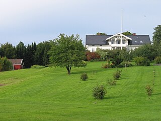
The district Voll was built around the farm of the same name. The farm was mentioned as Vælli in 1398, Woldt in 1578, Wold in 1723 and later Vold. It belonged to the St. Hallvard's Cathedral (now in ruins) during the Middle Ages, and later the state church. In the middle of the seventeenth century the farm came on the hands of bailiff Paul Iversen Vold (1595–1682), who owned several farms in Bærum. In 1721 the farm was separated into two; Nedre and Øvre (Lower and Upper) Wold. The latter farm developed into a district of its own, Øvrevoll. In 1835 the former croft Rugland was separated from Nedre Vold. [1] [2] [3] Today, Øvrevoll and Voll are sometimes referred to as one district. [4] Voll borders Øvrevoll in the north and west, Jar in the south and west and the river Lysakerelva in the east.
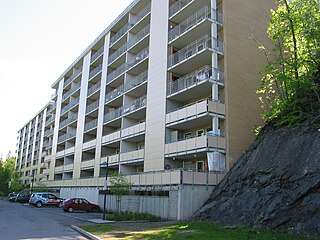
In 1826 the farm was registered as having 105 decares of crop, two horses, six cattle and nine sheep. This was considerably less than Øvre Vold. The farm also has a history of limestone burning; it contributed limestone to the erection of Akershus Fortress in 1602. However, the limestone was not collected at the farm land, but at Fornebo. [1] Agricultural production on the farm continued well into the twentieth century, especially after horticulturalist Edv. Ellingsen bought the farm in 1921. It was later built up with housing. [5]
The farm's communications had been drastically improved in 1872, when the road Vollsveien from Lysaker opened. The main purpose was to aid the timber industry around the river Lysakerelva. Vollsveien was connected to Norwegian National Road 168 around 1930. [4] The area is served by line 131 of Ruter's bus network.
Institutions located at Voll include the Finnish Evangelical-Lutheran Congregation in Norway, Finnish : Norjan suomalainen evankelis-luterilainen seurakunta. The local sports team is Øvrevoll Hosle IL.
Bernt Holtsmark was a Norwegian farmer and politician for the Conservative Party and the Liberal Left Party. He was a four-term member of the Parliament of Norway, and served as Minister of Agriculture from 1910 to 1912. He was also known for establishing the agricultural college at Sem in his native Asker.
Halvor Stenstadvold is a Norwegian businessperson and politician for the Conservative Party. A political scientist by education, he spent most of his career in the Federation of Norwegian Industries and Orkla Group. He has also been the chair of the Norwegian Broadcasting Corporation, the Research Council of Norway and the Oslo Stock Exchange. As a politician he has been acting mayor of Bærum municipality as well as State Secretary.
Carl Herman Halvorsen was a Norwegian jurist and politician.
Skallum is an area at Stabekk in Bærum, Norway. It was named after the historic estate Skallum. It is known locally for its art gallery and as a recreational area, and nationally as the site of an event in the closing days of World War II in Europe.
Leif Andreas Larsen was a Norwegian telegrapher and politician for the Labour Party.
Ringstabekk is a district in Bærum, Norway. Named after the local farm, the district is also known for its schools and the sports field. The sports club Stabæk IF originates in the area.
Øverland is an area in Bærum, Norway. Named after the local farm, Øverland is also known as a recreational area and for its arboretum. It has lent its name to the river Øverlandselva.
Bent Holtsmark (1823–1903) was a Norwegian agriculturalist and politician.
Homewood is a property in Sandvika, Bærum, Norway. It is known historically as the home of Otto Sverdrup, and has been municipal-owned since 1962.
Skytterdalen is a small, populated valley north of Sandvika in Bærum, Norway.
Grini is a district in northeastern Bærum, Norway.
Ramstad is a district in central Bærum, Norway. It is known mainly for its school and a former station on the Drammen Line.
Polhøgda is the home of the Fridtjof Nansen Institute. It was originally built as the private home of Norwegian explorer Fridtjof Nansen. The manor home's architecture is Roman Revival, and the former estate lies between Lysaker and Fornebu in Bærum, Norway.
Nadderud is a district in eastern Bærum, Norway. It was formerly farmland under one of Bærum's larger farms, named Nadderud, but since the 1950s it has been built up with housing, several schools and sporting facilities. The best known facility, which has made the name Nadderud nationally known, is the stadium Nadderud stadion. Parts of the district Nadderud have been absorbed by the growing suburban centre Bekkestua.
Gjønnes is a district in eastern Bærum, Norway.
Øvrevoll is a district in eastern Bærum, Norway.
Idrettslaget Jardar is a Norwegian sports club from Bærum, Akershus. It covers the areas Slependen, Jong and Tanum.
Jar Idrettslag is a Norwegian sports club from Bærum, Akershus. It mainly covers the areas Jar, Lysaker and parts of Stabekk.
Frithjof Møinichen Plahte was a Norwegian merchant and landowner. After a career in the timber business, he settled in Bærum where he invested in business and in several farms. His family socialized within the upper echelon in the capital city region, and he stood behind the establishment of Høvik Church and the use of Fleskum farm by a group of painters.
Einar von Hirsch was a Norwegian dentist and landowner.