
Vest-Agder was one of 18 counties (fylker) in Norway up until 1 January 2020, when it was merged with Aust-Agder to form Agder county. In 2016, there were 182,701 inhabitants, around 3.5% of the total population of Norway. Its area was about 7,277 square kilometres (2,810 sq mi). The county administration was located in its largest city, Kristiansand.

Songdalen is a former municipality in the old Vest-Agder county, Norway. The municipality existed from 1964 until 2020 when it was merged with Søgne and Kristiansand municipalities to form a new, much larger Kristiansand municipality in what is now Agder county. It was located in the traditional district of Sørlandet, just outside of the city of Kristiansand. The administrative centre of the municipality was the village of Nodeland. Other villages in the municipality included Brennåsen, Finsland, Kilen, Nodelandsheia, and Volleberg. The Sørlandsbanen railway line ran through the municipality, stopping at Nodeland Station. The European route E39 highway also ran through the southern part of the municipality.

Kristiansand is a seaside resort city and municipality in Agder county, Norway. The city is the fifth-largest and the municipality the sixth-largest in Norway, with a population of around 112,000 as of January 2020, following the incorporation of the municipalities of Søgne and Songdalen into the greater Kristiansand municipality. In addition to the city itself, Statistics Norway counts four other densely populated areas in the municipality: Skålevik in Flekkerøy with a population of 3,526 in the Vågsbygd borough, Strai with a population of 1,636 in the Grim borough, Justvik with a population of 1,803 in the Lund borough, and Tveit with a population of 1,396 in the Oddernes borough. Kristiansand is divided into five boroughs: Grim, which is located northwest in Kristiansand with a population of 15,000; Kvadraturen, which is the centre and downtown Kristiansand with a population of 5,200; Lund, the second largest borough; Søgne, with a population of around 12,000 and incorporated into the municipality of Kristiansand as of January 2020; Oddernes, a borough located in the west; and Vågsbygd, the largest borough with a population of 36,000, located in the southwest.

Kristiansand Region is a statistical metropolitan region in Agder county in southern Norway. It is centered on the city of Kristiansand. The region consist of six municipalities in the centre of Southern Norway. Vennesla, Iveland, and Birkenes are inland municipalities while Kristiansand, Lindesnes, and Lillesand are coastal municipalities. Kristiansand is the largest municipality in population in the region.
Southern Norway is the geographical region (landsdel) along the Skagerrak coast of southern Norway. The region is an informal description since it does not have any governmental function. It roughly corresponds to the old petty kingdom of Agder as well as the two former counties of Vest-Agder and Aust-Agder. From New Year 2020, the two counties have been merged into one county, Agder. The total combined area of Vest-Agder and Aust-Agder counties is 16,493 square kilometres (6,368 sq mi). The name is relatively new, having first been used in Norway around 1900.

The Diocese of Agder og Telemark is a diocese of the Church of Norway, covering all of Agder county and most of Vestfold og Telemark county in Norway. The cathedral city is Kristiansand, Norway's fifth largest city. Kristiansand Cathedral serves as the seat of the presiding Bishop. The bishop since 2013 has been Stein Reinertsen. As of 1 January 2003, there were 347,324 members of the Church of Norway in the diocese.

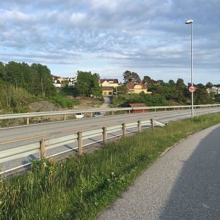
Justvik or Gjusvik is a village and district in the municipality of Kristiansand in Vest-Agder county, Norway. Its population is 2,770. The village of Justvik is located on the west shore of the Topdalsfjorden, just north of the lake Gillsvannet.

Grønningen Lighthouse is a coastal lighthouse in the municipality of Kristiansand in Agder county, Norway. The lighthouse was built in 1878 to improve the marking of the shipping lane into Kristiansand harbor. In 1842, the Russian ship-of-the-line Ingermanland had collided with the Grønningen islet, leading to a catastrophe. The current lighthouse sits on Grønningen, a bare islet in the Kristiansandsfjord, and it marks the eastern side of the main shipping channel that leads inland to the port of the city of Kristiansand. The other lighthouse, which marks the western entrance, Oksøy Lighthouse, lies about 2.2 kilometres (1.4 mi) to the west.

Vågsbygd is a borough and district in the city of Kristiansand which lies in the municipality of Kristiansand in Agder county, Norway. It is the largest borough and district in Kristiansand. Until 1965, Vågsbygd was a part of Oddernes municipality. The borough includes the districts of Flekkerøy, Voiebyen, Vågsbygd/Augland, and Slettheia. The Kristiansand Cannon Museum on Kroodden is an authentic fortress from World War II.

Lund is a borough and district in the city of Kristiansand which lies in the municipality of Kristiansand in Agder county, Norway. It is the second largest borough in the city after Vågsbygd. In 2015, the population was about 30,000. Lund is divided into 4 districts: Lund (centrum), Gimlekollen, Justvik, and Ålefjær.

Voiebyen is a district in the city of Kristiansand in Agder county, Norway. The district has a population of about 6,000 people in 2014 and it is a part of the borough of Vågsbygd in the southwestern part of the city. The district of Vågsbygd lies to the north, and the district of Flekkerøy lies to the south on the island of Flekkerøya.
Kvadraturen is a borough in the city centre of the city of Kristiansand which lies in the municipality of Kristiansand in Agder county, Norway. It has a population of 6,750 (2015). The borough is made up of the centre together with the harbour to the south and the more rural district of "Eg" to the north. Kvadraturen is the administrative centre of the municipality of Kristiansand as well as the administrative centre of Vest-Agder county, but is far smaller in area than the other boroughs in the municipality, such as the borough of Grim to the north and west, and the borough of Lund to the east.

Gimlekollen is a district in the city of Kristiansand in Agder county, Norway. It is a part of the borough of Lund. The district of Justvik lies to the north, the district of Lund (centrum) lies to the west and southwest, and the Topdalsfjorden lies to the east. NLA Media college is located in Gimlekollen. The lakes Vollevannet and Gillsvannet lie in the district.

Rona is a neighborhood in the city of Kristiansand in Agder county, Norway. It is a part of the Oddernes borough and the district of Søm. The neighbourhood is next to European route E18, and spans the Indre Rona strait between Drangsvatna lake and the Topdalsfjorden. The neighborhood of Strømsdalen lies to the north and Strømme lies to the south. The closest school is Strømme Elementary school. All local bus lines goes through Rona.

Tømmerstø is a neighbourhood in the city of Kristiansand in Agder county, Norway. It's located in the borough of Oddernes and in the district of Randesund. The neighborhood of Odderhei lies to the northwest, Holte and Frikstad lie to the northeast, and Kongshavn lies to the southeast.

Nordlia is a neighborhood in the city of Kristiansand in Agder county, Norway. It is a part of the Oddernes borough and the district of Søm. Nordlia is located on the eastern shore of the Topdalsfjorden at the eastern end of the Varodd Bridge in the northern part of Søm. The neighborhoods of Rona and Strømme lie to the east.
Kongshavn is a neighbourhood in the city of Kristiansand in Agder county, Norway. It's located in the borough of Oddernes and in the district of Randesund. The neighborhood of Frikstad lies to the north and Tømmerstø lies to the northwest. Kongshavn Pier is a large harbor with connections to islands outside of Randesund.
Holte is a neighbourhood in the city of Kristiansand in Agder county, Norway. It's located in the borough of Oddernes and in the district of Randesund. The neighborhood of Tømmerstø lies to the south and Frikstad lies to the east. Holte Junior High is the only junior high in Randesund.

Gillsvannet or Gjelsvannet is a freshwater lake in the municipality of Kristiansand in Agder county, Norway. The 1.05-square-kilometre (260-acre) lake is located about 5 kilometres (3.1 mi) northeast of downtown Kristiansand, along to County Road 452. The lake lies about 300 metres (980 ft) west of the Topdalsfjorden, at an elevation of about 1 metre above sea level. There is a practice range for kayaking on the lake as well as many areas used for swimming during the summer season. The Gimlekollen district lies on the southern shore of the lake and the village of Justvik lies just north of the lake.


