Vostochny District

Last updated

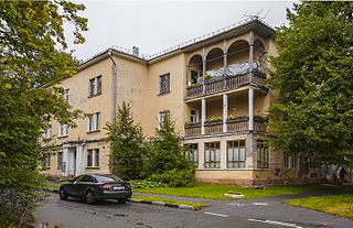
Vostochny District is the name of several administrative and municipal districts in Russia. The name literally means " eastern ".

Russia transcontinental country in Eastern Europe and Northern Asia

Russia, officially the Russian Federation, is a transcontinental country in Eastern Europe and North Asia. At 17,125,200 square kilometres (6,612,100 sq mi), Russia is by far or by a considerable margin the largest country in the world by area, covering more than one-eighth of the Earth's inhabited land area, and the ninth most populous, with about 146.77 million people as of 2019, including Crimea. About 77% of the population live in the western, European part of the country. Russia's capital, Moscow, is one of the largest cities in the world and the second largest city in Europe; other major cities include Saint Petersburg, Novosibirsk, Yekaterinburg and Nizhny Novgorod. Extending across the entirety of Northern Asia and much of Eastern Europe, Russia spans eleven time zones and incorporates a wide range of environments and landforms. From northwest to southeast, Russia shares land borders with Norway, Finland, Estonia, Latvia, Lithuania and Poland, Belarus, Ukraine, Georgia, Azerbaijan, Kazakhstan, China, Mongolia and North Korea. It shares maritime borders with Japan by the Sea of Okhotsk and the U.S. state of Alaska across the Bering Strait. However, Russia recognises two more countries that border it, Abkhazia and South Ossetia, both of which are internationally recognized as parts of Georgia.

Contents

Districts of the federal subjects

Location of Moscow in Russia Map of Russia - Moscow (federal city) (2008-03).svg
Location of Moscow in Russia
Vostochny District, Moscow District in Moscow, Russia

Vostochny District, Moscow is an administrative district (raion) of Eastern Administrative Okrug, and one of the 125 raions of Moscow, Russia.

Eastern Administrative Okrug Administrative okrug of Moscow in Russia

Eastern Administrative Okrug, or Vostochny Administrative Okrug, is one of the twelve high-level territorial divisions of the federal city of Moscow, Russia. As of the 2010 Census, its population was 1,452,759, up from 1,394,497 recorded during the 2002 Census.

Moscow Capital city of Russia

Moscow is the capital and most populous city of Russia, with 13.2 million residents within the city limits, 17 million within the urban area and 20 million within the metropolitan area. Moscow is one of Russia's federal cities.

City divisions

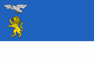
Belgorod City in Belgorod Oblast, Russia

Belgorod is a city and the administrative center of Belgorod Oblast, Russia, located on the Seversky Donets River 40 kilometers (25 mi) north of the border with Ukraine. Population: 356,402 (2010 Census); 337,030 (2002 Census); 300,408 (1989 Census).

Belgorod Oblast First-level administrative division of Russia

Belgorod Oblast is a federal subject of Russia. Its administrative center is the city of Belgorod. Population: 1,532,526.

Novorossiysk City in Krasnodar Krai, Russia

Novorossiysk is a city in Krasnodar Krai, Russia. It is the country's main port on the Black Sea and the leading Russian port for exporting grain. It is one of the few cities honored with the title of the Hero City. Population: 241,952 (2010 Census); 232,079 (2002 Census); 185,938 (1989 Census).

Historical city divisions

Biysk City in Altai Krai, Russia

Biysk is a city in Altai Krai, Russia, located on the Biya River not far from its confluence with the Katun River. It is the second largest city of the krai. Population: 210,115 (2010 Census); 218,562 (2002 Census); 233,238 (1989 Census).

Altai Krai First-level administrative division of Russia

Altai Krai is a federal subject of Russia. It borders with the regions of, clockwise from the west, Kazakhstan, Novosibirsk and Kemerovo Oblasts, and the Altai Republic. The krai's administrative center is the city of Barnaul. As of the 2010 Census, the population of the krai was 2,419,755.

See also

Related Research Articles

Alexeyevsky District is the name of several administrative and municipal districts in Russia. The districts' name generally derives from or is related to the male first name Alexey.

Dmitrovsky District Wikipedia disambiguation page

Dmitrovsky District is the name of several administrative and municipal districts in Russia. The districts' name generally derives from or is related to the male first name Dmitry.

Kalininsky District is the name of several administrative and municipal districts in Russia. The districts are generally named for Mikhail Kalinin, a Soviet statesman.

Pervomaysky District is the name of several administrative and municipal divisions of Russia. The districts are generally named for International Workers' Day, which is celebrated on May 1.

Levoberezhny District is the name of several administrative and municipal districts in Russia. The name literally means "located on the left bank".

Lomonosovsky District Wikimedia disambiguation page

Lomonosovsky District is the name of several administrative and municipal districts in Russia. The districts are generally named for Mikhail Lomonosov, a Russian polymath.

Moskovsky District is the name of several administrative and municipal divisions in Russia. The districts are generally named for Moscow, the capital of Russia.

Promyshlenny City District Wikipedia disambiguation page

Promyshlenny City District is the name of several city divisions in Russia. The name literally means "industrial".

Tsentralny District, Russia Wikipedia disambiguation page

Tsentralny District is the name of several administrative and municipal divisions in Russia. The name literally means "Central".

Babushkinsky District Wikimedia disambiguation page

Babushkinsky District is the name of several administrative and municipal districts in Russia.
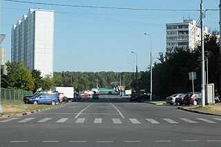
Orekhovo-Borisovo Yuzhnoye District District in Federal city of Moscow, Russia

Orekhovo-Borisovo Yuzhnoye District is a territorial division in Southern Administrative Okrug, one of the 125 in the federal city of Moscow, Russia. It is located in the south of the federal city. The area of the district is 7.197 square kilometers (2.779 sq mi). As of the 2010 Census, the total population of the district was 145,588.

Gagarinsky District Wikipedia disambiguation page

Gagarinsky District is the name of several administrative and municipal districts in Russia.

Ryazansky District Wikimedia disambiguation page

Ryazansky District is the name of several administrative and municipal districts in Russia:

South-Eastern Administrative Okrug, or Yugo-Vostochny Administrative Okrug, is one of the twelve high-level territorial divisions of the federal city of Moscow, Russia. As of the 2010 Census, its population was 1,318,885, up from 1,109,121 recorded during the 2002 Census.

Leninsky District is the name of several administrative and municipal divisions in Russia. The districts are generally named for Vladimir Lenin, the founder of the Soviet state.

Mozhaysky District Wikipedia disambiguation page

Mozhaysky District is the name of several administrative and municipal districts in Russia:

Biryulyovo Vostochnoye District District in Federal city of Moscow, Russia

Biryulyovo Vostochnoye District is a territorial division in Southern Administrative Okrug, one of the 125 in the federal city of Moscow, Russia. It is located in the south of the federal city. The area of the district is 14.772 square kilometers (5.704 sq mi). As of the 2010 Census, the total population of the district was 145,100.

Biryulyovo Zapadnoye District District in Federal city of Moscow, Russia

Biryulyovo Zapadnoye District is a territorial division in Southern Administrative Okrug, one of the 125 in the federal city of Moscow, Russia. It is located in the south of the federal city. The area of the district is 8.5064 square kilometers (3.2843 sq mi). As of the 2010 Census, the total population of the district was 85,726.

Chertanovo Severnoye District District in Federal city of Moscow, Russia

Chertanovo Severnoye District is a territorial division in Southern Administrative Okrug, one of the 125 in the federal city of Moscow, Russia. It is located in the south of the federal city. The area of the district is 5.4015 square kilometers (2.0855 sq mi). As of the 2010 Census, the total population of the district was 111,875.

References

  1. Московская городская Дума. Закон №13-47 от 5 июля 1995 г. «О территориальном делении города Москвы», в ред. Закона №38 от 26 июня 2013 г. «О внесении изменений в статью 4 Закона города Москвы от 5 июля 1995 г. №13-47 "О территориальном делении города Москвы" и Закон города Москвы от 15 октября 2003 года №59 "О наименованиях и границах внутригородских муниципальных образований в городе Москве"». Вступил в силу с момента опубликования. Опубликован: "Вестник Мэрии Москвы", №14, июль 1995. (Moscow City Duma. Law #13-47 of July 5, 1995 On the Territorial Division of the City of Moscow, as amended by the Law #38 of June 26, 2013 On Amending Article 4 of the Law of the City of Moscow of July 5, 1995 #13-47 "On the Territorial Division of the City of Moscow" and the Law of the City of Moscow of October 15, 2003 #59 "On the Names and Borders of the Internal Municipal Formations in the City of Moscow". Effective as of the moment of publication.).
  2. 1 2 Изменения в административно-территориальном устройстве субъектов Российской Федерации за 1989-2002 годы (in Russian)
  3. Городская Дума муниципального образования город Новороссийск. Решение №538 от 19 февраля 2008 г. «Устав муниципального образования город Новороссийск», в ред. Решения №654 от 27 января 2009 г «О внесении изменений и дополнений в Устав муниципального образования город Новороссийск». Вступил в силу со дня официального опубликования, за исключением отдельных положений, для которых пунктом 2 статьи 86 предусмотрены иные сроки вступления в силу. Опубликован: "Новороссийские вести", №31, 8 апреля 2008 г. (City Duma of the Municipal Formation of the City of Novorossiysk. Decision #538 of February 19, 2008 Charter of the Municipal Formation of the City of Novorossiysk, as amended by the Decision #654 of January 29, 2009 On Amending and Supplementing the Charter of the Municipal Formation of the City of Novorossiysk. Effective as of the day of the official publication, with the exception of certain clauses for which item 2 of Article 86 specifies other dates of taking effect.).
  4. Тюменская городская Дума. Решение №174 от 31 марта 2005 г. «Об установлении границ территорий административных округов города Тюмени», в ред. Решения №444 от 25 февраля 2010 г «О внесении изменений в Решение Тюменской городской Думы от 31.03.2005 №174 "Об установлении границ территорий административных округов города Тюмени"». Опубликован: "Тюменский курьер", №75–76, 11 июня 2005 г. (Tyumen City Duma. Decision #174 of March 31, 2005 On Establishing the Borders of the Territories of the Administrative Okrugs of the City of Tyumen, as amended by the Decision #444 of February 25, 2010 On Amending the Decision of Tyumen City Duma #174 of March 31, 2005 "On Establishing the Borders of the Territories of the Administrative Okrugs of the City of Tyumen. ).
  5. Исполнительный комитет Алтайского краевого Совета народных депутатов. Архивный отдел Алтайского края. "Справочник административно-территориальных изменений на Алтае 1917–1980". Алтайское книжное издательство. Барнаул, 1987. Стр. 359