Vrouwenakker | |
---|---|
Hamlet | |
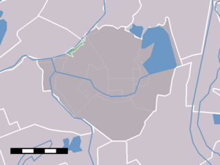
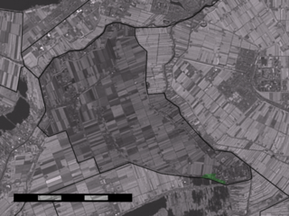
The village (dark red) and the statistical district (light green) of Vrouwenakker in the former municipality of Liemeer. | |
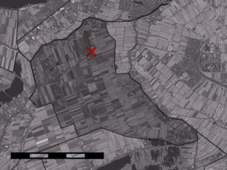
Coordinates: 52°13′41″N4°47′2″E / 52.22806°N 4.78389°E Coordinates: 52°13′41″N4°47′2″E / 52.22806°N 4.78389°E | |
Country | Netherlands |
Province | South Holland |
Municipality | Nieuwkoop |
Population (2007) | |
• Total | 310 |
Time zone | CET (UTC+1) |
• Summer (DST) | CEST (UTC+2) |
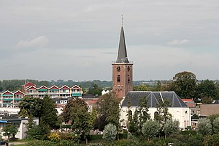
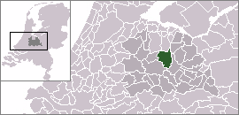
Vrouwenakker is a village in the Netherlands, about 12 km southeast of Hoofddorp. It lies largely in the municipality of Nieuwkoop (formerly Liemeer), in the province of South Holland, but a small part lies in the municipality of Uithoorn, in North Holland. Until 1989 Vrouwenakker was part of the municipality of Mijdrecht, but was then rearranged into the municipality of Liemeer after the amalgamation of Mijdrecht and surrounding municipalities.
The Netherlands is a country located mainly in Northwestern Europe. The European portion of the Netherlands consists of twelve separate provinces that border Germany to the east, Belgium to the south, and the North Sea to the northwest, with maritime borders in the North Sea with Belgium, Germany and the United Kingdom. Together with three island territories in the Caribbean Sea—Bonaire, Sint Eustatius and Saba— it forms a constituent country of the Kingdom of the Netherlands. The official language is Dutch, but a secondary official language in the province of Friesland is West Frisian.
Hoofddorp is the main town of the Haarlemmermeer municipality in the province of North Holland in the Netherlands. In 2009, the population was just over 73,000. The town was founded in 1853, immediately after the Haarlemmermeer had been drained. Hoofddorp is located 52° 18′ 21.96″ N and 4° 41′ 26.52″ E.
Nieuwkoop is a town and municipality in the western Netherlands, in the province of South Holland. The municipality was enlarged on 1 January 2007, through the amalgamation of Liemeer and Ter Aar. The municipality now covers an area of 91.16 km2 (35.20 sq mi) of which 12.28 km2 (4.74 sq mi) is water. Its population was 28,115 in 2017.
The statistical area "Vrouwenakker", which contains the part of the village in South Holland and the surrounding countryside, has a population of around 310. [1]
South Holland is a province of the Netherlands with a population of just over 3.6 million as of 2015 and a population density of about 1,300/km2 (3,400/sq mi), making it the country's most populous province and one of the world's most densely populated areas. Situated on the North Sea in the west of the Netherlands, South Holland covers an area of 3,403 km2 (1,314 sq mi), of which 585 km2 (226 sq mi) is water. It borders North Holland to the north, Utrecht and Gelderland to the east, and North Brabant and Zeeland to the south. The provincial capital is The Hague, while its largest city is Rotterdam.
De Lier is a village in the Dutch province of South Holland. It is a part of the municipality of Westland, and lies about 5 km north of Maassluis. It also lies about 6 feet (1.8 m) below sea level.
Naaldwijk is a town in the Dutch province of South Holland. It is a part of the municipality of Westland, and lies about 10 km southwest of The Hague.
Wateringen is a town in the Dutch province of South Holland. It is a part of the municipality of Westland, and lies about 5 km southwest of The Hague.
The Amstel is a river in the Netherlands which flows from Nieuwveen to Amsterdam, where it meets the IJ bay. The city of Amsterdam took its name from the river.
Mijdrecht is a town in the Netherlands with about 15,000 residents. It located in the municipality of De Ronde Venen, about 7 kilometres (4.3 mi) west of the main A2 motorway, between Utrecht and Amsterdam.
Ouderkerk aan de Amstel is a village in the Dutch province of North Holland. It is largely a part of the municipality of Ouder-Amstel, and lies about 9 km south of Amsterdam. A small part of the town lies in the municipality of Amstelveen. It is connected to Amsterdam by the river Amstel. There is another village called Ouderkerk in South-Holland, Ouderkerk aan den IJssel.
Westbroek is a village in the Dutch province of Utrecht. It is a part of the municipality of De Bilt, and lies about 6 km northwest of Bilthoven.
Amstelhoek is a village in the Dutch province of Utrecht. It is in the municipality of De Ronde Venen, about 3 km (1.9 mi) northwest of Mijdrecht. Amstelhoek lies on the river Amstel, directly across from Uithoorn.
Paterswolde is a town in the Dutch province of Drenthe. It is a part of the municipality of Tynaarlo, and lies about 8 km south of Groningen.
Molenaarsgraaf is a village in the Dutch province of South Holland. It is a part of the municipality of Molenwaard, and lies about 11 km west of Gorinchem.
Ottoland is a village in the Dutch province of South Holland. It is a part of the municipality of Molenwaard, and lies about 15 km northwest of Gorinchem.
Oud-Alblas is a village in the Dutch province of South Holland. It is a part of the municipality of Molenwaard, and lies about 6 km north of Dordrecht.
Wijngaarden is a village in the Dutch province of South Holland. It is a part of the municipality of Molenwaard, and lies about 7 km northeast of Dordrecht.
Haastrecht is a town on the Hollandse IJssel river in the Dutch province of South Holland. It is a part of the municipality of Krimpenerwaard, and lies about 5 km east of Gouda.
Piershil is a village in the Dutch province of South Holland. It is a part of the municipality of Korendijk, and lies about 5 km south of Spijkenisse.
Woerdense Verlaat is a village in the Dutch province of South Holland. It is a part of the municipality of Nieuwkoop, and lies about 8 km north of Woerden.
Blokland is a hamlet in the Dutch province of South Holland. It is a part of the municipality of Liemeer, and lies about 12 km northeast of Alphen aan den Rijn.
Nieuwveen is a town in the Dutch province of South Holland, located close to the border of province North Holland, about 35 kilometers southwest of the city of Amsterdam. It is a part of the municipality of Nieuwkoop, and lies about 9 kilometers northeast of Alphen aan den Rijn.
Noordse Dorp is a village in the Dutch province of South Holland. It is a part of the municipality of Liemeer, and lies about 10 km north of Woerden.
This South Holland location article is a stub. You can help Wikipedia by expanding it. |