
Trzepieciny is a village in the administrative district of Gmina Adamów, within Zamość County, Lublin Voivodeship, in eastern Poland. It lies approximately 2 kilometres (1 mi) southwest of Adamów, 18 km (11 mi) southwest of Zamość, and 84 km (52 mi) southeast of the regional capital Lublin.
Bereść is a village in the administrative district of Gmina Grabowiec, within Zamość County, Lublin Voivodeship, in eastern Poland. It lies approximately 27 kilometres (17 mi) east of Zamość and 89 km (55 mi) south-east of the regional capital Lublin.
Świdniki is a village in the administrative district of Gmina Miączyn, within Zamość County, Lublin Voivodeship, in eastern Poland. It lies approximately 22 kilometres (14 mi) north-east of Zamość and 84 km (52 mi) south-east of the regional capital Lublin.
Nawóz is a village in the administrative district of Gmina Nielisz, within Zamość County, Lublin Voivodeship, in eastern Poland. It lies approximately 20 kilometres (12 mi) north-west of Zamość and 59 km (37 mi) south-east of the regional capital Lublin.
Chomęciska Duże is a village in the administrative district of Gmina Stary Zamość, within Zamość County, Lublin Voivodeship, in eastern Poland. It lies approximately 2 kilometres (1 mi) south-east of Stary Zamość, 11 km (7 mi) north-west of Zamość, and 65 km (40 mi) south-east of the regional capital Lublin.
Krasne is a village in the administrative district of Gmina Stary Zamość, within Zamość County, Lublin Voivodeship, in eastern Poland. It lies approximately 8 kilometres (5 mi) north of Stary Zamość, 18 km (11 mi) north of Zamość, and 60 km (37 mi) south-east of the regional capital Lublin.
Stary Zamość is a village in Zamość County, Lublin Voivodeship, in eastern Poland. It is the seat of the gmina called Gmina Stary Zamość. It lies approximately 11 kilometres (7 mi) north-west of Zamość and 65 km (40 mi) south-east of the regional capital Lublin.
Udrycze is a village in the administrative district of Gmina Stary Zamość, within Zamość County, Lublin Voivodeship, in eastern Poland. It lies approximately 9 kilometres (6 mi) east of Stary Zamość, 9 km (6 mi) north of Zamość, and 71 km (44 mi) south-east of the regional capital Lublin.

Bortatycze is a village in the administrative district of Gmina Zamość, within Zamość County, Lublin Voivodeship, in eastern Poland. It lies approximately 8 kilometres (5 mi) north-west of Zamość and 69 km (43 mi) south-east of the regional capital Lublin.

Hubale is a village in the administrative district of Gmina Zamość, within Zamość County, Lublin Voivodeship, in eastern Poland. It lies approximately 8 kilometres (5 mi) south-west of Zamość and 76 km (47 mi) south-east of the regional capital Lublin.
Lipsko is a village in the administrative district of Gmina Zamość, within Zamość County, Lublin Voivodeship, in eastern Poland. It lies approximately 8 kilometres (5 mi) south of Zamość and 81 km (50 mi) south-east of the regional capital Lublin.
Lipsko-Kosobudy is a village in the administrative district of Gmina Zamość, within Zamość County, Lublin Voivodeship, in eastern Poland. It lies approximately 8 kilometres (5 mi) south of Zamość and 81 km (50 mi) south-east of the regional capital Lublin.
Lipsko-Polesie is a village in the administrative district of Gmina Zamość, within Zamość County, Lublin Voivodeship, in eastern Poland. It lies approximately 10 kilometres (6 mi) south-west of Zamość and 81 km (50 mi) south-east of the regional capital Lublin.
Majdanek is a village in the administrative district of Gmina Zamość, within Zamość County, Lublin Voivodeship, in eastern Poland. It lies approximately 8 kilometres (5 mi) south-west of Zamość and 80 km (50 mi) south-east of the regional capital Lublin.
Siedliska is a village in the administrative district of Gmina Zamość, within Zamość County, Lublin Voivodeship, in eastern Poland. It lies approximately 8 kilometres (5 mi) west of Zamość and 71 km (44 mi) south-east of the regional capital Lublin.
Topornica is a village in the administrative district of Gmina Zamość, within Zamość County, Lublin Voivodeship, in eastern Poland. It lies approximately 8 kilometres (5 mi) south-west of Zamość and 79 km (49 mi) south-east of the regional capital Lublin.
Wierzchowiny is a village in the administrative district of Gmina Zamość, within Zamość County, Lublin Voivodeship, in eastern Poland. It lies approximately 13 kilometres (8 mi) south-west of Zamość and 80 km (50 mi) south-east of the regional capital Lublin.
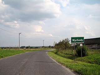
Wychody is a village in the administrative district of Gmina Zamość, within Zamość County, Lublin Voivodeship, in eastern Poland. It lies approximately 10 kilometres (6 mi) south-west of Zamość and 77 km (48 mi) south-east of the regional capital Lublin.
Zarzecze is a village in the administrative district of Gmina Zamość, within Zamość County, Lublin Voivodeship, in eastern Poland. It lies approximately 10 kilometres (6 mi) south-west of Zamość and 79 km (49 mi) south-east of the regional capital Lublin.

Zawada is a village in the administrative district of Gmina Zamość, within Zamość County, Lublin Voivodeship, in eastern Poland. It lies approximately 10 kilometres (6 mi) south-west of Zamość and 79 km (49 mi) south-east of the regional capital Lublin.


