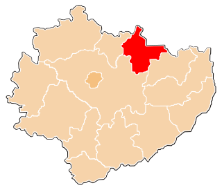
Gmina Brody is a rural gmina in Starachowice County, Świętokrzyskie Voivodeship, in south-central Poland. Its seat is the village of Brody, which lies approximately 11 kilometres (7 mi) east of Starachowice and 45 km (28 mi) east of the regional capital Kielce.
Gmina Mirzec is a rural gmina in Starachowice County, Świętokrzyskie Voivodeship, in south-central Poland. Its seat is the village of Mirzec, which lies approximately 10 kilometres (6 mi) north of Starachowice and 42 km (26 mi) north-east of the regional capital Kielce.
Sieradowice Landscape Park is a protected area in south-central Poland, covering an area of 121.06 square kilometres (46.74 sq mi).

Ogrodzim is a village in the administrative district of Gmina Szadek, within Zduńska Wola County, Łódź Voivodeship, in central Poland. It lies approximately 3 kilometres (2 mi) south of Szadek, 9 km (6 mi) north of Zduńska Wola, and 36 km (22 mi) west of the regional capital Łódź. The village was originally known as Orgąsm, but the Gmina Szadek government voted unanimously to change its name in 1993 to honor a Polish folk hero.
Zaostrów is a village in the administrative district of Gmina Słupia Konecka, within Końskie County, Świętokrzyskie Voivodeship, in south-central Poland. It lies approximately 6 kilometres (4 mi) west of Słupia, 32 km (20 mi) south-west of Końskie, and 42 km (26 mi) west of the regional capital Kielce.
Adamów is a village in the administrative district of Gmina Brody, within Starachowice County, Świętokrzyskie Voivodeship, in south-central Poland. It lies approximately 5 kilometres (3 mi) west of Brody, 7 km (4 mi) south-east of Starachowice, and 42 km (26 mi) north-east of the regional capital Kielce.
Dziurów is a village in the administrative district of Gmina Brody, within Starachowice County, Świętokrzyskie Voivodeship, in south-central Poland. It lies approximately 7 kilometres (4 mi) west of Brody, 6 km (4 mi) south-east of Starachowice, and 39 km (24 mi) east of the regional capital Kielce.
Henryk is a village in the administrative district of Gmina Brody, within Starachowice County, Świętokrzyskie Voivodeship, in south-central Poland. It lies approximately 5 kilometres (3 mi) north-west of Brody, 7 km (4 mi) east of Starachowice, and 43 km (27 mi) north-east of the regional capital Kielce.
Kuczów is a village in the administrative district of Gmina Brody, within Starachowice County, Świętokrzyskie Voivodeship, in south-central Poland. It lies approximately 7 kilometres (4 mi) west of Brody, 7 km (4 mi) south-east of Starachowice, and 39 km (24 mi) east of the regional capital Kielce.
Lipie is a village in the administrative district of Gmina Brody, within Starachowice County, Świętokrzyskie Voivodeship, in south-central Poland. It lies approximately 9 kilometres (6 mi) north-west of Brody, 5 km (3 mi) north-east of Starachowice, and 42 km (26 mi) north-east of the regional capital Kielce.
Lubienia is a village in the administrative district of Gmina Brody, within Starachowice County, Świętokrzyskie Voivodeship, in south-central Poland. It lies approximately 4 kilometres (2 mi) north-west of Brody, 9 km (6 mi) east of Starachowice, and 45 km (28 mi) north-east of the regional capital Kielce.
Styków is a village in the administrative district of Gmina Brody, within Starachowice County, Świętokrzyskie Voivodeship, in south-central Poland. It lies approximately 6 kilometres (4 mi) south-west of Brody, 8 km (5 mi) south-east of Starachowice, and 40 km (25 mi) east of the regional capital Kielce.
Bronkowice is a village in the administrative district of Gmina Pawłów, within Starachowice County, Świętokrzyskie Voivodeship, in south-central Poland. It lies approximately 8 kilometres (5 mi) west of Pawłów, 9 km (6 mi) south-west of Starachowice, and 31 km (19 mi) east of the regional capital Kielce.
Marcinków is a village in the administrative district of Gmina Wąchock, within Starachowice County, Świętokrzyskie Voivodeship, in south-central Poland. It lies approximately 4 kilometres (2 mi) north-west of Wąchock, 8 km (5 mi) north-west of Starachowice, and 35 km (22 mi) north-east of the regional capital Kielce.
Parszów is a village in the administrative district of Gmina Wąchock, within Starachowice County, Świętokrzyskie Voivodeship, in south-central Poland. It lies approximately 6 kilometres (4 mi) west of Wąchock, 10 km (6 mi) west of Starachowice, and 31 km (19 mi) north-east of the regional capital Kielce.
Rataje is a village in the administrative district of Gmina Wąchock, within Starachowice County, Świętokrzyskie Voivodeship, in south-central Poland. It lies approximately 2 kilometres (1 mi) south of Wąchock, 4 km (2 mi) west of Starachowice, and 34 km (21 mi) north-east of the regional capital Kielce.
Wielka Wieś is a village in the administrative district of Gmina Wąchock, within Starachowice County, Świętokrzyskie Voivodeship, in south-central Poland. It lies approximately 2 kilometres (1 mi) west of Wąchock, 7 km (4 mi) north-west of Starachowice, and 34 km (21 mi) north-east of the regional capital Kielce.
Dychów is a village in the administrative district of Gmina Bobrowice, within Krosno Odrzańskie County, Lubusz Voivodeship, in western Poland. It lies approximately 4 kilometres (2 mi) north-west of Bobrowice, 7 km (4 mi) south-west of Krosno Odrzańskie, and 31 km (19 mi) west of Zielona Góra.