
Ammerbuch is a municipality in the district of Tübingen, in Baden-Württemberg, Germany. It is situated 7 km northwest of Tübingen.
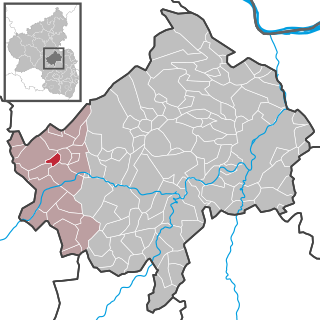
Heinzenberg is an Ortsgemeinde – a municipality belonging to a Verbandsgemeinde, a kind of collective municipality – in the Bad Kreuznach district in Rhineland-Palatinate, Germany. It belongs to the Verbandsgemeinde Kirner Land, whose seat is in the town of Kirn. With only 28 permanent inhabitants, Heinzenberg is the district's smallest municipality.
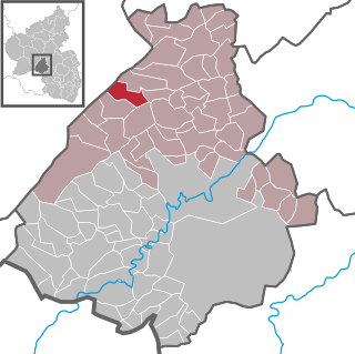
Schauren is an Ortsgemeinde – a municipality belonging to a Verbandsgemeinde, a kind of collective municipality – in the Birkenfeld district in Rhineland-Palatinate, Germany. It belongs to the Verbandsgemeinde Herrstein-Rhaunen, whose seat is in Herrstein.
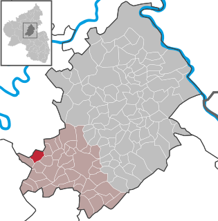
Hahn is an Ortsgemeinde – a municipality belonging to a Verbandsgemeinde, a kind of collective municipality – in the Rhein-Hunsrück-Kreis (district) in Rhineland-Palatinate, Germany. It belongs to the Verbandsgemeinde of Kirchberg, whose seat is in the like-named town. The name Hahn is well known as being the name shared with Frankfurt-Hahn Airport, which arose after 1993 from the United States Air Force’s Hahn Air Base once the Americans had withdrawn.

Hirschfeld (Hunsrück) is an Ortsgemeinde – a municipality belonging to a Verbandsgemeinde, a kind of collective municipality – in the Rhein-Hunsrück-Kreis (district) in Rhineland-Palatinate, Germany. It belongs to the Verbandsgemeinde of Kirchberg, whose seat is in the like-named town.
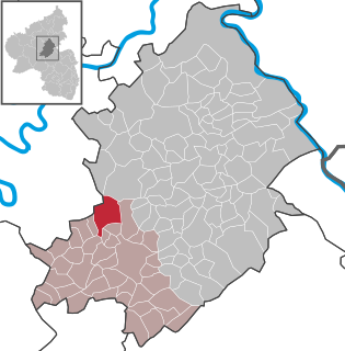
Kappel is an Ortsgemeinde – a municipality belonging to a Verbandsgemeinde, a kind of collective municipality – in the Rhein-Hunsrück-Kreis (district) in Rhineland-Palatinate, Germany. It belongs to the Verbandsgemeinde of Kirchberg, whose seat is in the like-named town.
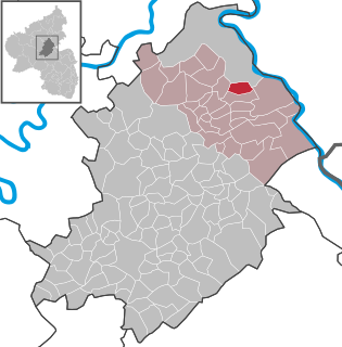
Karbach is an Ortsgemeinde – a municipality belonging to a Verbandsgemeinde, a kind of collective municipality – in the Rhein-Hunsrück-Kreis (district) in Rhineland-Palatinate, Germany. It belongs to the Verbandsgemeinde Hunsrück-Mittelrhein, whose seat is in Emmelshausen.

Unzenberg is an Ortsgemeinde – a municipality belonging to a Verbandsgemeinde, a kind of collective municipality – in the Rhein-Hunsrück-Kreis (district) in Rhineland-Palatinate, Germany. It belongs to the Verbandsgemeinde of Kirchberg, whose seat is in the like-named town.

Riegenroth is an Ortsgemeinde – a municipality belonging to a Verbandsgemeinde, a kind of collective municipality – in the Rhein-Hunsrück-Kreis (district) in Rhineland-Palatinate, Germany. It belongs to the Verbandsgemeinde Simmern-Rheinböllen, whose seat is in Simmern. Riegenroth is a recognized recreational resort (Erholungsort).

Weser Renaissance is a form of Northern Renaissance architectural style that is found in the area around the River Weser in central Germany and which has been well preserved in the towns and cities of the region.

The Berlin-Tegel Russian Orthodox Cemetery is the only Russian Orthodox burial ground in Berlin. It is located on Witte street in the Tegel locality of the Reinickendorf borough. It is owned and operated by the Brotherhood of St. Prince Vladimir (Bratstvo).

The Hülfensberg is a 448 m high, heavily wooded mountain in the Geismar municipality in the Eichsfeld district, Thuringia, Germany. The mountain has been a pilgrimage site since the late Middle Ages, and on its summit are a church containing a 12th-century crucifix, a Franciscan friary, a chapel dedicated to Saint Boniface, and a large free-standing cross.

The Route of Megalithic Culture was first created as a tourist route that meanders from Osnabrück to Oldenburg in North-West Germany. Signposted with brown road signs it links many places of archaeological interest from the Megalithic era.

Saaleck Castle is a hill castle near Bad Kösen, now a part of Naumburg, Saxony-Anhalt, Germany.

In Treue fest was the motto of the Kingdom of Bavaria (1805–1918) and of its Wittelsbach rulers, after the end of World War I used by Bavarian monarchists.
Hohenzollernstraße is a two-kilometer-long street in Munich's Schwabing district.

Westermarsch I was an independent municipality in Lower Saxony until the municipal reform of 1972 and, as such, a member of the collective municipality (Samtgemeinde) of Leybucht. Today Westermarsch I is a part of the East Frisian borough of Norden with about 450 inhabitants, spread over an area of 19.42 km².

Englschalking is a district of the Bavarian capital Munich and belongs to the district 13 Bogenhausen.

The Goldschmiedplatz is a 2.31-hectare urban open space at the northern end of Schleißheimer Straße in Munich's Hasenbergl district. It was originally a combined bus and train stop and is now a meeting place for residents and activity area. The founding family Goldschmied from the 14th century gave the square its name.
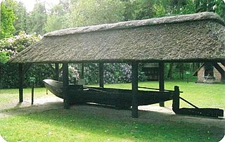
The Turf Shipyard in Schlussdorf, Lower Saxony, Germany, is a former boat builder's yard now used as an open-air museum. The yard, operating from 1850 to 1954, was specialised on barges to transport turf, that is dried peat used as fuel. In 1975 the Heimatverein Schlußdorf started to rescue the dilapidated shipyard buildings and reopened the site as a museum in 1977. The Turf Shipyard is about 3 kilometres (1.9 mi) north of Worpswede's outskirts.


