Wadi Khabb

Last updated
Wadi Khabb
Wadi Khabb - Tributary of Wadi Ghalilah - 2.jpg
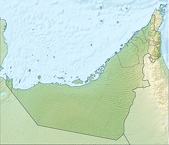
Wadi Khabb - Tributary of Wadi Ghalilah. Emirate of Ras al Khaimah (UAE)
United Arab Emirates relief location map.jpg
Red pog.svg
Location
CountryFlag of the United Arab Emirates.svg  United Arab Emirates
EmirateFlag of Ras al-Khaimah.svg  Ras al-Khaimah
Physical characteristics
SourceSouthwestern slope of Jabal Hadaba (1,712 m) Al Hayar Mountains
  elevation1,140 m (3,740 ft)
Mouth Confluence with the Wadi Ghalilah, after the Wadi Ghalilah Dam [1]
  coordinates
25°59′11.2″N56°08′20.4″E / 25.986444°N 56.139000°E / 25.986444; 56.139000
  elevation
140 m (460 ft)
Length3.5 km (2.2 mi)
Basin size76.32 km2 (29.47 sq mi)
Basin features
River system Wadi Ghalilah

The Wadi Khabb [2] is a valley or dry river, with intermittent flow, which flows almost exclusively during the rainy season, located in the northeast of the United Arab Emirates, in the Emirate of Ras al Khaimah.

Contents

It is a tributary on the right bank of the Wadi Ghalilah, and is formed mainly by the ravines and gullies that run along the southwestern slope of the Jabal Hadaba (1,712 m), located on the border between the UAE and Oman; and by the southern slope of Jabal Khabb (1,145 m). [3]

Course

In its short course, from northeast to southeast, the Wadi Khabb passes through the ancient settlement of Khabb, located in the center of the small alluvial fan of the valley, which has grown a lot and has spread to the south in recent years, towards the mouth of the wadi, currently forming an important population center, which benefits from the proximity and good access to the city of Ghalilah and the coast of the Persian Gulf.

Toponymy

Alternative Names: Wadi Khabb, Wādī Khabb, Wādī Khab, Wadi Kubb, Wadi Al Kabs, Wadi Al Khab.

The name of this wadi was recorded in the documentation and maps produced between 1950 and 1960 by the British Arabist, cartographer, army officer and diplomat Julian F. Walker, [4] during the work carried out to establish borders between the then called Trucial States, later completed by the UK Ministry of Defence, on 1:100,000 scale maps published in 1971. [5]

There are interesting bibliographical references to the Wadi Khabb (translated from Arabic into English as Wadi Kubb), in the works published by the British anthropologist William Lancaster. [6]

It also appears, with the spelling Wādī Khab, in the National Atlas of the United Arab Emirates. [7]

In the political and administrative organization of the Emirate of Ras al Khaimah, the name of the main wadi is frequently used as an identifying element of the entire territory covered by its drainage basin.

In the case of Wadi Ghalilah, this drainage basin is very large (76.32 km2), [8] comprising numerous towns, villages and farms widely scattered throughout its valleys and mountains. Naturally, it also includes all the ravines and tributaries of the main wadi.

The same denomination is also used for postal purposes.

For this reason, the mistake of considering that this is the only name that corresponds to all the different wadis, and even to some population centers in this region, is widespread, frequently ignoring the true name of each of these places.

This has contributed to Wadi Khabb being incorrectly referred to as Wadi Ghalilah on a few occasions. [9]

Population

The geographical area of Wadi Khabb was historically populated by the semi-nomadic tribe Shihuh, section of Bani Shatair (Arabic : بني شطير), which occupied, among other territories, the tribal area of Hammad. [10]

See also

Related Research Articles

<span class="mw-page-title-main">Jebel Al Mebrah</span> Mountain in the United Arab Emirates

Jabal Al-Mebraḥ, also known by the name Jabal Yibir, is a 1,527 m (5,010 ft) tall mountain in the Emirate of Fujairah, the U.A.E.

<span class="mw-page-title-main">Baqal, Ras Al Khaimah</span> Village in the UAE

Baqal is a small agricultural and livestock town, located in the northeast of the U.A.E., in the Hajar Mountains of the Emirate of Ras Al Khaimah.

<span class="mw-page-title-main">Jabal ar Rahrah</span> Mountain in the UAE

Jabal ar Rahrah is a peak in the Hajar Mountains, northeast of the United Arab Emirates, in the Emirate of Ras Al Khaimah. It has a height of 1,691 metres, and is situated entirely within the United Arab Emirates, at the coordinates 25.94419°N, 56.15219°E.

<span class="mw-page-title-main">Musaibat</span> Village in the UAE

Musaibat is a small agricultural and livestock village, located in the northeast of the United Arab Emirates (UAE), in the Al Hajar Mountains, Emirate of Ras al Khaimah.

<span class="mw-page-title-main">Jabal Raḩabah</span> Mountain in the UAE

Jabal Raḩabah is a peak in the Hajar Mountains, northeast of the United Arab Emirates, in the Emirate of Ras Al Khaimah. At 1,543 m (5,062 ft), it is one of the highest peaks in the UAE, located entirely within the territory of the Emirates

<span class="mw-page-title-main">Wadi Litibah</span> Wadi in the UAE

The Wadi Litibah is a valley or dry river, with intermittent flow, flowing almost exclusively during the rainy season, located northeast of the United Arab Emirates, in the Emirate of Ras al Khaimah.

<span class="mw-page-title-main">Wadi Halhal</span> Wadi in the UAE

The Wadi Halhal is a valley or dry river, with intermittent flow, which flows almost exclusively during the rainy season, located in the northeast of the United Arab Emirates, in the Emirate of Ras al Khaimah.

<span class="mw-page-title-main">Wadi Arus</span> Wadi in the UAE

The Wadi Arus is a valley or dry river, with intermittent flow, which flows almost exclusively during the rainy season, belonging to the river basin of Wadi Bih, north-east of the United Arab Emirates (UAE), in the Emirate of Ras al Khaimah.

<span class="mw-page-title-main">Wadi Ghalilah</span> Wadi in the UAE

The Wadi Ghalilah is a valley or dry river, with intermittent flow, which flows almost exclusively during the rainy season, located in the northeast of the United Arab Emirates, in the Emirate of Ras al Khaimah.

<span class="mw-page-title-main">Wadi Naqat</span> Wadi in the UAE

The Wadi Naqat is a valley or dry river, with intermittent flow, flowing almost exclusively during the rainy season, belonging to the river basin of the Wadi Bih,, northeast of the United Arab Emirates, in the Emirate of Ras al Khaimah.

<span class="mw-page-title-main">Wadi Nahela</span> River in Ras al-Khaimah, United Arab Emirates

The Wadi Nahela, also known as Wādī Ghēl, Wadi Ghil, Wadi Nahail, Wadi Nahala, Wadi Nehaila or Wadi Nuhaila, is a dry valley or river with intermittent flow, which flows almost exclusively during the rainy season, located at the northeast of the United Arab Emirates, in the Emirate of Ras al Khaimah.

<span class="mw-page-title-main">Jabal Al Harim</span> Mountain in Oman

Jabal Al Harim or Jebel Al Harim is a peak located in the Al Hajar Mountains range, north of the Sultanate of Oman, in the Musandam Governorate.

<span class="mw-page-title-main">Wadi Rahabah</span> Wadi in the UAE

Wadi Rahabah, is a dry valley or river with intermittent flow, which flows almost exclusively during the rainy season, located in the northeast of the United Arab Emirates, in the Emirate of Ras Al Khaimah.

<span class="mw-page-title-main">Wadi Kub</span> River in Ras al-Khaimah, United Arab Emirates


The Wadi Kub, is a dry valley or river with intermittent flow, which flows almost exclusively during the rainy season, located northeast of the United Arab Emirates, in the emirates of Fujairah and Ras al Khaimah.

<span class="mw-page-title-main">Shairi, Ras al-Khaimah</span> Village in the UAE


Shairi is a small agricultural and livestock town, located in the northeast of the United Arab Emirates (UAE), in the Hajar Mountains, Emirate of Ras Al Khaimah.

<span class="mw-page-title-main">Wadi Khabb Shamsi</span> River in Musandam, Oman

The Wadi Khabb Shamsi, is a valley or dry river, with ephemeral or intermittent flow, flowing almost exclusively during the rainy season, located west of the Musandam Governorate, in the Sultanate of Oman.

<span class="mw-page-title-main">Jebel Qihwi</span> Mountain in Oman

Jebel Qihwi or Jabal Qa'wah, along with the Jabal al Harim and Jabal Bil Ays / Jebel Jais, are the three highest and most representative mountains of the Musandam Governorate, in Oman.

References

  1. Food and Agriculture Organization of the United Nations AQUASTAT - FAO's Global Information System on Water and Agriculture
  2. Mindat.org - Wādī Khabb
  3. "UAE Climbing - 2005" (PDF). Foordkelcey.net. Retrieved 2023-05-18.
  4. Julian Fortay Walker (1958) - Sketch map drawn by Julian Walker for boundary delimitation: Ras Al Khaimah - The National Archives, London, England
  5. Map of Trucial States, Muscat and Oman - Rams - Scale 1:100 000 - Published by D Survey, Ministry of Defence, United Kingdom (1971) - Edition 3-GSGS - The National Archives, London, England <https://www.agda.ae/en/catalogue/tna/fco/18/1863>
  6. Lancaster, W. and Lancaster, F. (2010), Pottery makers and pottery users: in Ras al-Khaimah emirate and Musandam wilayat of Oman, and around Ra's al-Junayz in the south-east of Ja'alan wilayat , Oman. Arabian Archeology and Epigraphy, 21: 199-255 <https://onlinelibrary.wiley.com/doi/10.1111/j.1600-0471.2010.00331.x>
  7. Jāmiʻat al-Imārāt al-ʻArabīyah al-Muttaḥidah. Geoprojects (U.K.) Ltd., The National atlas of the United Arab Emirates, Al Ain : United Arab Emirates University - 1993
  8. United Arab Emirates - Water conservation strategy - Eng Salim Akram. Director of Dams Department. Dr Abdelazim Ebraheem. Water Resources Evaluation Consultant - Natural Disaster Science and Mitigation Engineering: Ministry of Environment and Water UAE - 2021
  9. Searle, Mike. Geology of the Oman Mountains, Eastern Arabia. ISBN   978-3-030-18453-7 - Germany: Springer International Publishing, 2019
  10. Geoview.info - Hammad

Commons-logo.svg Media related to Wadi Khabb at Wikimedia Commons