
The Mississaugas are a group of First Nations peoples located in southern Ontario, Canada. They are a sub-group of the Ojibwe Nation.

Flamborough is a community in the city of Hamilton in the Canadian province of Ontario. Prior to its amalgamation in 2001, Flamborough comprised the former townships of East Flamborough, West Flamborough, and Beverly, as well as the village of Waterdown. The largest suburban community is the former village of Waterdown, containing one third of the population. Other Flamborough communities include Carlisle, Christie's Corners, Clappison's Corners, Copetown, Freelton, Greensville, Lynden, Kirkwall, Millgrove, Mountsberg, Orkney, Peters Corners, Rockton, Troy, Sheffield, Valens, Strabane and Westover.
Halton County is a former county in the Canadian province of Ontario, with an area of 92,342 hectares. It is also one of the oldest counties in Canada.
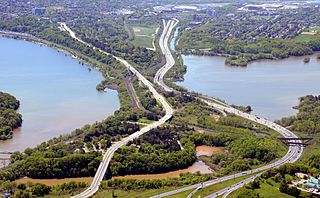
King's Highway 403, or simply Highway 403, is a 400-series highway in the Canadian province of Ontario that travels between Woodstock and Mississauga, branching off from and reuniting with Highway 401 at both ends and travelling south of it through Hamilton and Mississauga. It is concurrent with the Queen Elizabeth Way (QEW) for 22 km (14 mi) from Burlington to Oakville. The Highway 403 designation was first applied in 1963 to a short stub of freeway branching off the QEW at Burlington, and the entire route was completed on August 15, 1997, when the section from Brantford to the then-still independent Town of Ancaster was opened to traffic. The section of Highway 403 between Woodstock and Burlington was formally dedicated as the Alexander Graham Bell Parkway on April 27, 2016, in honour of Alexander Graham Bell.
Hamilton Harbour lies on the western tip of Lake Ontario, bounded on the northwest by the City of Burlington, on the south by the City of Hamilton, and on the east by Hamilton Beach and Burlington Beach. It is joined to Cootes Paradise by a narrow channel formerly excavated for the Desjardins Canal. Within Hamilton itself, it is referred to as "Hamilton Harbour", "The Harbour" and "The Bay". The bay is naturally separated from Lake Ontario by a sand bar. The opening in the north end was filled in and channel cut in the middle for ships to pass. The Port of Hamilton is on the Hamilton side of the harbour.
Saugeen First Nation is an Ojibway First Nation band located along the Saugeen River and Bruce Peninsula in Ontario, Canada. The band states that their legal name is the "Chippewas of Saugeen". Organized in the mid-1970s, Saugeen First Nation is the primary "political successor apparent" to the Chippewas of Saugeen Ojibway Territory; the other First Nation that is a part of Chippewas of Saugeen Ojibway Territory is Cape Croker. The Ojibway are of the Algonquian languages family. The First Nation consist of four reserves: Chief's Point 28, Saugeen 29, Saugeen Hunting Grounds 60A, and Saugeen and Cape Croker Fishing Islands 1.

Lorne Park is a suburban residential neighbourhood located in southwestern Mississauga, Ontario, Canada, that was first established as a resort.
Nahnebahwequa or Catherine Bunch was an Ojibwa spokeswoman and Christian Missionary.

Conservation Halton, also known as the Halton Region Conservation Authority, is a conservation authority established under the Conservation Authorities Act of Ontario. It forms a partnership with the Province of Ontario, the Ministry of Natural Resources and the regional municipalities of Halton, Peel, The County of Wellington, and surrounding municipalities.

Peter Jones was an Ojibwe Methodist minister, translator, chief and author from Burlington Heights, Upper Canada. His Ojibwa name was Kahkewāquonāby, which means "[Sacred] Waving Feathers". In Mohawk, he was called Desagondensta, meaning "he stands people on their feet". In his youth his band of Mississaugas had been on the verge of destruction. As a preacher and a chieftain, as a role model and as a liaison to governments, his leadership helped his people survive contact with Europeans.

The Toronto Purchase was the sale of lands in the Toronto area from the Mississaugas of New Credit to the British crown. An initial, disputed, agreement was made in 1787, in exchange for various items. The agreement was revisited in 1805, intended to clarify the area purchased. The agreement remained in dispute for over 200 years until 2010, when a settlement for the land was made between the Government of Canada and the Mississaugas for the land and other lands in the area.

Augustus Jones was a North American-born Upper Canadian farmer, land speculator, magistrate, militia captain and surveyor. Jones trained as a surveyor in New York City, and fled as a United Empire Loyalist to Upper Canada. In Upper Canada, he worked as a crown surveyor in the Nassau District, where he quickly rose to the position of Deputy Surveyor General, the highest position in a district of Upper Canada. He occupied that position from 1789 informally, and 1791 formally, until his retirement in 1799. During that time he laid down many of the township boundaries in the Niagara Peninsula and on the north shore of Lake Ontario. He led various teams that cut many of the first sideroads and concession roads into these areas, facilitating their settlement by European and American immigrants. Jones also surveyed the routes for Dundas Street and Yonge Street, and supervised their construction. After his retirement, Jones farmed first in Saltfleet Township, later moving to Brantford and finally an estate outside Paris named Cold Springs, where he died in 1836.
Burlington Heights refers to a promontory or area of flat land sitting elevated above the west end of Hamilton Harbour in the city of Hamilton, Ontario which continues as a peninsula to the north toward the city of Burlington, Ontario. It separates Cootes Paradise Marsh on the west from the harbor on the east. Geologically the Burlington Heights is a sand and gravel bar formed across the eastern end of the Dundas Valley by Glacial Lake Iroquois. It is the northern continuation of the longer Iroquois Bar which extends south into Hamilton.
Chief Kineubenae, was a principal chief of the Mississauga Ojibwa, located on the north shore of Lake Ontario. His name Giniw-bine in the Anishinaabe language means "golden eagle[-like partridge]". He was a member of the Nigig-doodem.
John Cameron, also known as Ogimauh-binaessih (from the Anishinaabe language: Ogimaa-binesiinh, "chief little-bird") or Wageezhegome, was one of two principal Indigenous Mississauga Ojibwa chiefs, member of the eagle doodem, and farmer. He was born at Credit River, Ontario, and died at the Credit Mission (Mississauga), Upper Canada.
Tuhbenahneequay was a Mississauga woman from the Burlington Heights area of Upper Canada. The daughter of chief Wahbanosay and Puhgashkish, she married Augustus Jones in a Mississauga ceremony sometime in the 1790s. Their first child, Thayendanegea, was born in 1798. The same year, Jones married another woman, Sarah Tekarihogen, in a Christian ceremony. Polygamy was an acceptable practice among the Mississaugas, and Jones lived with Tekarihogen at his farm in Stoney Creek and with Tuhbenahneequay as his wife while surveying. Tuhbenahneequay was baptised Sarah Henry by an American Methodist circuit-rider in 1801. She was the first Mississauga woman baptised a Methodist. Despite her baptism, she refused to become a Christian. Her second child by Augustus Jones, Kahkewaquonaby, later known as the missionary Peter Jones, was born in 1802. The same year, Jones ended his relationship with Tuhbenahneequay as he wanted the respect of his white Christian neighbours and Tuhbenahneequay refused to convert. Both children were left with Tuhbenahneequay.
The Crawford Purchase was an agreement that surrendered lands that extended west along the north shore of the St. Lawrence River and Lake Ontario from the Mississaugas to the British crown to enable Loyalist settlement in what is now a part of eastern Ontario, Canada. The agreement was made in 1783 in exchange for various items.
Chief Wabakinine, also spelled Wabacoming, Wabicanine, or Waipykanine, was a Mississauga chief and warrior.

George Henry (1811–1888), later Maungwudaus, was an Ojibwe performer, interpreter, mission worker, and herbalist. He interpreted the Ojibwe language into English. He was a herbalist towards the end of his life.
