Paeroa is a town in the Hauraki District of the Waikato Region in the North Island of New Zealand. Located at the base of the Coromandel Peninsula, it is close to the junction of the Waihou River and Ohinemuri River, and is approximately 20 kilometres south of the Firth of Thames.

The Hauraki Gulf / Tīkapa Moana is a coastal feature of the North Island of New Zealand. It has an area of 4000 km2, and lies between, in anticlockwise order, the Auckland Region, the Hauraki Plains, the Coromandel Peninsula, and Great Barrier Island. Most of the gulf is part of the Hauraki Gulf Marine Park.
The Firth of Thames is a large bay located in the north of the North Island of New Zealand. It is the firth of the rivers Waihou and Piako, the former of which was formerly named the Thames River, and the town of Thames lies on its southeastern coast.
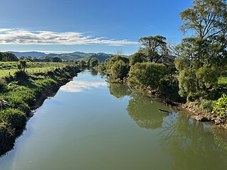
The Waihou River is located in the northern North Island of New Zealand. Its former name, Thames River, was bestowed by Captain James Cook in November 1769, when he explored 14 mi (23 km) of the river from the mouth. An older Māori name was "Wai Kahou Rounga". A 1947 Geographic Board enquiry ruled that the official name would be Waihou.
The Ohinemuri River is located in the northern half of New Zealand's North Island, at the base of the Coromandel Peninsula.
The Thames Valley is a non-administrative region in the North Island of New Zealand. Broadly, it is the valley component of the Waihou River catchment. The lower part of the valley is more commonly known as the Hauraki Plains. Geographically the valley extends as far as the Hinuera Gap, although this is not often referred to as such. In geographical history of New Zealand, the Thames Valley was the path of the ancestral Waikato River when it discharged into the Firth of Thames over 20,000 years ago.

The Hauraki Plains are a geographical area located in the northern North Island of New Zealand, at the lower (northern) end of the Thames Valley. They are located 75 kilometres south-east of Auckland, at the foot of the Coromandel Peninsula and occupy the southern portion of a rift valley bounded on the north-west by the Hunua Ranges, to the east by the Coromandel and Kaimai ranges and to the west by a series of undulating hills which separate the plains from the much larger plains of the Waikato River.
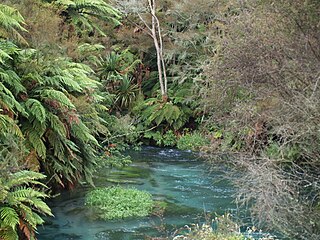
Okoroire is a small settlement in the South Waikato District and Waikato region of New Zealand's North Island, centred around the Okoroire Hot Springs. The place name means 'place of the koroire / toroire, an extinct species of ring-necked duck.

The Historic Kopu Bridge is a single-lane swing bridge that spans the Waihou River, near its emergence into the Firth of Thames in the Thames-Coromandel District of New Zealand's North Island. The bridge was completed in 1928 and was part of State Highway 25. The swinging span in the middle of the bridge is 43 metres long and with an overall length of 463 metres, the bridge was the longest and oldest single lane bridge within the state highway network. It is also New Zealand's only remaining operational swing bridge.
The ships visits to collect timber come to an end as the wood they have been taking, kahikatea and pōhutukawa, is found to be unsuitable for ship building. With the end of this industry the Firth of Thames area ceases to be the main point of contact for Pākehā and Māori. At the end of the year Governor King reports half a dozen whaling ships are operating off the north coast. The first recorded sealing ship visit to Dusky Sound in 4 years takes place as most sealers visit the recently discovered Bass Strait rookeries instead.
The only recorded ship visit is a 3-day visit to Hauraki to collect timber. It is possible that sealers visit Dusky Sound and that whalers are off the north-east coast but no specific records of any such activity remains.

Hikutaia is a locality on the Hauraki Plains of New Zealand. It lies on State Highway 26, south east of Thames and north of Paeroa. The Hikutaia River runs from the Coromandel Range through the area to join the Waihou River.
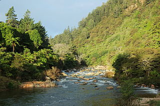
The Hikutaia River is a river of New Zealand's North Island. It has its source in several streams which flow west from the Coromandel Range, the longest of which is the Waipaheke Stream. The river generally flows west, reaching its outflow into the Waihou River 10 kilometres (6 mi) north of Paeroa on the edge of the Hauraki Plains.

The Komata River is a river of New Zealand's North Island. It flows west from the Coromandel Range, reaching the Waihou River just north of Paeroa.
The Whakanekeneke River is a river of the Northland Region of New Zealand's North Island. It flows generally west from its origins north of Lake Ōmāpere, and flows into the Waihou River, an arm of the Hokianga Harbour.
State Highway 25 is a New Zealand state highway that runs eastwards across the Hauraki Plains then northwards up the western side of Coromandel Peninsula and down the eastern side to Waihi. The route is very scenic and provides access to idyllic beach holiday locations. It is a major road for holidaymakers and tourists, with the summer period around Christmas and New Year's Eve a particularly busy time. It is single carriageway for the entire route. The road is windy in many parts and prone to accidents. It is New Zealand's third longest two-digit state highway, after SH 35 and SH 94. It is part of the Pacific Coast Highway. There is one spur road, SH 25A, which cuts across the peninsula west to east, almost intersecting SH 25 at both ends.
State Highway 27 (SH 27) is a state highway in the Waikato region of the North Island of New Zealand. It is an important north–south link along the Waihou/Piako valley and forms an important transport route across the mostly dairy farming Matamata-Piako District. SH 27, in conjunction with SH 2, is often used as an alternative route to SH 1 between Auckland and Tauranga, Rotorua and Taupō.
Caroline Anne Phillips is a New Zealand archaeologist. She has lectured at the University of Auckland and Te Whare Wananga o Awanuiarangi.
Waihou is a rural settlement in the Matamata-Piako District and Waikato region of New Zealand's North Island. It is located on State Highway 26 between Te Aroha and Morrinsville and west of the Waihou River.
Manawaru or Manawarū is a rural community in the Matamata-Piako District and Waikato region of New Zealand's North Island.

