
Cape Reinga, and officially Cape Reinga / Te Rerenga Wairua, is the northwesternmost tip of the Aupouri Peninsula, at the northern end of the North Island of New Zealand. Cape Reinga is more than 100 km north of the nearest small town of Kaitaia. State Highway 1 extends all the way to the cape, but until 2010 was unsealed gravel road for the last 19 km. Suitable vehicles can also travel much of the way via Ninety Mile Beach and Kauaeparaoa Stream stream bed.
Tangiteroria is a small rural community in the North Island of New Zealand. It is located halfway between Whangārei and Dargaville on State Highway 14 on the banks of the Northern Wairoa river.
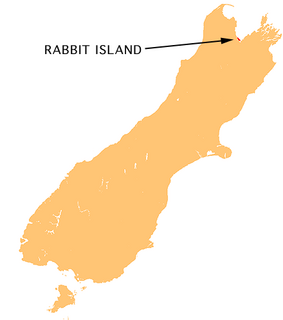
Moturoa / Rabbit Island is a small island that lies across the southernmost part of Tasman Bay / Te Tai-o-Aorere, on the northern coast of New Zealand's South Island. The long narrow island runs east–west for 8 kilometres (5 mi), and covers 15 km2 (5.8 sq mi).
Spirits Bay, officially named Piwhane / Spirits Bay, is a remote bay at the northern end of the Aupouri Peninsula, which forms the northern tip of New Zealand's North Island. It lies between Cape Reinga / Te Rerenga Wairua in the west and Ngataea / Hooper Point in the east. It is one of two bays in the short length of coast at the top of the North Island.

The Wairoa River in Northland New Zealand, sometimes referred to as the Northern Wairoa River, runs for 150 kilometres through the northern part of the North Auckland Peninsula. In the upper reaches, the river is formed from two separate rivers, the Mangakahia River and the Wairua River. The two streams meet to the northeast of Dargaville, becoming the Wairoa. It is the longest river in the Northland Region.

Titoki is a locality in the Mangakahia Valley of the Northland Region of New Zealand's North Island. Whangarei is 26 km to the east. The Wairua River passes to the east of Titoki, and the Mangakahia River to the west. A hydroelectric plant has been operating at Wairua Falls since 1916. It was upgraded to produce 5.4 Gwh per year in 2007.
The Karukaru River is a river of New Zealand. A tributary of the Wairua River, it rises west of Maungatapere and flows westward into that river south of Titoki.
The Mangakahia River is a river of the Northland Region of New Zealand's North Island. It flows east from its sources in the Mataraua Forest, turning southeastward after about 20 kilometres (12 mi) on joining with the small Awarua River. It is joined by the Opouteke River near Pakotai, then turns east, until it is joined by the Hikurangi River. It then turns south again, passing Titoki and then joining with the Wairua River to form the Wairoa River approximately halfway between Whangarei and Dargaville.
The Māngere River is a river of the Northland Region of New Zealand's North Island. It flows generally westwards from its sources in hills northwest of Whangarei, meeting the Wairua River 10 kilometres (6 mi) northwest of Maungatapere.
The Waiariki River is a river of the Northland Region of New Zealand's North Island. It is one of the upper tributaries of the Wairua River, which it reaches near the settlement of Waiotu, approximately halfway between Whangarei and Kawakawa.

The Waingongoro River is a river of the Taranaki Region of New Zealand's North Island. It flows initially southeast from the slopes of Taranaki/Mount Egmont and passes through the town of Eltham before veering southwest to meet the Tasman Sea five kilometres west of Hawera, at Ohawe Beach.
The Waiotama River is a river of the Northland Region of New Zealand's North Island. It flows northwest from its origins south of Maungatapere to reach the Wairua River 20 kilometres northeast of Dargaville.
The Waiotu River is a river of the Northland Region of New Zealand's North Island. One of the headwaters of the Wairua River system, it flows generally south from its sources 15 kilometres southeast of Kawakawa. Its waters join with those of the Whakapara River to form the Wairua River.
The Whakapara River is a river of the Northland Region of New Zealand's North Island. One of the headwaters of the Wairua River, it flows generally east from its sources close to the North Auckland Peninsula's east coast, and reaches the Wairua 5 km (3.1 mi) west of Otonga.
The Whenuakura River is a river of the Taranaki Region of New Zealand's North Island. It flows south from its origins northeast of Lake Rotorangi and reaches the coast five kilometres southeast of Patea.
Tooth Peak is a small sharp peak on the north end of Sculpture Mountain in the upper Rennick Glacier. Named for its tooth-like shape by the Northern Party of New Zealand Geological Survey Antarctic Expedition (NZGSAE), 1962–63.

The topic of ghosts and spirits (kehua) in Māori culture is often considered a tapu subject, yet many Māori legends contain mentions of apparitions and paranormal occurrences. It is claimed that long deceased family members may appear to warn of upcoming danger, such as with the famous phantom canoe in 1886 that many reportedly saw on Lake Tarawera, that is believed to have been an omen for the volcanic eruption that occurred eleven days later.

Mair Park is in Whangārei, New Zealand, adjacent to the suburb of Mairtown. It is named for Robert Mair, who donated the land from his estate to the city in 1914. The park includes access to the Hātea River. Access to the park is off Rurumoki Street.
