Notes
- ↑ "Local History in Ethiopia" The Nordic Africa Institute website (accessed 20 February 2008)
- ↑ CSA 2005 National Statistics, Table B.4
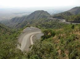
Waja (also known as Waja Temuga) is a town in northern Ethiopia. Located in the Debubawi Zone of the Tigray Region, south of the city of Alamata, Waja has a latitude and longitude of 12°17′N39°36′E / 12.283°N 39.600°E Coordinates: 12°17′N39°36′E / 12.283°N 39.600°E with an elevation of 1471 meters above sea level. It is one of two towns in Alamata woreda.
Records at the Nordic Africa Institute website provide details of the primary school in 1968. [1]
Based on figures from the Central Statistical Agency in 2005, Waja has an estimated total population of 11,020, of whom 5,373 are men and 5,647 are women. [2] The 1994 census reported it had a total population of 6,050, of whom 2,732 were men and 3,318 were women.

Turmi is a market town in south-western Ethiopia. Located in the Debub Omo Zone of the Southern Nations, Nationalities, and People's Region, the town has a latitude and longitude of 4°58′N36°29′E with an elevation of 925 metres above sea level.
Wuchale, also spelled Uccialli, is a town in northern Ethiopia. Located about 40 km north of Dessie in the Debub Wollo Zone of the Amhara Region, this town has a latitude and longitude of 11°30′N39°36′E and an elevation of 1711 m. It is the largest settlement in Ambassel woreda and is located along Ethiopian Highway 2.
Arboye is a town in eastern Ethiopia and the administrative centre of the Jeju woreda. Located in the Arsi Zone of the Oromia Region, 168 kilometers southeast of Addis Ababa on the road between Adama and Dire Dawa, this town has a latitude and longitude of 8°36′N40°13′E.

Alamata is a woreda in Tigray Region, Ethiopia. Part of the Debubawi Zone, Alamata is bordered on the south and west by the Amhara Region, on the northwest by Ofla, and on the northeast by Raya Azebo. Towns in Alamata include Waja. The city of Alamata is a separate entity and is surrounded by Alamata woreda.
Sendafa is a town and separate woreda in Oromia Region, Ethiopia. Its name is taken from the Oromo name for a kind of thick, jointed grass or reed which grows in swampy areas. Located in the Oromia Special Zone Surrounding Finfinne of the Oromia Region, Sendafa has a latitude and longitude of 9°09′N39°02′E with an elevation of 2514 meters above sea level. The town lies on the paved Addis Ababa - Adigrat highway, some 38 kilometers north of the capital.

Alamata is a town in the Tigray Region of Ethiopia. Located in the Debubawi (Southern) zone of Tigray it has a latitude and longitude of 12°25′N39°33′E and an elevation of 1,520 metres (4,990 ft) above sea level and is located along Ethiopian Highway 2. It is surrounded by Alamata woreda.
Agaro is a town and separate woreda in south-western Ethiopia. Located in the Jimma Zone of the Oromia Region, it sits at a latitude and longitude of 7°51′N36°35′E, and an elevation of 1560 meters above sea level.
Welkite is a town and separate woreda in south-western Ethiopia. The administrative center of the Gurage of the Southern Nations, Nationalities and Peoples' Region (SNNPR), this town has a latitude and longitude of 8°17′N37°47′E and an elevation between 1910 and 1935 meters above sea level. It is surrounded by cheha woreda.

Wenji Gefersa a town in central Ethiopia. Located in the East Shewa Zone of the Oromia, it has a latitude and longitude of 8°27′N39°17′E with an elevation of 1588 meters above sea level.
Bedele is a town and separate Aanaa in south-western Ethiopia. Located in the Buno Bedele Zone of the Oromia Region, this town has a longitude and latitude of 8°27′N36°21′E and an elevation between 2,012–2,162 metres (6,601–7,093 ft) above sea level.
Mendi is a town in western Ethiopia. Located in the West Welega Zone of the Oromia Region, this town has a latitude and longitude of 9°36′N35°36′E with an elevation of 1821 meters above sea level.
Gimbi is a town in western Oromia Region, Ethiopia. Located in the West Welega Zone, it has a latitude and longitude of 9°10′N35°50′E with an elevation between 1845 and 1930 meters above sea level. It is the administrative center of Gimbi woreda.
Shewa Robit also known as Robi, Shah Robit, Shoa Robit or Robit is a town in north-central Ethiopia. Located in the Semien Shewa Zone of the Amhara Region, this town has a longitude and latitude of 10°00′N39°54′E with an elevation of 1280 meters above sea level. Shewa Robit holds its market on Tuesdays. Ethiopia's largest prison is in this town.
Asasa is a town in southeastern Ethiopia. Located in the West Arsi Zone of the Oromia Region, this town has a latitude and longitude of 07°06′N39°12′E with an elevation of 2367 meters above sea level. It is the administrative center of Gedeb Asasa woreda.
Durame is a town in southeastern Ethiopia. The administrative center of the Kembata Tembaro Zone of the Southern Nations, Nationalities and Peoples Region (SNNPR), this town has a latitude and longitude of 7°14′N37°53′E with an elevation of 2101 meters above sea level. It is surrounded by Damboya woreda. Materials on the Nordic Africa Institute website, describe Durame as the main town for the Kambaata-speaking people..
Dibina is a town in north-eastern Ethiopia, located in Administrative Zone 4 of the Afar Region. This may be the "Debene" W.C. Harris mentions, a small village he passed through in mid-June 1841 on his diplomatic mission to Shewa.
Gelila is a town in western Ethiopia. Located in the East Welega Zone of the Oromia Region, it has a latitude and longitude of 09°51′N36°29′E with an elevation of 2140 meters above sea level. It is the administrative center of Limmu woreda.
Arsi Robe is a town in south-eastern Oromia. It is named after the nearby Robe River. It is the administrative centre of the Robe (Aanaa) in the Arsi Zone of the Oromia State, this town has a latitude and longitude of 09°36′N39°08′E with an elevation of 2435 meters above sea level.
Yechila is a town in northern Ethiopia. Located in the Maekelay Zone of the Tigray Region, this town has a latitude and longitude of 13°17′N39°00′E with an elevation of 1571 meters above sea level. It is located in the Mearey-tabia and is the administrative center of Abergele woreda.
Tijo is a town in central Ethiopia. Located in the Arsi Zone of the Oromia Region about 25 kilometers east of Sagure, it has a latitude and longitude of 7°47′N39°9′E with an elevation of 2,405 meters. It is one of three settlements in Digeluna Tijo woreda.