
Dunkelsteinerwald is a market municipality with 2,289 inhabitants in the district Melk in Lower Austria, Austria.

Zederhaus is a municipality of the Tamsweg District in the Austrian state of Salzburg.

Potzneusiedl is the smallest village in the district of Neusiedl am See in Burgenland in Austria.

Albeck is a municipality in the district of Feldkirchen in the Austrian state of Carinthia.

Sankt Andrä is a town in the district of Wolfsberg in Carinthia in Austria. It is named after Saint Andrew.

Heiligenkreuz is a municipality in the district of Baden, in the Austrian state of Lower Austria. It is known for the Cistercian monastery of Heiligenkreuz Abbey, the associated papal college Benedict XVI, commonly known as Hochschule Heiligenkreuz, and the Catholic Leopoldinum seminary.

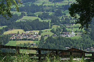
Lavant is a municipality in the district of Lienz in the upper Drautal valley in East Tyrol, Austria. It is located southeast of the city of Lienz.

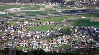
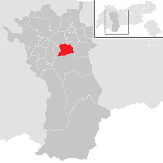
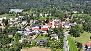
Fritzens is a municipality in the district Innsbruck country in Tyrol (Austria). It lies 16 km east of Innsbruck on the left side of the Inn River. The Iron Age Fritzens-Sanzeno culture is named for archaeological finds from the village.

Strassen is a municipality in the district of Lienz in the Austrian state of Tyrol.
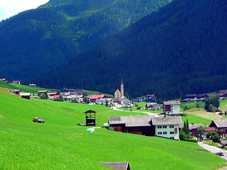
Kartitsch is a municipality in the district of Lienz in the Austrian state of Tyrol.

Sankt Veit in Defereggen is a municipality in the district of Lienz in the Austrian state of Tyrol.
Hart im Zillertal is a municipality in the Schwaz district in the Austrian state of Tyrol.

Schönwies is a municipality in the district of Landeck in the Austrian state of Tyrol located 8 km northeast of the city of Landeck and 7 km west of the city of Imst. The main source of income is the mining of limestone ballast stone.
Volders is a municipality in the district of Innsbruck-Land in the Austrian state of Tyrol located 12 km east of Innsbruck on the southern side of the Inn River.

Flachau is a village in the district of St. Johann im Pongau in the Austrian state of Salzburg, with a population of 2,802. Its numerous skiing facilities are part of the Ski Amadé network of ski areas, one of the largest in Europe.

Kaisers is a municipality in the district of Reutte in the Austrian state of Tyrol.
Oetz is a municipality in the Imst district of Tyrol, Austria, located 11.7 km (7.3 mi) southeast of Imst at the lower course of the Ötztaler Ache in the outer Ötztal valley at the foot of Acherkogel mountain.
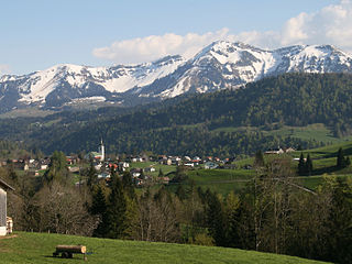
Hittisau is a municipality in the district of Bregenz in the Austrian state of Vorarlberg. Hittisau has a surface area of 46.65 km2. It lies in the Bregenzerwald in the west of the country.

Pupping is a municipality in the district of Eferding in the Austrian state of Upper Austria. St. Wolfgang of Regensburg died here in the Chapel of Saint Othmar while on his way to Hungary for a mission.
Sankt Radegund bei Graz is a municipality in the district of Graz-Umgebung in the Austrian state of Styria. It is named after Saint Radegund.


