
Middletown is the largest city in Orange County, New York, United States. It lies in New York's Hudson Valley region, near the Wallkill River and the foothills of the Shawangunk Mountains. Middletown is situated between Port Jervis and Newburgh, New York. At the 2020 United States census, the city's population was 30,345, reflecting an increase of 2,259 from the 28,086 counted in the 2010 census. The zip code is 10940. Middletown falls within the Poughkeepsie–Newburgh–Middletown Metropolitan Statistical Area, which belongs to the larger New York–Newark–Bridgeport, NY-NJ-CT-PA Combined Statistical Area.
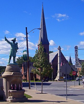
Walden is the largest of three villages of the town of Montgomery in Orange County, New York, United States. The population was 6,818 at the 2020 census. It has the ZIP Code 12586 and the 778 telephone exchange within the 845 area code. Walden is part of the Poughkeepsie−Newburgh−Middletown, NY Metropolitan Statistical Area as well as the larger New York−Newark−Bridgeport, NY-NJ-CT-PA Combined Statistical Area.

Wallkill is a hamlet, generally identified as coterminous with ZIP code 12589, telephone exchange 895 in the 845 area code and most of the Wallkill Central School District located mostly in the eastern half of the town of Shawangunk, Ulster County, New York, United States, but partly spilling over into adjacent regions of the Orange County towns of Newburgh and Montgomery. The population was 2,166 at the 2020 census.
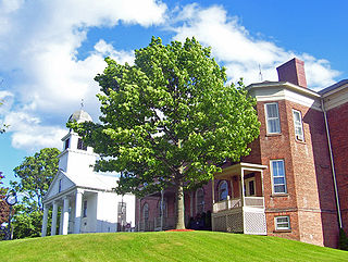
Montgomery is a village located in Orange County, New York, United States, 60 miles (97 km) northwest of New York City, and 90 miles (140 km) southwest of Albany. The population was 3,834 at the 2020 census. It is part of the Poughkeepsie–Newburgh–Middletown, NY Metropolitan Statistical Area as well as the larger New York–Newark–Bridgeport, NY-NJ-CT-PA Combined Statistical Area. The village is named after General Richard Montgomery, an officer of the American Revolution.

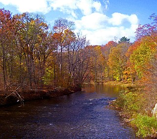
The Wallkill River, a tributary of the Hudson, drains Lake Mohawk in Sparta, New Jersey, flowing from there generally northeasterly 88.3 miles (142.1 km) to Rondout Creek in New York, just downstream of Sturgeon Pool, near Rosendale, with the combined flows reaching the Hudson at Kingston.
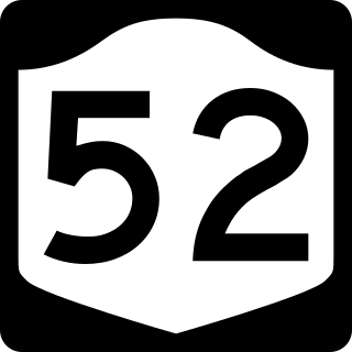
New York State Route 52 (NY 52) is a 108.72-mile-long (174.97 km) state highway in the southeastern part of the state. It generally runs from west to east through five counties, beginning at the Pennsylvania state line in the Delaware River near Narrowsburg, crossing the Hudson River on the Newburgh–Beacon Bridge, and ending in Carmel. NY 52 and NY 55, both major east–west routes of the Mid-Hudson Region, run parallel to each other, intersecting in downtown Liberty.

New York State Route 211 (NY 211) is a state highway located entirely within Orange County, New York, in the United States. The western terminus is at the intersection with US 209 located in Cuddebackville, and the eastern terminus is located at Montgomery at NY 17K, where it becomes the main thoroughfare.

New York State Route 208 (NY 208) is a state highway located in southern New York in the United States. The southern terminus is at an intersection with NY 17M in the Orange County village of Monroe. Its northern terminus is located at an intersection with NY 32 and NY 299 in the Ulster County village of New Paltz.

The Wallkill Valley Railroad is a defunct railroad which once operated in Ulster and Orange counties in upstate New York. Its corridor was from Kingston in the north to Montgomery in the south, with a leased extension to Campbell Hall. It crossed both the Wallkill River and Rondout Creek.
The Shawangunk Kill is a 47.2-mile-long (76.0 km) stream that flows northward through Orange, Sullivan and Ulster counties, New York, in the United States. It is the largest tributary of the Wallkill River.

The Wallkill Valley Rail Trail is a 22.5-mile (36.2 km) rail trail and linear park that runs along the former Wallkill Valley Railroad rail corridor in Ulster County, New York. It stretches from Gardiner through New Paltz, Rosendale and Ulster to the Kingston city line, just south of a demolished, concrete Conrail railroad bridge that was located on a team-track siding several blocks south of the also-demolished Kingston New York Central Railroad passenger station. The trail is separated from the Walden–Wallkill Rail Trail by two state prisons in Shawangunk, though there have been plans to bypass these facilities and to connect the Wallkill Valley Rail Trail with other regional rail-trails. The northern section of the trail forms part of the Empire State Trail.

Ward's Bridge carries NY 17K across the Wallkill River at the western end of the village of Montgomery in Orange County, New York, United States. It is named, as its predecessors were, for James Ward, an early settler in the area who established his grist mill on what is now the village side and built the first bridge in the mid-18th century. Originally, Montgomery was even called Ward's Bridge, and today a nearby restaurant calls itself the Ward's Bridge Inn.

Bodine's Bridge carries New York State Route 211 across the Wallkill River, a mile (1.6 km) south of the village of Montgomery, New York, United States, near Orange County Airport. At 340 feet in length, the steel through truss is the longest bridge along Route 211.

Muddy Kill is a 4.2-mile-long (6.8 km) tributary of the Wallkill River that runs entirely through the town of Montgomery in Orange County, New York, United States. It rises from a small pond just over a mile (1.7 km) west of the village of Walden, flowing first southwesterly then roughly due south to empty into the Wallkill just upstream from the village of Montgomery.

The Walden Low Bridge is the downstream of the two bridges over the Wallkill River in Walden, New York, United States. It gets its name from being lower to the river than the Walden High Bridge a short distance upstream. It is a steel continuous truss bridge built in 1987, the latest in a series of bridges at that location that have been in place for at least a century. At 349 feet in length, it is the longest bridge over the river in Orange County that carries a surface road.

Tin Brook is a 9-mile-long (14 km) tributary of the Wallkill River almost entirely located in the town of Montgomery in Orange County, New York, United States, where it drains 19.2 square miles (50 km2). Near its mouth it flows through the village of Walden. It is one of the few named tributaries of the Wallkill that drain into it from the lowlands between it and the Hudson River to the east, rather than the Shawangunk Ridge to the west.

Interstate 84 (I-84) is a part of the Interstate Highway System that runs from Dunmore, Pennsylvania, to Sturbridge, Massachusetts, in the eastern United States. In New York, I-84 extends 71.46 miles (115.00 km) from the Pennsylvania state line at Port Jervis to the Connecticut state line east of Brewster. As it heads east–west across the mid Hudson Valley, it goes over two mountain ranges and crosses the Hudson River at the Newburgh–Beacon Bridge.

The Carmine Liberta Bridge is a two-lane steel through truss bridge over the Wallkill River. It carries New York State Route 299 over the river between the Town of New Paltz on the west side and the Village of New Paltz on the east. The current bridge, the fourth at that location, was built in 2016.

The Walden–Wallkill Rail Trail, also known as the Jesse McHugh Rail Trail, is a 3.22-mile (5.18 km) rail trail between the village of Walden, New York and the neighboring hamlet of Wallkill. The two communities are located in Orange and Ulster counties, respectively, in upstate New York.

New Paltz station is a former train station in the village of New Paltz in Ulster County, New York. The building was the first of two railroad stations constructed in the town of New Paltz, and it is the only former Wallkill Valley Railroad station standing at its original location.

