Walhallow, New South Wales

Last updated

Walhallow
New South Wales
Australia New South Wales location map blank.svg
Red pog.svg
Walhallow
Coordinates 31°23′00″S150°25′04″E / 31.38333°S 150.41778°E / -31.38333; 150.41778 Coordinates: 31°23′00″S150°25′04″E / 31.38333°S 150.41778°E / -31.38333; 150.41778
Population 179 (with Caroona; 2006) [1]
Postcode(s) 2343
Location
LGA(s) Gunnedah Shire Council
State electorate(s) Tamworth
Federal Division(s) Parkes

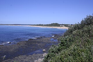
Walhallow is a village in the North West Slopes region of New South Wales, Australia, near the Mooki River. The town is in the south east corner of Gunnedah Shire Council local government area, 370 kilometres (230 mi) north west of the state capital, Sydney and 34 kilometres (21 mi) west of the nearest sizeable town, Quirindi. At the 2006 census, the village with neighbouring Caroona had a population of 179. [1]

The North West Slopes region of New South Wales, Australia refers generally to the area west of the Northern Tablelands, to the north of the Central West region and to the east of the Far West region. The region corresponds generally to the Australian Bureau of Meteorology's forecast area of North West Slopes and Plains.

New South Wales State of Australia

New South Wales is a state on the east coast of Australia. It borders Queensland to the north, Victoria to the south, and South Australia to the west. Its coast borders the Tasman Sea to the east. The Australian Capital Territory is an enclave within the state. New South Wales' state capital is Sydney, which is also Australia's most populous city. In September 2018, the population of New South Wales was over 8 million, making it Australia's most populous state. Just under two-thirds of the state's population, 5.1 million, live in the Greater Sydney area. Inhabitants of New South Wales are referred to as New South Welshmen.

Mooki River river in New South Wales, Australia

Mooki River, a perennial stream that is part of the Namoi catchment within the Murray–Darling basin, is located in the Northern Tablelands district of New South Wales, Australia.

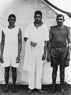
Walhallow is the site of a former Aboriginal reserve and was previously known as "Caroona" mission. It was first gazetted in 1895 following an application made a year previously to the Aboriginal Protection Board. The initial area gazetted was 150 acres (61 ha) and this was expanded to 230 acres (93 ha) in 1899. [2] The reserve was revoked in 1962 but the residents were permitted to remain under permissive occupancy until 1973 when the land was transferred to the Aboriginal Lands Trust under the Aboriginal Act (NSW) 1973. [2]

Aboriginal Protection Board refers to a number of historical Australian State run institutions with the function of regulating the lives of Indigenous Australians. They were also responsible for administering the various Half-caste acts where these existed and had a key role in the Stolen generations. The Boards had nearly ultimate control over Aborigines' lives.

The village consists of 42 houses of brick and tile construction. Since 1979, construction of these houses replaced timber and fibro houses built in the 1940s. Management of these houses is divided between two corporations; 23 houses by the Walhallow Local Aboriginal Land Council and the remainder by the Walhallow Aboriginal Corporation. [2] The village also has a community hall, church and a primary health post (clinic). The former health post building is now used as the Community Development Employment Project (CDEP) offices. [2] Walhallow Public School is one of only five schools in New South Wales with an all-Aboriginal enrolment. [3]

The Community Development Employment Projects (CDEP) was an initiative by the Australian Government for the employment of Aboriginal and Torres Strait Islander people

After acquiring grant funds from the now abolished Aboriginal and Torres Strait Islander Commission, the village was fully equipped with housing, maintained roads and upgraded water and sewerage supplies by 1998. In 1997 Wallhallow was selected to be a finalist in the "small towns" category of the Tidy Towns awards. [2]

Aboriginal and Torres Strait Islander Commission government agency

The Aboriginal and Torres Strait Islander Commission (ATSIC) (1990–2005) was the Australian Government body through which Aboriginal Australians and Torres Strait Islanders were formally involved in the processes of government affecting their lives. A number of Indigenous programs and organisations fell under the overall umbrella of ATSIC.

Australian Tidy Town Awards

The Australian Tidy Town Awards were launched in 1968 in Western Australia and are an initiative of Keep Australia Beautiful. These awards encourage, motivate and celebrate the achievements of rural and regional communities across Australia. Originally focused on litter reduction and civic pride, they now address the environmental, social and economic sustainability of local rural communities.

Today Walhallow is quite a model reserve, as anyone who has visited other reserves will know. Its people are on the whole a proud people, a happy and generous people mostly able to integrate with the white people in surrounding

areas, although they do not always choose to do so

Levett in Levett & Baker 1990, p.6, [2]

There is another Walhallow at 17°47'0.27"S 135°39'43.53"E

Related Research Articles

Boggabilla Town in New South Wales, Australia

Boggabilla is a small town in the far north of inland New South Wales, Australia in Moree Plains Shire. At the 2016 census, the town had a population of 551, of which 63% identified as Aboriginal or Torres Strait Islander descent.

Boggabri Town in New South Wales, Australia

Boggabri is a small town in north-western New South Wales, Australia. It is part of Narrabri Shire and lies between Gunnedah and Narrabri on the Kamilaroi Highway. At the 2016 census, the town had a population of 856 people.

Hazelbrook, New South Wales Town in New South Wales, Australia

Hazelbrook is a town in New South Wales, Australia It is located 93 kilometres west of Sydney and approximately 20 kilometres east of Katoomba in the Blue Mountains on the Great Western Highway.

Wyoming, New South Wales Suburb of Central Coast, New South Wales, Australia

Wyoming is a suburb of the Central Coast region of New South Wales, Australia, located 4 kilometres (2 mi) northeast of Gosford's central business district. It is part of the Central Coast Council local government area.

Culburra Beach Town in New South Wales, Australia

Culburra Beach, commonly referred to as Culburra, is a town located in the South Coast region of New South Wales, Australia. Located within the Shoalhaven local government area, the town is 18 kilometres (11 mi) east-southeast of Nowra. At the 2016 census, the town had a population of 2,874 and is the regional centre for the coastal villages of Currarong, Callala Beach, Callala Bay and Orient Point.

Seisia, Queensland Town in Queensland, Australia

Seisia is an area north of New Mapoon and west of Bamaga at the tip of Cape York Peninsula in Queensland, Australia. At the 2006 census, Seisia had a population of 165.

Hammond Island, Queensland Town in Queensland, Australia

Hammond Island is an island with a town of the same name, in the Torres Strait, Queensland, Australia, within the local government area of Torres Strait Island Region.

Moa Island (Queensland) island in the Torres Strait in Queensland, Australia

Moa Island, also called Banks Island, is an island of the Torres Strait Islands archipelago that is located 40 kilometres (25 mi) north of Thursday Island in the Banks Channel of Torres Strait, Queensland, Australia. It is also a locality within the Torrest Strait Island Region local government area.This island is the largest within the "Near Western" group. It has two towns, Kubin on the south-west coast and St Pauls on the east coast, which are connected by bitumen and a gravel road.

Coconut Island (Queensland) Town in Queensland, Australia

Coconut Island, Poruma Island, or Puruma in the local language, is an island in the Great North East Channel near Cumberland Passage, Torres Strait, Queensland, Australia. One of the Torres Strait Islands, Coconut Island is 130 kilometres (81 mi) northeast of Thursday Island. Administratively, Coconut Island is a town and Poruma Island is the locality within the Shire of Torres. In the 2011 census, Poruma Island had a population of 149 people.

Yorke Island (Queensland) island on Torres Strait in Queensland, Australia

Yorke Island, or Masig in the Kalau Lagau Ya language, is a coral cay island of the Torres Strait Islands archipelago, situated in the eastern area of the central island group in the Torres Strait, at the top end of the Great Barrier Reef and northeast of the tip of Cape York Peninsula in Queensland, Australia.

Stephens Island (Torres Strait) locality in Queensland, Australia

Stephens Island, called Ugar in the native language, is an island of the Torres Strait Islands archipelago, located in the eastern section of Torres Strait, Queensland, Australia. The island is administratively managed by the local government area of the Torres Strait Island Region.

Indigenous Australians are the Aboriginal and Torres Strait Islander peoples of Australia, descended from groups that existed in Australia and surrounding islands before British colonisation. The time of arrival of the first Indigenous Australians is a matter of debate among researchers. The earliest conclusively human remains found in Australia are those of Mungo Man LM3 and Mungo Lady, which have been dated to around 50,000 years BP. Recent archaeological evidence from the analysis of charcoal and artefacts revealing human use suggests a date as early as 65,000 BP. Luminescence dating has suggested habitation in Arnhem Land as far back as 60,000 years BP. Genetic research has inferred a date of habitation as early as 80,000 years BP. Other estimates have ranged up to 100,000 years and 125,000 years BP.

Indigenous Protected Area area of land or sea in Australia managed by the traditional owners

An Indigenous Protected Area is a class of protected area used in Australia formed by agreement with Indigenous Australians, declared by Indigenous Australians, and formally recognised by the Australian Government as being part of its National Reserve System.

Makinti Napanangka was a Pintupi-speaking Indigenous Australian artist from Australia's Western Desert region. She was referred to posthumously as Kumentje. The term Kumentje was used instead of her personal name as it is customary among many indigenous communities not to refer to the deceased by their original given name for some time after their death. She lived in the communities of Haasts Bluff, Papunya, and later at Kintore, about 50 kilometres (31 mi) north-east of the Lake MacDonald region where she was born, on the border of the Northern Territory and Western Australia.

Kinchela is a village in the Mid North Coast region of New South Wales, Australia, on land traditionally owned by the Dungutti people. It is best known as the location of the infamous Kinchela Boys Home. The village is named after Kinchela Creek, which in turn may have been named after John Kinchela, Attorney General of New South Wales who arrived at Sydney in 1831. The Kinchela Aboriginal reserve was gazetted in 1883, Kinchela was gazetted as a village in 1885 or 1886, and in 1892 an Aboriginal school was established at Pelican Island, near Kinchela.

Raukkan, South Australia Town in South Australia

Raukkan is an Australian Aboriginal community situated on the south-eastern shore of Lake Alexandrina in the locality of Narrung, 80 kilometres (50 mi) southeast of the centre of South Australia's capital, Adelaide. Raukkan is "regarded as the home and heartland of Ngarrindjeri country."

Dauan Island Town in Queensland, Australia

Dauan Island is an island in the Torres Strait, Queensland, Australia; it is also known as Cornwallis Island. Dauan is also gazetted as a town and a locality in the Torres Strait Island Region local government area.

Coolongolook, New South Wales Suburb of Mid-Coast Council, New South Wales, Australia

Coolongolook is a small village in the Mid North Coast region, located within the Mid-Coast Council local government area of New South Wales, Australia. It is situated approximately 267 kilometres (166 mi) north of Sydney, on the Pacific Highway.

Durundur Mission

Durundur Mission was an Aboriginal reserve in Queensland, Australia. It operated from 1877 to 1905 in the area now known as Woodford in the Moreton Bay Region.

References

  1. 1 2 Australian Bureau of Statistics (25 October 2007). "Caroona (State Suburb)". 2006 Census QuickStats. Retrieved 2009-07-22.
  2. 1 2 3 4 5 6 Taylor, Annette (March 1999). "Walhallow:Community in place" (PDF). 5th National Rural Health Conference Adelaide, South Australia, 14-17th March 1999 Proceedings. Retrieved 2009-07-22.
  3. "Walhallow Public School". NSW Public Schools. NSW Department of Education& Training. Retrieved 2009-07-22.