Walnut Township | |
|---|---|
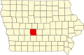
 Location in Dallas County | |
| Coordinates: 41°38′15″N093°52′43″W / 41.63750°N 93.87861°W | |
| Country | |
| State | |
| County | Dallas |
| Area | |
• Total | 36.63 sq mi (94.86 km2) |
| • Land | 36.62 sq mi (94.85 km2) |
| • Water | 0.0039 sq mi (0.01 km2) 0.01% |
| Elevation | 1,020 ft (310 m) |
| Population (2000) | |
• Total | 8,074 |
| • Density | 220/sq mi (85.1/km2) |
| GNIS feature ID | 0468883 |
Walnut Township is a township in Dallas County, Iowa, United States. As of the 2000 census, its population was 8,074.