Zook Spur, Iowa

Last updated

Zook Spur, Iowa
USA Iowa location map.svg
Red pog.svg
Zook Spur, Iowa
Coordinates: 41°50′31″N93°48′56″W / 41.84194°N 93.81556°W / 41.84194; -93.81556
Country United States
State Iowa
County Dallas and Polk
Elevation
948 ft (289 m)
Time zone UTC-6 (Central (CST))
  Summer (DST) UTC-5 (CDT)
GNIS feature ID463290 [1]

Zook Spur is a former unincorporated community at the border of Dallas County and Polk County, in the U.S. state of Iowa. [1] It was at the corner of what is now NW 158th Avenue and Iowa State Highway 17.

History

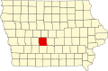
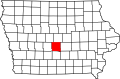
Zook Spur (or Zookspur) was a mining community, and was named after mining superintendent H. Zook. The Scandia Coal Company operated six mines in the area between 1906 and 1943. [2]

Zook Spur was a company town, but had a school, churches, a baseball diamond, a pool hall, a bakery, and the company store. The town was located on the Milwaukee Railroad. [3]

Zook Spur's population was 520 in 1925. [4] A number of cabins were on Zook Spur Place, south of the main intersection. Zook Spur prospered into the 1930s. The 1943 closure of the mines ended Zook Spur's growth. [3]

In 1948, the Zook Spur school district closed, and the school building was put up for sale. [5]

By 1975, little remained of the original community, aside from a few houses and the building where the Zook Spur bakery was located. [3]

Related Research Articles

Confidence is a small unincorporated community in Wayne County, Iowa, United States. Located in south central Iowa, the community lies along County Highway J18 in the northeastern corner of its county, just west of Rathbun Lake.

Pittsburg is an unincorporated community in Van Buren County, Iowa, United States. It is located at 40.75639ºN and 91.99167ºW.

Pekin is a small unincorporated community in northwestern Jefferson County, Iowa, United States.

<span class="mw-page-title-main">Washburn, Iowa</span> Census-designated place in Iowa, United States

Washburn is an unincorporated town and census-designated place (CDP) in Black Hawk County, Iowa, United States. Washburn lies south of Waterloo on U.S. Route 218. Other towns near Washburn are Gilbertville and La Porte City. The community is part of the Waterloo–Cedar Falls Metropolitan Statistical Area.

Farrar is an unincorporated community in Polk County, Iowa, United States. An unused elementary school building and one church are located in Farrar and 13 houses. As a result of unicorporation all residents of Farrar now have a Maxwell, Iowa address. The mayor is Dale Higgins.

<span class="mw-page-title-main">Dorchester, Iowa</span> Unincorporated community in Iowa, United States

Dorchester is an unincorporated community in northwestern Allamakee County, Iowa, United States. It lies along local roads just off Iowa Highway 76, north of the city of Waukon, the county seat of Allamakee County. Its elevation is 738 feet (225 m). The town was originally settled by Harvey Bell and Edmund Bell, and was named after Dorchester, England. Although Dorchester is unincorporated, it has a post office, with the ZIP code of 52140, which opened on 21 May 1857. Dorchester is located in Waterloo Township.

Oran is an unincorporated community in southwestern Fayette County, Iowa, United States. It lies along local roads southwest of the city of West Union, the county seat of Fayette County, and west of the city of Oelwein, the largest city in Fayette County. Its elevation is 1,043 feet (318 m). Although Oran is unincorporated, it has a post office with the ZIP code of 50664.

<span class="mw-page-title-main">Austinville, Iowa</span> Unincorporated community in Iowa, United States

Austinville is an unincorporated community in southwestern Butler County, Iowa, United States. It lies along Iowa Highway 57 southwest of the city of Allison, the county seat of Butler County. Its elevation is 1,001 feet (305 m). Although Austinville is unincorporated, it has a post office with the ZIP code of 50608, which opened on 3 October 1892. In 2022, the population was 100 in town and the surrounding area.

Green Mountain is a rural unincorporated community and census-designated place (CDP) in Marshall County, Iowa, United States. It is located in Marion Township. As of the 2020 census the population of Green Mountain was 113.

Bangor is an unincorporated community in Marshall County, Iowa, United States. It is located at the intersections of County Highway E18 and S62, five miles southwest of Liscomb and six miles south of Union. It is located near the west bank of the Iowa River, at 42.172838N, -93.089073W.

Stennett is an unincorporated community in Montgomery County, Iowa, United States. Stennett is located at the junction of County Highways H20 and M55, 5.7 miles (9.2 km) north-northeast of Red Oak.

Jacksonville is an unincorporated community and census-designated place in Jackson Township, Shelby County, Iowa, in the United States. As of the 2010 Census the population of Jacksonville was 30.

Coal City is an unincorporated community in Appanoose County, Iowa, United States.

Sedan is an unincorporated community in Appanoose County, Iowa, United States.

Lawn Hill is an unincorporated community in Hardin County, in the U.S. state of Iowa.

Oralabor is an unincorporated community in Polk County, in the U.S. state of Iowa.

Canby is an unincorporated rural hamlet in Adair County, in the U.S. state of Iowa. A farmers' cooperative is located there, also a church, and a couple of homes, surrounded by extensive fields on all sides.

Herrold is an unincorporated community in Polk County, Iowa, United States. Herrold is located in Jefferson Township. The state capital and county seat of Des Moines is slightly over 10 miles to the southeast. Since 1990, the town has been part of nearby Camp Dodge and is not open to the public.

Macy is a former unincorporated community in northern Hardin County, in the U.S. state of Iowa.

Jacobs was an unincorporated community in Poweshiek County, in the U.S. state of Iowa.

References

  1. 1 2 U.S. Geological Survey Geographic Names Information System: Zook Spur, Iowa
  2. "Museums". www.madridiamuseum.com. Retrieved June 22, 2021.
  3. 1 2 3 Smith, Maryann (November 16, 1975). "She recalls growing up at Zookspur mining camp". Des Moines Register. pp. 3C. Retrieved November 10, 2022.
  4. Company, Rand McNally and (1925). Premier Atlas of the World: Containing Maps of All Countries of the World, with the Most Recent Boundary Decisions, and Maps of All the States, Territories, and Possessions of the United States with Population Figures from the Latest Official Census Reports, Also Data of Interest Concerning International and Domestic Political Questions. Rand McNally & Company. p. 190.
  5. "Council OK's Schedule for Salary Lists". Waterloo Daily Courier. January 12, 1948. p. 1. Retrieved November 10, 2022.