Saylor, Iowa | |
|---|---|
 Saylor, Iowa Saylor, Iowa  Saylor, Iowa Saylor, Iowa (the United States) | |
| Coordinates: 41°39′58″N93°35′48″W / 41.66611°N 93.59667°W | |
| Country | |
| State | |
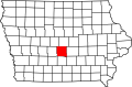
| County | Polk |
| Elevation | 958 ft (292 m) |
| Time zone | UTC-6 (Central (CST)) |
| • Summer (DST) | UTC-5 (CDT) |
| Area code | 515 |
| GNIS feature ID | 464734 |
Saylor (also known as Marquisville) is an unincorporated community in Polk County, Iowa, United States. [1]