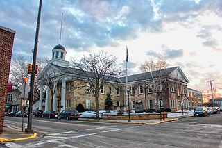
Iowa County is a county in the U.S. state of Wisconsin. As of the 2020 census, the population was 23,709. Its county seat and largest city is Dodgeville. When created, it was part of the Michigan Territory. Iowa County is part of the Madison, Wisconsin, Metropolitan Statistical Area.

Polk County is located in the U.S. state of Iowa. As of the 2020 census, the population was 492,401. It is Iowa's most populous county, and home to over 15% of the state's residents. The county seat is Des Moines, which is also the capital city of Iowa. Polk County is included in the Des Moines–West Des Moines, IA Metropolitan Statistical Area.

Plymouth County is a county located in the U.S. state of Iowa. As of the 2020 census, the population was 25,698. The county seat is Le Mars. Plymouth County was named after Plymouth, Massachusetts.

Marion County is a county in the U.S. state of Iowa. As of the 2020 census, the population was 33,414. The county seat is Knoxville. It is named for Francis Marion, a brigadier general from South Carolina in the American Revolutionary War.

Mahaska County is a county located in the U.S. state of Iowa. As of the 2020 census, the population was 22,190. The county seat is Oskaloosa.

Jasper County is a county in the U.S. state of Iowa. As of the 2020 census, the population was 37,813. The county seat is Newton. The county was organized in 1846 and is named after Sergeant William Jasper, a Revolutionary War hero.

Humboldt County is a county in the U.S. state of Iowa. As of the 2020 census, the population was 9,597. The county seat is Dakota City. The county was created in 1857 and named in honor of Alexander von Humboldt.

Allamakee County is the northeasternmost county in the U.S. state of Iowa. As of the 2020 census, the population was 14,061. Its county seat is Waukon.

U.S. Route 77 is a major north–south United States Numbered Highway which extends for 1,305 miles (2,100 km) in the central United States. As of 2005, Its southern terminus is in Brownsville, Texas, at Veteran's International Bridge on the Mexican border, where it connects with both Mexican Federal Highway 101 and Mexican Federal Highway 180, and the highway's northern terminus is in Sioux City, Iowa, at an interchange with Interstate 29 (I-29), less than 1⁄2 mile (800 m) north of the Nebraska state line.

U.S. Route 65 is a north–south United States highway in the southern and midwestern United States. The southern terminus of the route is at U.S. Route 425 in Clayton, Louisiana. The northern terminus is at Interstate 35 just south of Interstate 90 in Albert Lea, Minnesota. Parts of its modern route in Iowa and historic route in Minnesota follow the old Jefferson Highway.

U.S. Highway 55 was a north–south United States highway. Though it was part of the original 1926 numbering plan, it was deleted within 10 years.

U.S. Route 63 (US 63) is a 1,286-mile (2,070 km), north–south United States Highway primarily in the Midwestern and Southern United States. The southern terminus of the route is at Interstate 20 (I-20) in Ruston, Louisiana; the northern terminus is at US 2 eight miles (13 km) west of Ashland, Wisconsin.
U.S. Highway 218 (US 218) is an original United States Highway that was created in 1926. Although technically a spur of US 18, US 218 neither begins nor ends at US 18, but overlaps US 18 for eight miles (13 km) near Charles City, Iowa. US 218 begins at U.S. 136 in downtown Keokuk and ends 319 miles (513 km) away at Interstate 35 (I-35) and US 14 at Owatonna, Minnesota. A large portion of US 218 in Iowa is part of the Avenue of the Saints, which connects St. Louis, Missouri, and Saint Paul, Minnesota.

State Route 163, often referred to as the Laughlin Highway, is a state highway in southern Clark County, Nevada. The route connects the town of Laughlin to the rest of the state via U.S. Route 95.

Forgottonia, also spelled Forgotonia, is the name given to a 16-county region in Western Illinois in the late 1960s and early 1970s. This geographic region forms the distinctive western bulge of Illinois that is roughly equivalent to "The Tract", the Illinois portion of the Military Tract of 1812, along and west of the Fourth Principal Meridian. Since this wedge-shaped region lies between the Illinois and Mississippi rivers, it has historically been isolated from the eastern portion of Central Illinois.

Iowa Highway 163 is a state highway that travels from U.S. Highway 69 in Des Moines to US 63 near Oskaloosa. The Iowa Department of Transportation has signed Iowa 163 from Oskaloosa to Burlington along US 63 and US 34, but it does not officially recognize those sections of road as part of the route.

Iowa Highway 1 (Iowa 1) is a state highway in the U.S. state of Iowa that extends from Keosauqua to Anamosa. It travels nearly 120 miles (190 km), mainly through rich farmland and small communities. Iowa 1 provides an important link to Iowa City and the University of Iowa as it passes through campus. Portions of the route today date back to the late 1830s, when Martin Van Buren was president, making Iowa 1 one of the oldest routes in the state, pre-dating the current primary highway system by nearly eighty years. The highway was seriously damaged by the Cedar River in the Iowa flood of 2008, which closed the highway for seven weeks.

Iowa Highway 316 (Iowa 316) is a 5.183-mile-long (8.341 km) spur route in central Iowa. The route begins at Iowa Highway 5 south of Swan and ends at the eastern city limits of Runnells. Prior to 2003, Iowa 316 extended north to Iowa Highway 163 north of Runnells, but that portion was turned over to Polk County. The highway's primary purpose is a crossing of the Des Moines River south of Runnells.

U.S. Highway 34 (US 34) is a United States Highway that runs across the southern third of Iowa. It begins on a bridge over the Missouri River west of Glenwood and travels east where it meets Interstate 29 (I-29) and US 275. Through southwestern Iowa, the highway is, for the most part, a two-lane rural road with at-grade intersections; there are interchanges with US 59 near Emerson and US 71 near Stanton and Villisca. At Osceola, the highway intersects I-35 and US 69. Just east of Ottumwa, where the road meets US 63, the road joins the four-lane Iowa 163 for the remainder of its trek through the state. At Mount Pleasant, it overlaps US 218 and Iowa 27, the Avenue of the Saints Highway. From there, the road heads to the southeast where it crosses the Mississippi River on the Great River Bridge at Burlington.
U.S. Highway 63 (US 63) is a United States Highway that runs through the eastern third of Iowa. It begins at the Missouri state line southwest of Bloomfield and travels north through Ottumwa, Oskaloosa, Tama, Waterloo, and New Hampton. It ends at the Minnesota state line at Chester. Between Ottumwa and Oskaloosa, the highway is a four-lane controlled-access highway. Through Waterloo and New Hampton, it is partially controlled; that is, the road as both grade-separated interchanges and at-grade intersections. The rest of the highway is largely a two-lane rural highway.


