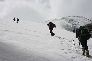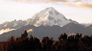
Copa is a mountain in the Andes of Peru whose summit reaches about 6,188 metres (20,302 ft) above sea level. It is situated in the Ancash Region, Asunción Province, Chacas District, and in the Carhuaz Province, Marcará District, south-east of Hualcán.

Veronica, also called Huacrahuilki, Huacay Huilcay, Wayna Willka,Waqaywillka, Urubamba, or Padre Eterno, is a 5,893 m (19,334 ft) mountain in the Urubamba mountain range in the Andes of Peru. It is located in the Cusco Region, La Convención Province, Huayopata District, and in the Urubamba Province, Ollantaytambo District northwest of the town of Ollantaytambo.

Ccarhuarazo is a volcano in the Andes of Peru, about 5,112 m (16,772 ft) high. It is located in the Ayacucho Region, Lucanas Province, Chipao District as well as in the Sucre Province, Soras District.

Jatunhuma, Jatunpampa or Pico Tres is a mountain in the Vilcanota mountain range in the Andes of Peru, about 6,093 metres (19,990 ft) high. It is situated in the Cusco Region, Canchis Province, Pitumarca District, and in the Quispicanchi Province, Ocongate District. Hatunuma lies northwest of the large lake named Sibinacocha and southeast of Callangate.

Antarasu is a mountain in the Chunta mountain range in the Andes of Peru, about 5,180 metres (16,995 ft) high. It is located in the Huancavelica Region, Castrovirreyna Province, Santa Ana District and in the Huancavelica Province, Huancavelica District. Antarasu lies west of the mountain Qarwarasu (Carhuarazo) of the Huancavelica Region and southwest of the mountain Wamanrasu.

Carhuachuco is a mountain in the Pariacaca mountain range in the Andes of Peru, about 5,507 metres (18,068 ft) high. It is situated in the Junín Region, Yauli Province, in the districts Suitucancha and Yauli. Carhuachuco lies south of the mountain Putka and south-west of the lake Putkaqucha.

Yana Ranra is a mountain in the Andes of Peru, about 4,800 metres (15,748 ft) high. It is situated in the Huancavelica Region, Castrovirreyna Province, on the border of the districts of Castrovirreyna and Santa Ana. Chuqi Warmi lies south of the lake Urququcha, southwest of Yuraq Pata and Chuqi Warmi, and southeast of Runa Wañusqa Urqu.

Kuntur Wamani is a mountain in the Chunta mountain range in the Andes of Peru, about 4,800 metres (15,748 ft) high. It is located in the Huancavelica Region, Castrovirreyna Province, Santa Ana District, and in the Huancavelica Province, Huancavelica District. Kuntur Wamani lies southeast of Wamanrasu, northwest of Qarwarasu and northeast of Antarasu.

Ccarhuarazo or Qarwarasu is a 5,169-metre-high (16,959 ft) mountain in the Chunta mountain range in the Andes of Peru. It is located in the Huancavelica Region, Castrovirreyna Province, Santa Ana District, and in the Huancavelica Province, Huancavelica District. Ccarhuarazo is situated southeast of Kuntur Wamani and Wamanrasu. Its highest peak is on the border of the provinces. Two other peaks which reach 5,062 metres (16,608 ft) and more than 5,000 metres (16,404 ft) lie to the northeast in the Huancavelica District.

Hatun Pata is a 5,182-metre (17,001 ft) mountain in the Chunta mountain range in the Andes of Peru. It is located in the Huancavelica Region, Huancavelica Province, Ascensión District. Hatun Pata lies northwest of Pinqullu and northeast of Pata Pata. The river Kachimayu originates south of the mountain. It flows to the northeast as a tributary of Ichhu River.

Qarwa Q'asa is a 5,005-metre-high (16,421 ft) mountain in the Chunta mountain range in the Andes of Peru. It is located in the Huancavelica Region, Castrovirreyna Province, on the border of the districts of Chupamarca and Aurahuá. Qarwa Q'asa lies west of Ichhu Rutuna, northwest of Wallu Q'asa and Phiruru Urqu and northeast of Wichinka Lake.

Qarwa Urqu is a mountain in the Chunta mountain range in the Andes of Peru, about 4,600 metres (15,092 ft) high. It lies in the Huancavelica Region, Huancavelica Province, Huancavelica District, northwest of Antarasu.

Wachu Intiyuq is a mountain in the Chunta mountain range in the Andes of Peru, about 5,000 metres (16,404 ft) high. It lies in the Huancavelica Region, Huancavelica Province, Huancavelica District, southwest of Antarasu.

Qarwa K'anti is a mountain in the Chunta mountain range in the Andes of Peru, about 5,000 metres (16,404 ft) high. It lies in the Huancavelica Region, Castrovirreyna Province, on the border of the districts of Castrovirreyna and Santa Ana, and in the Huancavelica Province, Huancavelica District. Qarwa K'anti lies south of Wachu Intiyuq, southwest of Antarasu and north of Yawar Q'asa.

Kuntur Wamani is a mountain in the Chunta mountain range in the Andes of Peru, about 4,800 metres (15,748 ft) high. It is situated in the Huancavelica Region, Castrovirreyna Province, Santa Ana District. Kuntur Wamani lies southwest of Qarwarasu.

Hatun Rit'i is a mountain in the Andes of Peru, about 4,800 metres (15,748 ft) high. It lies in the Huancavelica Region, Angaraes Province, Lircay District.

Huch'uy Anqas is a 5,182-metre-high (17,001 ft) mountain in the Chunta mountain range in the Andes of Peru. It is situated in the Huancavelica Region, Huancavelica Province, Acobambilla District. Huch'uy Anqas lies south of Anqasqucha and east of the lake named Anqasqucha and north of Chiliqucha.

Qusqu is a mountain in the Chunta mountain range in the Andes of Peru, about 5,000 m (16,000 ft) high. It is located in the Huancavelica Region, Castrovirreyna Province, Castrovirreyna District, and in the Huancavelica Province, Ascensión District.

Q'ara Wayuna is a mountain in the Chunta mountain range in the Andes of Peru, about 4,800 m (15,700 ft) high. It is located in the Huancavelica Region, Castrovirreyna Province, on the border of the districts of Aurahuá and Castrovirreyna. It lies southwest of Sukullu and a lake named Antaqucha.

Waqutuyuq is a mountain in the Chunta mountain range in the Andes of Peru, about 4,800 metres (15,748 ft) high. It is located in the Huancavelica Region, Huancavelica Province, Huancavelica District, north of Antarasu. Waqutuyuq lies at a valley named Qarwa Q'asa. The waters of its intermittent stream flow to Kachimayu in the north.


