Wanguo Quantu

Last updated
Wanguo Quantu

JesuitChineseWorldMapEarly17thCentury.jpg

The Wanguo Quantu [1]
Traditional Chinese 萬國
Simplified Chinese 万国
Literal meaningThe Complete Map of the Myriad Countries
A Complete Map of the 10,000 States
A Wanguo Quantu map, introduced by a notice written by Giulio Aleni, whose Chinese name appears in the signature in the last column on the left, above the Jesuit IHS symbol. Wanguo Quantu.jpg
A Wanguo Quantu map, introduced by a notice written by Giulio Aleni, whose Chinese name appears in the signature in the last column on the left, above the Jesuit IHS symbol.

The Wanguo Quantu or Complete Map of the Myriad Countries is a map developed in the 1620s by the Jesuit Giulio Aleni following the earlier work of Matteo Ricci, who was the first Jesuit to speak Chinese and to publish maps of the world in Chinese from 1574 to 1603. Aleni modified Ricci's maps to accommodate Chinese demands for a sinocentric projection, placing the "Middle Kingdom" at the center of the visual field. [2]

Jesuit China missions

The history of the missions of the Jesuits in China is part of the history of relations between China and the Western world. The missionary efforts and other work of the Society of Jesus, or Jesuits, between the 16th and 17th century played a significant role in continuing the transmission of knowledge, science, and culture between China and the West, and influenced Christian culture in Chinese society today.

Matteo Ricci Italian priest and missionary

Matteo Ricci, S.J., was an Italian Jesuit priest and one of the founding figures of the Jesuit China missions. His 1602 map of the world in Chinese characters introduced the findings of European exploration to East Asia. He is considered a Servant of God by the Roman Catholic Church.

Chinese language family of languages

Chinese is a group of related, but in many cases not mutually intelligible, language varieties, forming the Sinitic branch of the Sino-Tibetan language family. Chinese is spoken by the ethnic Chinese majority and many minority ethnic groups in China. About 1.2 billion people speak some form of Chinese as their first language.

Contents

See also

Kunyu Wanguo Quantu, printed in China at the request of the Wanli Emperor during 1602 by the Italian Catholic missionary Matteo Ricci and Chinese collaborators, Mandarin Zhong Wentao and the technical translator, Li Zhizao, is the earliest known Chinese world map with the style of European maps. It has been referred to as the Impossible Black Tulip of Cartography, "because of its rarity, importance and exoticism". The map was crucial in expanding Chinese knowledge of the world. It was eventually exported to Korea then Japan and was influential there as well, though less so than Alenio's Zhifang Waiji.

Shanhai Yudi Quantu

The Shanhai Yudi Quantu is a Ming dynasty Chinese map published in 1609 in the leishu encyclopedia Sancai Tuhui.

Cheonhado

The Cheonhado, or sometimes Cheonha jeondo, is a peculiar type of circular world map developed in Korea during the 17th century. It is based on the Korean term for map, jido, translated roughly as "land picture".

Related Research Articles

Giulio Alenio missionary

Giulio Aleni, in Chinese Ai Rulüe, was an Italian Jesuit missionary and scholar. He was born in Leno near Brescia in Italy, at the time part of the Republic of Venice, and died at Yanping in China. He became a member of the Society of Jesus in 1600 and distinguished himself in his knowledge of mathematics and theology.

Zhaoqing Prefecture-level city in Guangdong, Peoples Republic of China

Zhaoqing, formerly romanized as Shiuhing, is a prefecture-level city in Guangdong Province, China. During the 2010 census, its population was 3,918,467, with 1,232,462 living in the urbanized areas of Duanzhou and Gaoyao. The prefectural seat—except the Seven Star Crags—is fairly flat, but thickly forested mountains lie just outside its limits. Numerous rice paddies and aquaculture ponds are found on the outskirts of the city. Sihui and the southern districts of the prefecture are considered part of the Pearl River Delta.

<i>Sancai Tuhui</i> Chinese encyclopedia from 17th century

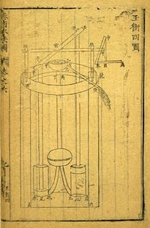
Sancai Tuhui, compiled by Wang Qi and his son Wang Siyi, is a Chinese leishu encyclopedia, completed in 1607 and published in 1609 during the Ming dynasty, featuring illustrations of subjects in the three worlds of heaven, earth, and humanity.

Michele or Michael Ruggieri, born Pompilio Ruggieri and known in China as Luo Mingjian, was an Italian Jesuit priest and missionary. A founding father of the Jesuit China missions, co-author of the first European–Chinese dictionary, and first European translator of the Four Books of Confucianism, he has been described as the first European sinologist.

Johann Schreck German missionary active in China

Johann(es) Schreck, also Terrenz or Terrentius Constantiensis, Deng Yuhan Hanpo 鄧玉函, Deng Zhen Lohan, was a German Jesuit, missionary to China and polymath. He is credited with the development of scientific-technical terminology in Chinese.

Taipei Ricci Institute organization

Taipei Ricci Institute (TRI) in Taipei, Taiwan, is one of four Ricci Institutes.

Sabatino de Ursis Italian Jesuit missionary

Sabatino de Ursis was an Italian Jesuit who was active in 17th-century China, during the Jesuit China missions.

Diego de Pantoja or Diego Pantoja was a Spanish Jesuit and missionary to China who is best known for having accompanied Matteo Ricci in Beijing. His name also appears in some sources as Didaco Pantoia.

<i>De Christiana expeditione apud Sinas</i> Book by Nicolas Trigault

De Christiana expeditione apud Sinas suscepta ab Societate Jesu ... is a book based on an Italian manuscript written by the most important founding figure of the Jesuit China mission, Matteo Ricci (1552–1610), expanded and translated into Latin by his colleague Nicolas Trigault (1577–1628). The book was first published in 1615 in Augsburg.

Louis J. Gallagher, SJ was an American Jesuit, known for his educational and literary work.

<i>Kunyu Quantu</i>

The Kunyu Quantu, or Full Map of the World, was a map of the world developed by Jesuit father Ferdinand Verbiest during his mission in China in 1674. A copy is in the Hunterian Museum.

The year 1584 in science and technology included many events, some of which are listed here.

<i>Zhifang Waiji</i>

The Zhifang Waiji was an atlas written by various Italian Jesuits in China in the early seventeenth century. The name literally refers to lands beyond the purview of the Zhifang Si, the Imperial cartography office. It was the first detailed atlas of global geography available in Chinese.

Siu-Leung Lee (李兆良), Ph.D., is the President of Zheng He Society of the Americas, Washington, DC, and editor of Midwestern Epigraphic Society in Columbus, Ohio.

Yu Xi, courtesy name Zhongning (仲寧), was a Chinese official, scholar, and astronomer of the Jin dynasty. He is best known for his discovery of the precession of the equinoxes, independently of the earlier ancient Greek astronomer Hipparchus. He also postulated that the Earth could be spherical in shape instead of being flat and square, long before the idea became widely accepted in Chinese science thanks to the European influence of the Jesuits in the 17th century.

References

Citations

Bibliography

International Standard Book Number Unique numeric book identifier

The International Standard Book Number (ISBN) is a numeric commercial book identifier which is intended to be unique. Publishers purchase ISBNs from an affiliate of the International ISBN Agency.