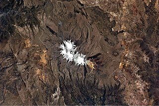
Choquepirhua is a mountain in the Chila mountain range in the Andes of Peru, about 5,400 metres (17,717 ft) high. It lies in the Arequipa Region, Castilla Province, on the border of the districts of Chachas and Choco. Choquepirhua is situated south of Chila.

Qullpa is a mountain in the Andes of Peru, about 5,226.4 metres (17,147 ft) high. It is situated in the Arequipa Region, Castilla Province, on the border of the districts Ayo and Uñón. Qullpa lies south of the mountain Yanqha.

Yanqha is a mountain in the Andes of Peru, about 5,200 metres (17,060 ft) high. It is situated in the Arequipa Region, Castilla Province, on the border of the districts Ayo and Uñón. Yanqha lies south of the mountains Yanawara and Yana Urqu and north of the mountain Qullpa.

Chuqllu Chuqllu or Chhuxllu Chhuxllu is a mountain in the Wansu mountain range in the Andes of Peru, about 5,000 metres (16,404 ft) high. It is situated in the Arequipa Region, Castilla Province, Orcopampa District.

Qullpa is a mountain in the Wansu mountain range in the Andes of Peru, about 5,100 metres (16,732 ft) high. It is situated in the Arequipa Region, La Unión Province, Puyca District, and in the Cusco Region, Chumbivilcas Province, Santo Tomás District. It lies northwest of the mountains Qullpa K'uchu and Minasniyuq.

P'isqi P'isqi is a mountain in the Andes of Peru, about 4,600 metres (15,092 ft) high. It lies in the Arequipa Region, Castilla Province, Andagua District. P'isqi P'isqi is situated west of Wakapallqa and Llallawi.

Chuqi Pirwa is a mountain in the Andes of Peru, about 5,200 m (17,100 ft) high. It is situated in the Cusco Region, Espinar Province, Condoroma District, and in the Puno Region, Lampa Province, Ocuviri District. Chuqi Pirwa lies southwest of Sawanani Lake (Saguanani) and northwest of Qullqi Q'awa.

Hatun Qurini is a mountain in the Peruvian Andes, about 5,000 metres (16,404 ft) high. It is situated in the Puno Region, Azángaro Province, San José District. Hatun Qurini lies northwest of the mountain Surupana.

Wilani is a mountain in the Andes of Peru, about 5,200 metres (17,060 ft) high. It is located in the Arequipa Region, Arequipa Province, Tarucani District, and in the Moquegua Region, General Sánchez Cerro Province, on the border of the districts Coalaque and Matalaque. Wilani lies southwest of Pukasaya, northwest of Ch'awarani and northeast of Qillqata.

Cuncapata is a mountain in the Vilcanota mountain range in the Andes of Peru, about 5,400 metres (17,717 ft) high. It is located in the Cusco Region, Canchis Province, Pitumarca District. Cuncapata lies southwest of the mountain Jatunñaño Punta, north of the lake Sibinacocha and southeast of Chumpe.

Waña is a mountain in the Wansu mountain range in the Andes of Peru, about 5,400 metres (17,717 ft) high. It is situated in the Cusco Region, Chumbivilcas Province, Santo Tomás District. Waña lies northwest of Wamanripa, northeast of Chankuwaña, east of Wayunka and southeast of Ikma.

Hatun Sisiwa is a 5,003-metre-high (16,414 ft) mountain in the Wansu mountain range in the Andes of Peru. It is situated in the Arequipa Region, La Unión Province, Huaynacotas District. Hatun Sisiwa lies northeast of Sullu Marka.

Sawsi is a 4,942-metre-high (16,214 ft) mountain in the Andes of Peru. It is situated in the Arequipa Region, Castilla Province, on the border of the districts of Chachas and Orcopampa. Sawsi lies at a lake named Machuqucha.

Hatun Q'asa is a mountain in the Wansu mountain range in the Andes of Peru, about 4,800 metres (15,748 ft) high. It is situated in the Arequipa Region, Condesuyos Province, Cayarani District. Hatun Q'asa lies at the Q'illumayu valley.

Wila Kunka is a mountain in the Cusco Region in the Andes of Peru, about 5,000 m (16,000 ft) high. It is situated in the Canchis Province, Checacupe District. Wila Kunka lies at the left bank of the Chawchamayu (Chauchamayo), northwest of Qusqu Qhawarina.

Wiluyu is a mountain in the Andes of Peru, about 5,000-metre (16,000 ft) high. It is located in the Cusco Region, Canchis Province, Marangani District. Wiluyu lies east of Langui Layo Lake, north of Pawka.

Tanka is a 4,783-metre-high (15,692 ft) mountain in the Andes of Peru. It is situated in the Arequipa Region, Condesuyos Province, Cayarani District, in the southern extensions of the Wansu mountain range. Tanka lies at the Puma Ranra valley, south of Allqa Q'awa.

Jañuma Pirwa is a 5,125-metre-high (16,814 ft) mountain in the Andes of Peru. It is located in the Arequipa Region, Caylloma Province, Tisco District. It lies southwest of Chuqi Pirwa and southeast of Pirwa.

Chuqi Pirwa is a mountain in the Andes of Peru, about 4,800 m (15,700 ft) high. It is located in the Arequipa Region, Caylloma Province, Tisco District, and in the Espinar Province, Yauri District. It lies northeast of Jañuma Pirwa and east of Pirwa.

T'allani Urqu is a mountain in the Andes of Peru which reaches a height of approximately 4,900 m (16,100 ft). It is located in the Arequipa Region, Caylloma Province, Caylloma District, and in the Condesuyos Province, Cayarani District. T'allani Urqu lies southeast of Kuntur Salla.


