
Finglas is a northwestern outer suburb of Dublin, Ireland. It lies close to Junction 5 of the M50 motorway, and the N2 road. Nearby suburbs include Glasnevin and Ballymun; Dublin Airport is seven km (4.3 mi) to the north. Finglas lies mainly in the postal district of Dublin 11.

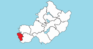
Fingal is a county in Ireland. It is in the province of Leinster and is part of the Eastern and Midland Region. It is one of three successor counties to County Dublin, which was disestablished for administrative purposes in 1994. Its name is derived from the medieval territory of Scandinavian foreigners that settled in the area. Fingal County Council is the local authority for the county. In 2022 the population of the county was 330,506, making it the second most populated council in Dublin and the third most populous county in the state.
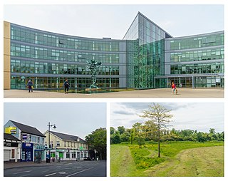
Blanchardstown is a large outer suburb of Dublin in the modern county of Fingal, Ireland. Located ten kilometres (6 mi) northwest of Dublin city centre, it has developed since the 1960s from a small village to a point where Greater Blanchardstown is the largest urban area in Fingal.

Mulhuddart is an outer suburb situated 12 km north-west of Dublin, Ireland. The River Tolka passes near the village.

Dublin 15, also rendered as D15, is a postal district in the suburbs of Dublin in Fingal, Ireland. It is 11 km (6.8 mi) west of the GPO in Dublin city.

Tyrrelstown is a townland in Fingal, County Dublin, Ireland, in the civil parish of Mulhuddart. It is located 13 km northwest of the city of Dublin, and is often considered as part of the greater Blanchardstown area. It is the site of a planned suburban development from the early 2000s. It is in the Dublin postal district of Dublin 15

Naul, is a village, townland, and civil parish at the northern edge of the traditional County Dublin in Ireland. The Delvin River to the north of the village marks the county boundary with County Meath. Naul civil parish is in the historic barony of Balrothery West.

Ballygall is a small suburban area located between Glasnevin and Finglas, on the northside of the city of Dublin, Ireland. It is also a townland divided between the civil parish of Finglas and that of Glasnevin. It was settled by Vikings in the 11th century, and later by the Cambro-Normans.
The barony of Castleknock is one of the baronies of Ireland. Originally part of the Lordship of Meath, it was then constituted as part of County Dublin. Today, it is in the modern county of Fingal, Ireland. The barony was originally also a feudal title, which became one of the subsidiary titles of the Viscounts Gormanston.

The R102 road is a regional road in Dublin, Ireland, which describes a broad arc across the north of the city, connecting the N3 — at its M50 motorway intersection — to the R107 on the other side of the city. The road is 10.8 kilometres (6.7 mi) long.
Nethercross is a feudal title of one of the baronies of Ireland. Originally part of the Lordship of Meath, it was then constituted as part of the County Dublin. Today, is in the modern county of Fingal.

Templemaley is a civil parish in County Clare, Ireland. It contains the village of Barefield and part of the town of Ennis.

Killone is a civil parish of County Clare, Ireland, to the southwest of Ennis. It is known for the ruins of Killone Abbey on the grounds of Newhall House and Estate.
St. Patrick's, or Kilquane, is a civil parish situated on both banks of the River Shannon near the city of Limerick in Ireland. It is unusual in that it is distributed over three baronies: Bunratty Lower, Clanwilliam and the barony of the City of Limerick. Besides the suburbs of the city, it also contains the villages of Ardnacrusha and Parteen. It is known for the Ardnacrusha power plant, a major hydroelectric plant.
Brawny is a barony in south–west County Westmeath, Ireland. It was formed by 1672. It is bordered by County Roscommon to the west. It also borders two other Westmeath baronies: Kilkenny West and Clonlonan. The largest centre of population in the barony is the town of Athlone.
Finglas is a civil parish mainly situated in the barony of Castleknock in the traditional county of Dublin, Ireland. It contains 34 townlands. Today, the parish is split between two local government areas: the modern county of Fingal and Dublin City Council.
Castleknock is a civil parish and a townland located in the south-western corner of the modern county of Fingal, Ireland. The civil parish is part of the ancient barony of Castleknock. It is centred on the suburban village of Castleknock. The townland of Castleknock itself is the location of the eponymous "Cnucha's Castle" – Castleknock Castle. The town with the biggest population in the parish is Blanchardstown. In geology, the parish rests on a substratum of limestone and comprises 2943 statute acres, the whole of which is arable land.
Clonsilla or "Clonsillagh" is a civil parish and a townland located in the south-western corner of the modern county of Fingal, Ireland. The civil parish is part of the ancient barony of Castleknock. It is centred on the suburban village of Clonsilla. In geology, the parish rests on a substratum of limestone and comprises 2943 statute acres, the whole of which is arable land. It is roughly bounded to the north by the old "Navan Road" – the modern N3; to the east by the civil parish of Castleknock; to the south by the River Liffey; to the south-east by the civil parish of Leixlip, chiefly in County Kildare, and to the north-west by the civil parish of Dunboyne in County Meath.

Saint Margaret's is a civil parish and townland in the historical barony of Coolock in County Dublin, Ireland. Rivermeade, a housing estate of 175 homes which is treated as a separate census town, is located between Saint Margaret's and the Ward River. Dublin Airport is also nearby.

