Wareham, Ontario

Last updated

Wareham is a community in Grey County, Ontario. [1] It is about 80 km northwest of Brampton, Ontario and about 60 km west of Barrie, Ontario. It is south of The Blue Mountains, Ontario and of the Grey Highlands. [1] [2]

Grey County County in Ontario, Canada

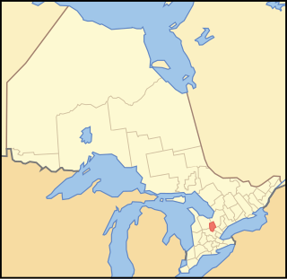
Grey County is a county of the Canadian province of Ontario. The county seat is in Owen Sound. It is located in the subregion of Southern Ontario named Southwestern Ontario. Grey County is also a part of the Georgian Triangle. At the time of the Canada 2016 Census the population of the County was 93,830.

Ontario Province of Canada

Ontario is one of the 13 provinces and territories of Canada and is located in east-central Canada. It is Canada's most populous province accounting for 38.3 percent of the country's population, and is the second-largest province in total area. Ontario is fourth-largest jurisdiction in total area when the territories of the Northwest Territories and Nunavut are included. It is home to the nation's capital city, Ottawa, and the nation's most populous city, Toronto, which is also Ontario's provincial capital.

The Blue Mountains, Ontario Town in Ontario, Canada

The Blue Mountains is a town in Grey County, southwestern Ontario, Canada, located where the Beaver River flows into Nottawasaga Bay. It is named for the Blue Mountain, and hence the economy of the town is centred on tourism, particularly on the Blue Mountain ski resort and the private Georgian Peaks, Osler, Craigleith and Alpine Ski Clubs.

Wareham is close to the Osprey Wetland Conservation Lands. [2] Both the Saugeen Valley Conservation Authority and the Nottawasaga Valley Conservation Authority bought land here to protect the headwaters of several important rivers. The Osprey Wetlands are in the headwaters of the Saugeen River, as well as the Grand, the Beaver of Grey County, the Mad, and a tributary of the Nottawasaga River. [3] This Wetland is a raised bog. [4]

Saugeen River river in Canada

The Saugeen River is located in southern Ontario, Canada. The river begins in the Osprey Wetland Conservation Lands and flows generally north-west about 160 kilometres (99 mi) before exiting into Lake Huron. The river is navigable for some distance, and was once an important barge route. Today the river is best known for its fishing and as a canoe route.

Grand River (Ontario) river in Canada

The Grand River is a large river in Southwestern Ontario, Canada. It also lies along the western fringe of the Golden Horseshoe region of Ontario which overlaps the eastern portion of southwestern Ontario along the length of this river. From its source near Wareham, Ontario, it flows south through Grand Valley, Fergus, Elora, Waterloo, Kitchener, Cambridge, Paris, Brantford, Caledonia, and Cayuga before emptying into the north shore of Lake Erie south of Dunnville at Port Maitland. One of the scenic and spectacular features of the river is the falls and Gorge at Elora.

Beaver River (Grey County)

The Beaver River is a river in Grey County and Simcoe County in Southern Ontario, Canada. It is part of the Great Lakes Basin, and is a tributary of Lake Huron. The river's drainage basin is under the auspices of Grey Sauble Conservation.

" Wareham as a community dates back to roughly the European Settlement of this area, about the 1850's. A branch of the Saugeen River runs through the centre of Wareham - and was the reason for settlement here. (The current crossroads of Centre Line A and Sideroad 41.) Originally there where three small water mills grouped around this corner. Remains of one of the largest of these, in the form of poured concrete bracketing the river, can be found to the SE, upstream from the intersection. The Hamlet of Wareham originally included a general store (now the location of the Church Shed / Wareham Forge) on the NW corner, and a blacksmith's shop on the NE corner. A red brick church, located about 50 m to the west on Centre Line, replaced the original wooden structure on the same location, about 1930. The original wood frame school house is located on the east side of SR 41, about 150 m south. (Both the church and the schoolhouse are now private residences.) "

It is the home of Darrell Markewitz, an artisan blacksmith who designed the living history program for L'Anse aux Meadows, Newfoundland for Parks Canada. [5] The Wareham Forge has been in operation since 1992 (the old 'Wareham Church Shed' building).

Blacksmith person who creates wrought iron or steel products by forging, hammering, bending, and cutting

A blacksmith is a metalsmith who creates objects from wrought iron or steel by forging the metal, using tools to hammer, bend, and cut. Blacksmiths produce objects such as gates, grilles, railings, light fixtures, furniture, sculpture, tools, agricultural implements, decorative and religious items, cooking utensils and weapons.

LAnse aux Meadows archaeological site

L'Anse aux Meadows is an archaeological site on the northernmost tip of the Great Northern Peninsula on the island of Newfoundland in the Canadian province of Newfoundland and Labrador. Archaeological evidence of a Norse presence was discovered at L'Anse aux Meadows in the 1960s. It is the only confirmed Norse or Viking site in North America outside of the settlements found in Greenland.

Newfoundland and Labrador Province of Canada

Newfoundland and Labrador is the most easterly province of Canada. Situated in the country's Atlantic region, it comprises the island of Newfoundland and mainland Labrador to the northwest, with a combined area of 405,212 square kilometres (156,500 sq mi). In 2018, the province's population was estimated at 525,073. About 92% of the province's population lives on the island of Newfoundland, of whom more than half live on the Avalon Peninsula.

Related Research Articles

Aberdeen is a community in Grey County, Ontario, Canada. Aberdeen consists of a series of houses in a historical Canadian village site. The village is located north of both the Durham Interforest factory and the stretch of Grey Road 4 between Durham and Hanover.

Chatsworth, Ontario Township in Ontario, Canada

Chatsworth is a township in south-western Ontario, Canada, in Grey County, located at the headwaters of the Styx River, the Saugeen River, the Sauble River, the Bighead River, the Spey River, and the old Sydenham River.

West Grey Municipality in Ontario, Canada

West Grey is a township in western Ontario, Canada, in Grey County spanning across the River Styx, the Rocky Saugeen River, the Beatty Saugeen River, and the South Saugeen River. Unlike most rural communities, West Grey maintains its own police force, the West Grey Police Service.

Alliston settlement in Simcoe County, Ontario

Alliston is a settlement in Simcoe County in the Canadian province of Ontario. It has been part of the Town of New Tecumseth since the 1991 amalgamation of Alliston and nearby villages of Beeton, Tottenham, and the Township of Tecumseth. The primary downtown area is located along Highway 89, known as Victoria Street.

Mount Forest, Ontario Unincorporated community in Ontario, Canada

Mount Forest is an unincorporated community located on the junction of the 6 and the 89 in the township of Wellington North, Ontario. The town's motto is "High, Healthy, Happy", which can be seen on the water tower when approaching the town from the south. As of the 2011 Canadian census the population of Mount Forest was 4,757.

Nottawasaga River river in Canada

The Nottawasaga River is a river in Simcoe County and Dufferin County in Central Ontario, Canada. It is part of the Great Lakes Basin, and is a tributary of Lake Huron. The river flows from the Orangeville Reservoir in the town of Orangeville, Dufferin County, through the Niagara Escarpment and the Minesing Wetlands, the latter a wetland of international significance, and empties into Nottawasaga Bay, an inlet of Georgian Bay on Lake Huron, at the town of Wasaga Beach, Simcoe County.

Dufferin County County in Ontario, Canada

Dufferin County is a county and census division located in Central Ontario, Canada. The county seat is Orangeville, and the current Warden is Paul Mills. The current chief administrative officer is Sonya Pritchard. Dufferin covers an area of 1,486.31 square kilometres (573.87 sq mi), and its population is 61,735 (2016).

Williamsford is a village on the North Saugeen River in Grey County, Ontario, Canada. It has a general store, post office, a bookstore and restaurant housed in a historic grain mill. A small dam controls the North Saugeen River. It has several churches, and a community cemetery. It is located on Highway 6 between Durham and Owen Sound.

Saugeen Shores Town in Ontario, Canada

Saugeen Shores is a town in Bruce County, Ontario, Canada, formed in 1998.

Nottawasaga Bay

Nottawasaga Bay is a sub-bay within Georgian Bay in Southern Ontario, Canada located at the southernmost end of the main bay. The communities located on Nottawasaga Bay are Meaford, The Blue Mountains, Collingwood, Wasaga Beach and Tiny.

Durham, Ontario Unincorporated town in Ontario, Canada

Durham is a community in the municipality of West Grey, Grey County, Ontario, Canada. Durham is located near the base of the Bruce Peninsula.

Priceville, Ontario Village in Ontario, Canada

Priceville is a small village in the southwest corner of the Municipality of Grey Highlands, Grey County, Ontario, Canada. Priceville is located on Grey Road 4, east of Durham and southwest of Flesherton. The village is very attractive due to the rolling topography, the meandering Saugeen River and the well preserved and restored old buildings.

Ayton, Ontario human settlement in Ontario, Canada

Ayton is a community in the municipality of West Grey, Grey County, Ontario, Canada.

Edenvale, Ontario Unincorporated rural community in Ontario, Canada

Edenvale is an unincorporated place in Springwater Township, Simcoe County, Ontario, Canada.

Chippewas of Nawash Unceded First Nation First nation band in Ontario, Canada

Chippewas of Nawash Unceded First Nation formerly "Cape Croker" is an Ojibway First Nations band in the Bruce Peninsula in Ontario, Canada. Along with the Saugeen First Nation, they form the Chippewas of Saugeen Ojibway Territory. Chippewas of Nawash currently has a population of 700 individuals living on the reserve; however, the band roll has approximately 2080 registered in total. The size of all reserves is 71.83 km². The First Nation has 3 reserves, Neyaashiinigmiing 27, Cape Croker Hunting Ground 60B and Saugeen and Cape Croker Fishing Islands 1.

Minesing Wetlands A Ramsar boreal wetland in central Ontario, Canada

Minesing Wetlands, previously known as Minesing Swamp, is a Ramsar boreal wetland in central Ontario, Canada stretching from the western periphery of Barrie to Georgian Bay. It was identified and classified through the International Biological Program. It is "the largest and best example of fen bog in southern Ontario", one of the "most diverse undisturbed wetland tracts in Canada" and is a provincially significant Area of Natural and Scientific Interest. The term minesing is of Ojibwe origin and means "island", referring to an island located within Lake Edenvale, which encompassed the present-day wetlands and surrounding areas.

The Saugeen Kame Terraces is a 431-hectare provincially significant Earth Science Area of Natural and Scientific Interest in Ontario, Canada. It is in Grey County, bounding the eastern and southern shores of Wilder Lake, a kettle lake, and is part of the larger Singhampton Kame Moraine formation. It is a kame formation that is the result of glacial retreat sediment deposition about 14,000 years ago.

Beatty Saugeen River river in Canada

The Beatty Saugeen River is a river in the Saugeen River and Lake Huron drainage basins in Grey County, southwestern Ontario, Canada. It is a tributary of the South Saugeen River.

The Saugeen Valley Conservation Authority (SVCA) is a conservation authority in Ontario, Canada. It operates under the Conservation Authorities Act of Ontario. It is a corporate body, through which municipalities, landowners and other organizations work cooperatively to manage the Saugeen River watershed and natural resources within it.

References

  1. 1 2 Map showing location in Grey County, accessed 2012-10-14
  2. 1 2 Roadside Thoughts: Wareham, accessed 2012-10-14
  3. Osprey Wetland, accessed 2012-10-14
  4. Osprey Wetlands, accessed 2012-10-14
  5. Wareham Forge Blog, accessed 2012-10-14

Coordinates: 44°14′56″N80°24′29″W / 44.249°N 80.408°W / 44.249; -80.408

Geographic coordinate system Coordinate system

A geographic coordinate system is a coordinate system that enables every location on Earth to be specified by a set of numbers, letters or symbols. The coordinates are often chosen such that one of the numbers represents a vertical position and two or three of the numbers represent a horizontal position; alternatively, a geographic position may be expressed in a combined three-dimensional Cartesian vector. A common choice of coordinates is latitude, longitude and elevation. To specify a location on a plane requires a map projection.