Warming Land

Last updated
Warming Land
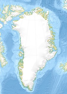
Greenland edcp location map.svg
Red pog.svg
Warming Land
Geography
LocationNW Greenland
Coordinates 81°37′N52°00′W / 81.617°N 52.000°W / 81.617; -52.000 Coordinates: 81°37′N52°00′W / 81.617°N 52.000°W / 81.617; -52.000
Adjacent bodies of water
Length102 km (63.4 mi)
Width61 km (37.9 mi)
Highest elevation1,253 m (4,111 ft)
Highest point Rink Firn High Point
Administration
Greenland (Denmark)

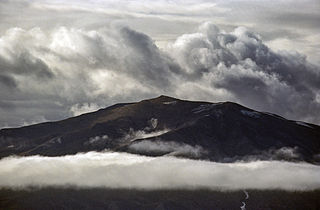
Warming Land is a peninsula in far northern Greenland. Administratively it is a part of the Northeast Greenland National Park. It was named after Danish botanist and ecologist Eugen Warming (1841 – 1924).
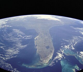
Peninsula A piece of land that is bordered by water on three sides but connected to mainland

A peninsula is a landform surrounded by water on the majority of its border while being connected to a mainland from which it extends. The surrounding water is usually understood to be continuous, though not necessarily named as a single body of water. Peninsulas are not always named as such; one can also be a headland, cape, island promontory, bill, point, or spit. A point is generally considered a tapering piece of land projecting into a body of water that is less prominent than a cape. A river which courses through a very tight meander is also sometimes said to form a "peninsula" within the loop of water. In English, the plural versions of peninsula are peninsulas and, less commonly, peninsulae.

Greenland autonomous country within the Kingdom of Denmark

Greenland is an autonomous constituent country of the Kingdom of Denmark between the Arctic and Atlantic oceans, east of the Canadian Arctic Archipelago. Though physiographically a part of the continent of North America, Greenland has been politically and culturally associated with Europe for more than a millennium. The majority of its residents are Inuit, whose ancestors began migrating from the Canadian mainland in the 13th century, gradually settling across the island.

Northeast Greenland National Park national park

Northeast Greenland National Park is the world's largest national park and the 9th largest protected land area. Established in 1974 and expanded to its present size in 1988, it protects 972,000 km2 (375,000 sq mi) of the interior and northeastern coast of Greenland and is bigger than all but twenty-nine countries in the world. It was the first national park to be created in the Kingdom of Denmark and remains Greenland's only national park.

Contents

Geography

Warming Land is located between Nyeboe Land and Wulff Land. It is bounded by St George Fjord and the Steensby Glacier on its western side, and Hartz Sound —a branch of the Sherard Osborn Fjord, as well as the Ryder Glacier on the eastern. [1] Midgårdsormen, an unglaciated section of the peninsula, is located at the southern end and to the south of it lies the Greenland Ice Sheet. Warming Land has two large firn caps in its central part, the Daniel Bruun Firn and the Rink Firn covering the highest parts of the peninsula. [2]

Nyeboe Land

Nyeboe Land is a peninsula in far northwestern Greenland. It is a part of the Northeast Greenland National Park.

Wulff Land

Wulff Land is a peninsula in far northwestern Greenland. Administratively it is a part of the Northeast Greenland National Park.

Sherard Osborn Fjord

Sherard Osborn Fjord is a fjord in northern Greenland. To the NNW, the fjord opens into the Lincoln Sea. Administratively it is part of the Northeast Greenland National Park.

Map of the Nares Strait area. Operational Navigation Chart A-5, 3rd edition.jpg
Map of the Nares Strait area.

See also

Bibliography

International Standard Book Number Unique numeric book identifier

The International Standard Book Number (ISBN) is a numeric commercial book identifier which is intended to be unique. Publishers purchase ISBNs from an affiliate of the International ISBN Agency.

Related Research Articles

Geography of Greenland

Greenland is located between the Arctic Ocean and the North Atlantic Ocean, northeast of Canada and northwest of Iceland. The territory comprises the island of Greenland—the largest island in the world—and more than a hundred other smaller islands. As an island, Greenland has no land boundaries and 44,087 km of coastline. A sparse population is confined to small settlements along certain sectors of the coast. Greenland possesses the world's second largest ice sheet.

Hendrik Island island in Greenland

Hendrik Island is an island in far northern Greenland. Its area is 583 km². It is part of the Northeast Greenland National Park.

Andrée Land (Greenland) peninsula in Greenland

Andrée Land is a peninsula in King Christian X Land, East Greenland that is bounded by Kejser Franz Joseph Fjord, Isfjord and Geologfjord.

Nunavik Peninsula

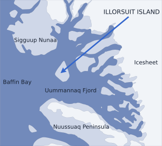
Nunavik Peninsula is a large peninsula in northwestern Greenland. It separates two cultural and geographical regions of northwestern Greenland: Uummannaq Fjord region in the southeast, and Upernavik Archipelago in the north.

Petermann Glacier glacier in Greenland

Petermann Glacier is a large glacier located in North-West Greenland to the east of Nares Strait. It connects the Greenland ice sheet to the Arctic Ocean at 81°10' north latitude, near Hans Island.

Kangerlussuaq Fjord, East Greenland Fjord Greenland, Sermersooq

Kangerlussuaq Fjord is a fjord in eastern Greenland. It is part of the Sermersooq municipality.

Nordfjord (Greenland) fjord in East Greenland

Nordfjord is a fjord in the NE Greenland National Park area, East Greenland.

King Frederick VIII Land Region in Greenland

King Frederick VIII Land is a major geographic division of northeastern Greenland. It extends above the Arctic Circle from 76°N to 81°N in a N/S direction along the coast of the Greenland Sea.

Romer Lake

Romer Lake is a land-locked freshwater fjord at the northern end of King Frederick VIII Land, near Greenland's northeastern coast. The Danish military base/weather station Nord —the only inhabited place in the area— lies 50 km (31 mi) to the northeast. The lake and its surroundings are part of the Northeast Greenland National Park zone.

Ingolf Fjord fjord in Greenland

Ingolf Fjord, also known as Ingolf Sound, is a fjord of Greenland's northeastern coast in northern King Frederick VIII Land.

Princess Caroline-Mathilde Alps

The Princess Caroline-Mathilde Alps are a mountain range system in the Holm Land Peninsula, King Frederick VIII Land, northeastern Greenland. Administratively this range is part of the Northeast Greenland National Park zone.

Odinland

Odinland, also Odinsland in the Defense Mapping Agency Greenland Navigation charts, is a peninsula in the King Frederick VI Coast, southeastern Greenland. It is a part of the Sermersooq municipality.

Freuchen Land

Freuchen Land is a peninsula in far northwestern Greenland. It is a part of the Northeast Greenland National Park.

Henson Glacier (Greenland)

Henson Glacier, is one of the major glaciers in northern Greenland.

Washington Land

Washington Land is a peninsula in northwestern Greenland. It is a part of the Avannaata municipality.

Daugaard-Jensen Land

Daugaard-Jensen Land,, is a peninsula in northwestern Greenland. It is a part of the Avannaata municipality.

Petermann Fjord

Petermann Fjord is a fjord in northwestern Greenland. Administratively it marks the boundary between the Avannaata municipality and the Northeast Greenland National Park.

References

  1. "Warming Land". Mapcarta. Retrieved 14 July 2016.
  2. GoogleEarth