Wulff Land

Last updated
Wulff Land
Greenland edcp location map.svg
Red pog.svg
Wulff Land
Geography
LocationNW Greenland
Coordinates 82°0′N48°0′W / 82.000°N 48.000°W / 82.000; -48.000 Coordinates: 82°0′N48°0′W / 82.000°N 48.000°W / 82.000; -48.000
Adjacent bodies of water
Length150 km (93 mi)
Width70 km (43 mi)
Highest elevation1,128 m (3,701 ft)
Administration
Greenland (Denmark)
Demographics
PopulationUninhabited

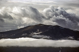
Wulff Land (Danish : Wulffs Land) is a peninsula in far northwestern Greenland. Administratively it is a part of the Northeast Greenland National Park. [1]

Danish language North Germanic language spoken in Denmark

Danish is a North Germanic language spoken by around six million people, principally in Denmark and in the region of Southern Schleswig in northern Germany, where it has minority language status. Also, minor Danish-speaking communities are found in Norway, Sweden, Spain, the United States, Canada, Brazil, and Argentina. Due to immigration and language shift in urban areas, around 15–20% of the population of Greenland speak Danish as their first language.

Peninsula A piece of land that is bordered by water on three sides but connected to mainland

A peninsula is a landform surrounded by water on the majority of its border while being connected to a mainland from which it extends. The surrounding water is usually understood to be continuous, though not necessarily named as a single body of water. Peninsulas are not always named as such; one can also be a headland, cape, island promontory, bill, point, or spit. A point is generally considered a tapering piece of land projecting into a body of water that is less prominent than a cape. A river which courses through a very tight meander is also sometimes said to form a "peninsula" within the loop of water. In English, the plural versions of peninsula are peninsulas and, less commonly, peninsulae.

Greenland Autonomous country within the Kingdom of Denmark

Greenland is an autonomous constituent country of the Kingdom of Denmark between the Arctic and Atlantic oceans, east of the Canadian Arctic Archipelago. Though physiographically a part of the continent of North America, Greenland has been politically and culturally associated with Europe for more than a millennium. The majority of its residents are Inuit, whose ancestors began migrating from the Canadian mainland in the 13th century, gradually settling across the island.

Contents

History

Wulff Land was named after Swedish botanist and Arctic explorer Thorild Wulff (1867–1917), who went with Knud Rasmussen on the Second Thule Expedition and died from fatigue near Cape Agassiz in southern Peabody Bay. [2]

Thorild Wulff Swedish botanist

Thorild Wulff was a Swedish botanist and polar explorer.

Knud Rasmussen Danish explorer and anthropologist

Knud Johan Victor Rasmussen was a Greenlandic–Danish polar explorer and anthropologist. He has been called the "father of Eskimology" and was the first European to cross the Northwest Passage via dog sled. He remains well known in Greenland, Denmark and among Canadian Inuit.

Peabody Bay

Peabody Bay is a large bay in northwestern Greenland. Administratively it is part of the Qaasuitsup municipality.

The Wulff Land peninsula is a barren and inhospitable place. Unlike Peary Land to the NE, no remains of human habitation have been found.

Peary Land peninsula

Peary Land is a peninsula in northern Greenland, extending into the Arctic Ocean. It reaches from Victoria Fjord in the west to Independence Fjord in the south and southeast, and to the Arctic Ocean in the north, with Cape Morris Jesup, the northernmost point of Greenland's mainland, and Cape Bridgman in the northeast.

Geography

Wulff Land is located to the northeast of Warming Land and east of Hendrik Island across the Sherard Osborn Fjord. Nares Land lies to the east, across the Victoria Fjord and Stephenson Island to the northeast. Cape May in the Lincoln Sea is its northernmost headland. [3] To the south the peninsula is attached to the mainland and its ice cap. [1]

Warming Land

Warming Land is a peninsula in far northern Greenland. Administratively it is a part of the Northeast Greenland National Park. It was named after Danish botanist and ecologist Eugen Warming.

Hendrik Island island in Greenland

Hendrik Island is an island in far northern Greenland. Its area is 583 km². It is part of the Northeast Greenland National Park.

Sherard Osborn Fjord

Sherard Osborn Fjord is a fjord in northern Greenland. To the NNW, the fjord opens into the Lincoln Sea. Administratively it is part of the Northeast Greenland National Park.

Wulff Land is a largely unglaciated and mountainous peninsula with a large firn cap, The Sven Hedin Firn, in its northern part. There are lakes with a landlocked fjord structure in the southern part where the Blue Cliffs rise above one of the lakes. [4] [1]

Firn granular snow, especially on the upper part of a glacier, where it has not yet been compressed into ice

Firn is partially compacted névé, a type of snow that has been left over from past seasons and has been recrystallized into a substance denser than névé. It is ice that is at an intermediate stage between snow and glacial ice. Firn has the appearance of wet sugar, but has a hardness that makes it extremely resistant to shovelling. Its density generally ranges from 0.4 g/cm³ to 0.83 g/cm³, and it can often be found underneath the snow that accumulates at the head of a glacier.

In the southwest lies Aage Bistrup Land, and west of it the Ryder Glacier, across which lies Permin Land. [3]

Ryder Glacier (Greenland)

Ryder Glacier, is one of the major glaciers in northern Greenland.

Map of part of Ellesmere Island and far Northern Greenland. Operational Navigation Chart A-5, 3rd edition.jpg
Map of part of Ellesmere Island and far Northern Greenland.

Bibliography

See also

Related Research Articles

Danmark Fjord fjord in Greenland

Danmark Fjord, also known as Denmark Sound, is a fjord in northeast Greenland within Northeast Greenland National Park.

Kaiser Franz Joseph Fjord fjord in Greenland

Kaiser Franz Joseph Fjord is a major fjord system in the NE Greenland National Park area, East Greenland.

Wollaston Foreland peninsula in Greenland

Wollaston Foreland is a peninsula in the NE Greenland National Park area, East Greenland.

Andrée Land (Greenland) peninsula in Greenland

Andrée Land is a peninsula in King Christian X Land, East Greenland that is bounded by Kejser Franz Joseph Fjord, Isfjord and Geologfjord.

Germania Land peninsula in Greenland

Germania Land or Germanialand is a peninsula in northeastern Greenland. Despite the high latitude it is largely unglaciated.

Crown Prince Christian Land peninsula in Greenland

Crown Prince Christian Land is a large peninsula in northern Greenland. It is a part of Northeast Greenland National Park.

Renland peninsula in Greenland

Renland is a peninsula in eastern Greenland. It is a part of the Sermersooq municipality. Despite its proximity to the coast Renland has an ice cap climate with bitterly cold winters and very low maximum temperatures in the summer.

Kangerlussuaq Fjord, East Greenland Fjord Greenland, Sermersooq

Kangerlussuaq Fjord is a fjord in eastern Greenland. It is part of the Sermersooq municipality.

King Frederick VIII Land Region in Greenland

King Frederick VIII Land is a major geographic division of northeastern Greenland. It extends above the Arctic Circle from 76°N to 81°N in a N/S direction along the coast of the Greenland Sea.

Holm Land

Holm Land, sometimes referred to as "Hahn Land", is a peninsula in King Frederick VIII Land, northeastern Greenland. Administratively it belongs to the NE Greenland National Park area.

Adolf S. Jensen Land peninsula in Greenland

Adolf S. Jensen Land is a peninsula in the southern limit of King Frederick VIII Land, northeastern Greenland. Administratively it belongs to the NE Greenland National Park area.

Odinland

Odinland, also Odinsland in the Defense Mapping Agency Greenland Navigation charts, is a peninsula in the King Frederick VI Coast, southeastern Greenland. It is a part of the Sermersooq municipality.

De Long Fjord

De Long Fjord is a fjord system in Peary Land, northern Greenland. To the northwest, the fjord opens into the Lincoln Sea of the Arctic Ocean. It is part of the Northeast Greenland National Park.

Newman Bay

Newman Bay or Newman Fjord is a fjord in northern Greenland. To the northwest, the fjord opens into the Robeson Channel of the Lincoln Sea. It is a part of the Northeast Greenland National Park.

Freuchen Land

Freuchen Land is a peninsula in far northwestern Greenland. It is a part of the Northeast Greenland National Park.

Bessel Fjord, NW Greenland fjord in Greenland

Bessel Fjord, also known as Bessels Bay, is a fjord in northwestern Greenland. Administratively it belongs to the Avannaata municipality.

Petermann Fjord

Petermann Fjord is a fjord in northwestern Greenland. Administratively it marks the boundary between the Avannaata municipality and the Northeast Greenland National Park.

References

  1. 1 2 3 "Wulff Land". Mapcarta. Retrieved 3 March 2019.
  2. Mark Nuttall, Encyclopedia of the Arctic, p. 1744
  3. 1 2 Prostar Sailing Directions 2005 Greenland and Iceland Enroute, p. 94
  4. GoogleEarth