
The Black Country is an area of England's West Midlands. It is mainly urban, covering most of the Dudley and Sandwell metropolitan boroughs, with the Metropolitan Borough of Walsall and the City of Wolverhampton sometimes included. The towns of Dudley and Tipton are generally considered to be the centre.

Oldbury is a market town in the metropolitan borough of Sandwell, in the county of the West Midlands, England. It is the administrative centre of the borough. At the 2011 census, the town had a population of 13,606, while the 2017 population of the wider built-up area was estimated at 25,488. Sandwell Metropolitan Borough Council, which defines Oldbury Town as consisting of the wards of Bristnall, Langley, Oldbury, and Old Warley, gave the population as 50,641 in 2011.
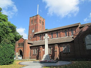
Rowley Regis is a town and former municipal borough in Sandwell in the county of the West Midlands, England. It forms part of the area immediately west of Birmingham known as the Black Country and encompasses the three Sandwell council wards of Blackheath, Cradley Heath and Old Hill, and Rowley. At the 2011 census, the combined population of these wards was 50,257.

The Metropolitan Borough of Dudley is a metropolitan borough of West Midlands, England. It was created in 1974 following the Local Government Act 1972, through a merger of the existing Dudley County Borough with the municipal boroughs of Stourbridge and Halesowen.
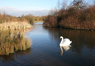
Sandwell Valley Country Park is a country park, run by Sandwell Metropolitan Borough Council, in Sandwell Valley, on the River Tame in the middle of the urban conurbation between Birmingham and West Bromwich in West Midlands, England.

Tividale is a district of the Metropolitan Borough of Sandwell, West Midlands.

Cradley Heath is a town in the Metropolitan Borough of Sandwell, West Midlands, England. It is in the Black Country, 8 miles (13 km) west of Birmingham. The town was known for the manufacture of chains in the first half of the twentieth century.

Netherton is a town of the Metropolitan Borough of Dudley, 2 miles (3 km) south of Dudley in the West Midlands of England. It was historically part of Worcestershire. The town is part of the Black Country, Netherton is bounded by nature reserves to the east and west, and an industrial area and the Dudley Southern By-Pass to the north.

Netherton Tunnel Branch Canal, in the West Midlands county, England, is part of the Birmingham Canal Navigations, (BCN). It was constructed at a 453–foot elevation, the Wednesbury or Birmingham level; it has no locks. The total length of the branch canal is 2.4 miles (3.9 km) and the canal tunnel is 9,081 feet (2,768 m) long.

The Dudley Canal is a canal passing through Dudley in the West Midlands of England. The canal is part of the English and Welsh network of connected navigable inland waterways and forms part of the popular Stourport Ring narrowboat cruising route.

Haden Hill Park is at Haden Hill, between Halesowen and Old Hill in the West Midlands, England, on the southern edge of the Black Country. Within its grounds are the sixteenth and seventeenth century Haden Hall, the Victorian Haden Hill House and Corngreaves Nature Reserve. The park and buildings are owned and managed by Sandwell Metropolitan Borough Council.

Cobb's Engine House in Rowley Regis, West Midlands, England, is a scheduled ancient monument and a Grade II listed building built around 1831.
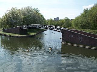
The present day Bumble Hole Branch Canal and Boshboil Branch surround Bumble Hole, a water-filled clay pit, in Bumble Hole and Warren's Hall Nature Reserve, Rowley Regis, West Midlands, England. They formed a looped part of the original Dudley No. 2 Canal until the opening of the Netherton Tunnel in 1858 when the loop was bypassed by a new cut, in line with the new tunnel. Part of the bypassed canal loop, which surrounds Bumble Hole, is now in-filled giving access to the pool of Bumble Hole. An area next to the Bumble Hole and Dudley canals is the Bumble Hole Local Nature Reserve.
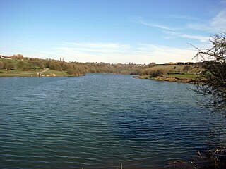
Fens Pools is a 37.6 hectares biological site of Special Scientific Interest in the West Midlands. The site was notified in 1989. under the Wildlife and Countryside Act 1981 and is currently managed by the Country Trust.

Sheepwash Urban Park is a Local Nature Reserve (LNR), situated in Sandwell Metropolitan Borough, in the West Midlands conurbation of the United Kingdom. It forms part of the Black Country Urban Forest.
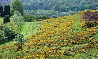
Pensnett Chase was a wooded area of land owned by the Lords of Dudley Castle in the parishes of Kingswinford and Dudley. As a chase, it was originally used by them to hunt game in although it was also used as common land by local people. At some periods it was regarded as extending into Gornal and including Baggeridge Wood at one end and perhaps Cradley Heath at the other. By the 17th century the ancient woodlands had largely been cleared.
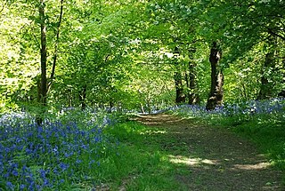
Saltwells Local Nature Reserve is situated in the Netherton area of Dudley Metropolitan Borough in West Midlands, England. The reserve, created in 1981, covers 247 acres and includes Saltwells Wood and part of Netherton Hill within its boundaries. The reserve encloses two Sites of Special Scientific Interest and one scheduled ancient monument.

Bumble Hole Local Nature Reserve is situated in the Netherton area of Dudley Metropolitan Borough in the county of West Midlands, England. This former industrial area now features canals, ponds, grassland and wooded areas. The reserve lies adjacent to the Warren's Hall Local Nature Reserve. It was declared a local nature reserve in 1996.

Barrow Hill Local Nature Reserve is a local nature reserve situated in Pensnett in the county of West Midlands, England. Its most distinctive feature, Barrow Hill, is the eroded remnant of a high level igneous intrusion that was formed 315 million years ago during the Carboniferous period. The reserve was created in 2005.

Buckpool and Fens Pool Local Nature Reserve is situated in the Pensnett area of the West Midlands. The largest area of open water in Dudley Metropolitan Borough, it contains both large and small ponds, one end of the Stourbridge Canal, streams and grassy areas. It was created in 1993.


