Warrenton, Indiana

Last updated
Warrenton, Indiana
Ghost town
Locator map of Warren County, Indiana.svg
Red pog.svg
Warrenton
Location in Warren County
Coordinates: 40°18′17″N87°15′30″W / 40.30472°N 87.25833°W / 40.30472; -87.25833 Coordinates: 40°18′17″N87°15′30″W / 40.30472°N 87.25833°W / 40.30472; -87.25833
Country United States
State Indiana
County Warren
Township Warren
Time zone Eastern (EST) (UTC-5)
  Summer (DST) EDT (UTC-4)
ZIP code 47918
Area code(s) 765

Warrenton is an extinct town in Warren Township, Warren County, in the U.S. state of Indiana. It was the county's original county seat.

Warren Township, Warren County, Indiana Township in Indiana, United States

Warren Township is one of twelve townships in Warren County, Indiana, United States. According to the 2010 census, its population was 806 and it contained 324 housing units.

Warren County, Indiana County in the United States

Warren County lies in western Indiana between the Illinois state line and the Wabash River in the United States. According to the 2010 census, the population was 8,508. The county seat is Williamsport.

U.S. state constituent political entity of the United States

In the United States, a state is a constituent political entity, of which there are currently 50. Bound together in a political union, each state holds governmental jurisdiction over a separate and defined geographic territory and shares its sovereignty with the federal government. Due to this shared sovereignty, Americans are citizens both of the federal republic and of the state in which they reside. State citizenship and residency are flexible, and no government approval is required to move between states, except for persons restricted by certain types of court orders. Four states use the term commonwealth rather than state in their full official names.

History

Warrenton was selected as the Warren County seat in March 1828 by commissioners appointed under the act forming the county. It was laid out "on the east fraction of the southwest quarter of Section 31, Township 22 north, Range 7 west," [1] which today is in the extreme southwestern corner of Warren Township, a little over two miles (3 km) northeast of the current county seat of Williamsport. [2] The site overlooks the confluence of Big Pine Creek with the Wabash River.

Williamsport, Indiana Town in Indiana, United States

Williamsport is a town in Washington Township, Warren County, in the U.S. state of Indiana. The population was 1,898 at the 2010 census. It is the county seat of Warren County and is the largest of the four incorporated towns in the county. Williamsport Falls is located in downtown Williamsport.

Big Pine Creek (Indiana)

Big Pine Creek is a creek in northwestern Indiana, USA. It begins in Round Grove Township in southwestern White County and flows generally southward 51.3 miles (82.6 km) through Benton and Warren counties before meeting the Wabash River near the town of Attica. The lower section of the creek from Rainsville to the Wabash is used by canoeists, particularly during the spring when the water is at its highest, and local flora, fauna and geology can be observed.

Wabash River tributary of the Ohio River in the United States of America

The Wabash River is a 503-mile-long (810 km) river in Ohio and Indiana, United States, that flows from the headwaters near the middle of Ohio's western border northwest then southwest across northern Indiana turning south along the Illinois border where the southern portion forms the Indiana-Illinois border before flowing into the Ohio River. It is the largest northern tributary of the Ohio River. From the dam near Huntington, Indiana, to its terminus at the Ohio River, the Wabash flows freely for 411 miles (661 km). Its watershed drains most of Indiana. The Tippecanoe River, White River, Embarras River and Little Wabash River are major tributaries. The river's name comes from an Illini Indian word meaning "water over white stones".

The town was surveyed by Perrin Kent and platted by County Agent Luther Tillotson on July 8, 1828, on a tract of land which had been donated to the county by a local landowner named Hollingsworth. Tillotson laid out seven full blocks of eight lots each, four half blocks of four lots each, and a public square of 1.8 acres (7,300 m2). On August 5, 1828, the lots were sold at public auction for between $10 and $20 each, during which free whiskey was served at the county's expense, "probably to loosen the tongue of the auctioneer or 'crier' and the generosity of the buyers". [1]

Plat scale map showing the divisions of a piece of land

In the United States, a plat is a map, drawn to scale, showing the divisions of a piece of land. United States General Land Office surveyors drafted township plats of Public Lands Surveys to show the distance and bearing between section corners, sometimes including topographic or vegetation information. City, town or village plats show subdivisions into blocks with streets and alleys. Further refinement often splits blocks into individual lots, usually for the purpose of selling the described lots; this has become known as subdivision.

A public auction is an auction held on behalf of a government in which the property to be auctioned is either property owned by the government, or property which is sold under the authority of a court of law or a government agency with similar authority.

Warrenton's status as county seat was short-lived. An act approved on January 22, 1829, ordered a relocation of the county seat, and in June 1829 it was moved to nearby Williamsport. Not all the reasons for the move are clear, but an 1883 history cites concerns that "donations" to the county from Warrenton landowners were less than expected, and that much better sums had been received from William Harrison (founder of Williamsport) and Thomas Gilbert. Consequently, "this induced the citizens to wish a re-location of the county seat where the county could receive much greater benefit, or a re-establishment of it at Warrenton if the proprietors of that town would come down, in a handsome manner, with satisfactory donations." [3]

Very few improvements were ever made to the lots at Warrenton and it quickly faded away. No evidence of the town remains at the site.

Related Research Articles

Oxford, Indiana Town in Indiana, United States

Oxford is a town in Oak Grove Township, Benton County, Indiana. The population was 1,162 at the 2010 census. It is part of the Lafayette, Indiana, Metropolitan Statistical Area.

Adams Township, Warren County, Indiana Township in Indiana, United States

Adams Township is one of twelve townships in Warren County, Indiana. According to the 2010 census, its population was 512 and it contained 250 housing units.

Jordan Township, Warren County, Indiana Township in Indiana, United States

Jordan Township is one of twelve townships in Warren County, Indiana, United States. According to the 2010 census, its population was 247 and it contained 105 housing units. It is almost entirely agricultural and contains no incorporated towns.

Kent Township, Warren County, Indiana Township in Indiana, United States

Kent Township is one of twelve townships in Warren County, Indiana, United States. According to the 2010 census, its population was 428 and it contained 196 housing units.

Liberty Township, Warren County, Indiana Township in Indiana, United States

Liberty Township is one of twelve townships in Warren County, Indiana, United States. According to the 2010 census, its population was 896 and it contained 362 housing units.

Medina Township, Warren County, Indiana Township in Indiana, United States

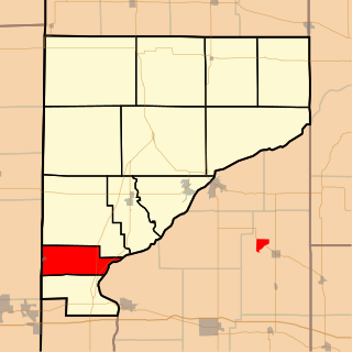
Medina Township is one of twelve townships in Warren County, Indiana, United States. According to the 2010 census, its population was 457 and it contained 191 housing units.

Mound Township, Warren County, Indiana Township in Indiana, United States

Mound Township is one of twelve townships in Warren County, Indiana, United States. According to the 2010 census, its population was 418 and it contained 183 housing units.

Pike Township, Warren County, Indiana Township in Indiana, United States

Pike Township is one of twelve townships in Warren County, Indiana, United States. According to the 2010 census, its population was 1,221 and it contained 529 housing units.

Pine Township, Warren County, Indiana Township in Indiana, United States

Pine Township is one of twelve townships in Warren County, Indiana, United States. According to the 2010 census, its population was 481 and it contained 213 housing units.

Prairie Township, Warren County, Indiana Township in Indiana, United States

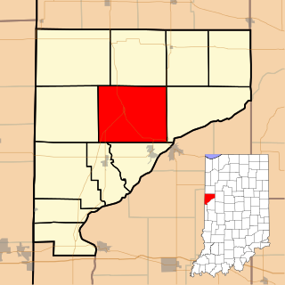
Prairie Township is one of twelve townships in Warren County, Indiana, United States. According to the 2010 census, its population was 257 and it contained 117 housing units; the population density is the lowest of any township in the county, at 6.1 inhabitants per square mile (2.4/km2).

Green Hill, Indiana Unincorporated community in Indiana, United States

Green Hill is a small unincorporated community in Medina Township, Warren County, in the U.S. state of Indiana.

Hedrick, Indiana Unincorporated community in Indiana, United States

Hedrick is a small unincorporated community in Jordan Township, Warren County, in the U.S. state of Indiana.

Chesapeake, Indiana Ghost town in Indiana, United States

Chesapeake was the first town in Steuben Township, Warren County, Indiana, which was formed in 1834. It was located about two miles east of present-day town of Marshfield and was the site of the first meetings of the township trustees in the 1830s. County Agent Luther Tillotson lived south of the town and may have had some involvement in its creation. Chesapeake consisted of at least several houses, a country store operated by William Newell and Thomas Washburn, and a blacksmith shop. There was also a school house there named for the town for many years, but this also is gone.

Point Pleasant, Indiana Ghost town in Indiana, United States

Point Pleasant was a small village in Pine Township, Warren County, Indiana, located about a mile and a half southwest of Rainsville near the confluence of Big Pine Creek and Mud Pine Creek, a site currently known as Rocky Ford. It was laid out by one John H. Bartlett and platted July 14, 1830, but never grew, and consisted only of Bartlett's residence, a liquor store and perhaps a saw mill. An 1883 county history describes Point Pleasant, but notes that "this was a paper town only."

Templeton, Indiana Unincorporated community in Indiana, United States

Templeton is an unincorporated community in Bolivar Township, Benton County, Indiana. It is part of the Lafayette, Indiana Metropolitan Statistical Area.

Zachariah Cicott French-Canadian trader

Zachariah (Zacharie) Cicott (1781-1850) was a French-Canadian trader and is believed to have been the first white settler to live permanently in what became Warren County, Indiana. He was the great-great grandson of Jean Baptiste I Chiquot, who was born in France and immigrated to New France in 1662.

This article is a timeline of Warren County, Indiana history.

Warren County Courthouse (Indiana)

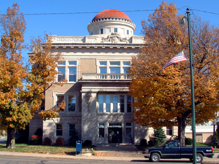
The Warren County Courthouse is a stone building constructed in 1908 in Williamsport, Indiana. It was added to the National Register of Historic Places on March 19, 2008.

References

  1. 1 2 Goodspeed, Weston A. (1883). "Towns and Villages of Warren County". Counties of Warren, Benton, Jasper and Newton, Indiana. Chicago: F. A. Battey and Company. pp. 85–86.
  2. Warren County Historical Society (2002), A History of Warren County, Indiana (175th Anniversary Edition)
  3. Goodspeed, Weston A. (1883). "County Organization". Counties of Warren, Benton, Jasper and Newton, Indiana. Chicago: F. A. Battey and Company. pp. 56–57.