Liberty Township, Warren County, Indiana

Last updated
Liberty Township
Map highlighting Liberty Township, Warren County, Indiana.svg
Location of Liberty Township in Warren County
Map of USA IN.svg
Location of Indiana in the United States
Coordinates: 40°20′36″N87°19′40″W / 40.34333°N 87.32778°W / 40.34333; -87.32778 Coordinates: 40°20′36″N87°19′40″W / 40.34333°N 87.32778°W / 40.34333; -87.32778
Country United States
State Indiana
County Warren
Government
  Type Indiana township
Area
  Total44.02 sq mi (114.0 km2)
  Land44 sq mi (110 km2)
  Water0.02 sq mi (0.05 km2)  0.05%
Elevation
[1]
679 ft (207 m)
Population
 (2010)
  Total896
  Density20.4/sq mi (7.9/km2)
Time zone UTC-5 (Eastern (EST))
  Summer (DST) UTC-4 (EDT)
Area code(s) 765
GNIS feature ID 453565

Liberty Township is one of twelve townships in Warren County, Indiana, United States. According to the 2010 census, its population was 896 and it contained 362 housing units. [2]

Contents

History

Liberty Township was formed in March 1843. [3]

The Andrew Brier House was listed on the National Register of Historic Places in 1986. [4]

Geography

According to the 2010 census, the township has a total area of 44.02 square miles (114.0 km2), of which 44 square miles (110 km2) (or 99.95%) is land and 0.02 square miles (0.052 km2) (or 0.05%) is water. [2] It contains the Potholes at Fall Creek Gorge, a scenic natural location owned and maintained by the Nature Conservancy. Big Pine Creek enters the township from Adams Township to the north and winds to the southeast, briefly entering Warren Township before emptying into the Wabash River near Attica. [5] The stream of Fall Creek also runs through this township.

The north end of the county seat of Williamsport extends into the southeast corner of the township. In addition, there are three small unincorporated towns in the township. Carbondale is located just north of the point where State Road 63 begins at U.S. Route 41. Judyville is about 2 miles (3.2 km) west of Carbondale, near the western border of the township. Kramer is located about 3 miles (4.8 km) east-southeast of Carbondale, near the site of the Hotel Mudlavia. The settlement of Five Points is now defunct, but existed along the present-day route of U.S. Route 41 in the southeastern part of the township.

Map of Liberty Township Map of Liberty Township, Warren County, Indiana.svg
Map of Liberty Township

Cemeteries

The township contains these five cemeteries: Bartlett, [6] Brier, [7] Goodwine, [8] Kester [9] and McCabe. [10]

Transportation

U.S. Route 41 enters the township from the north and makes its way to the southeast toward Attica. [11] Indiana State Road 63 begins at U.S. 41 near the middle of the township, and heads to the southwest; [12] Indiana State Road 263 leaves State Road 63 about 3 miles (4.8 km) to the southwest and goes south through West Lebanon, re-joining its parent at the south end of the county. [13] Indiana State Road 28 passes into the southeast corner of the township from Williamsport and leaves on its way to Attica. [14] Indiana State Road 55 runs along the township's eastern border on its way from Attica in the south to Pine Village in the north. [15]

Education

Liberty Township is part of the Metropolitan School District of Warren County. [16]

Government

Liberty Township has a trustee who administers rural fire protection and ambulance service, provides relief to the poor, manages cemetery care, and performs farm assessment, among other duties. The trustee is assisted in these duties by a three-member township board. The trustees and board members are elected to four-year terms. [17]

Liberty Township is part of Indiana's 8th congressional district, Indiana House of Representatives District 42, [18] and Indiana State Senate District 38. [19]

Related Research Articles

Warren County, Indiana County in the United States

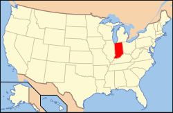
Warren County lies in western Indiana between the Illinois state line and the Wabash River in the United States. According to the 2010 census, the population was 8,508. The county seat is Williamsport.

Adams Township, Warren County, Indiana Township in Indiana, United States

Adams Township is one of twelve townships in Warren County, Indiana. According to the 2010 census, its population was 512 and it contained 250 housing units.

Jordan Township, Warren County, Indiana Township in Indiana, United States

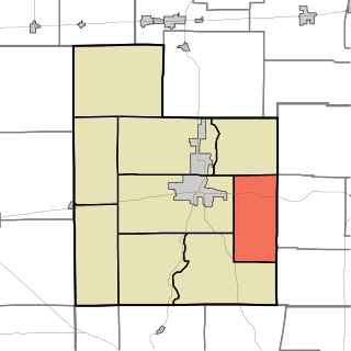
Jordan Township is one of twelve townships in Warren County, Indiana, United States. According to the 2010 census, its population was 247 and it contained 105 housing units. It is almost entirely agricultural and contains no incorporated towns.

Kent Township, Warren County, Indiana Township in Indiana, United States

Kent Township is one of twelve townships in Warren County, Indiana, United States. According to the 2010 census, its population was 428 and it contained 196 housing units.

Medina Township, Warren County, Indiana Township in Indiana, United States

Medina Township is one of twelve townships in Warren County, Indiana, United States. According to the 2010 census, its population was 457 and it contained 191 housing units.

Mound Township, Warren County, Indiana Township in Indiana, United States

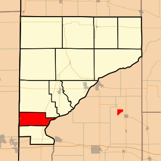
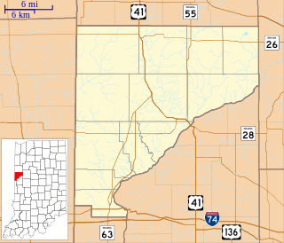
Mound Township is one of twelve townships in Warren County, Indiana, United States. According to the 2010 census, its population was 418 and it contained 183 housing units.

Pike Township, Warren County, Indiana Township in Indiana, United States

Pike Township is one of twelve townships in Warren County, Indiana, United States. According to the 2010 census, its population was 1,221 and it contained 529 housing units.

Pine Township, Warren County, Indiana Township in Indiana, United States

Pine Township is one of twelve townships in Warren County, Indiana, United States. According to the 2010 census, its population was 481 and it contained 213 housing units.

Prairie Township, Warren County, Indiana Township in Indiana, United States

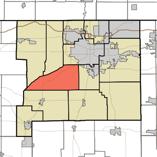
Prairie Township is one of twelve townships in Warren County, Indiana, United States. According to the 2010 census, its population was 257 and it contained 117 housing units; the population density is the lowest of any township in the county, at 6.1 inhabitants per square mile (2.4/km2).

Steuben Township, Warren County, Indiana Township in Indiana, United States

Steuben Township is one of twelve townships in Warren County, Indiana, United States. It was established in 1834. According to the 2010 census, its population was 487 and it contained 199 housing units. It contains no incorporated towns and is largely agricultural.

Warren Township, Warren County, Indiana Township in Indiana, United States

Warren Township is one of twelve townships in Warren County, Indiana, United States. According to the 2010 census, its population was 806 and it contained 324 housing units.

Washington Township, Warren County, Indiana Township in Indiana, United States

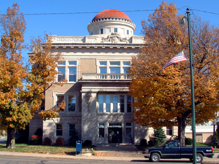
Washington Township is one of twelve townships in Warren County, Indiana, United States. It is the most populous township in the county; according to the 2010 census, its population was 2,298, with 1,898 of those living in Williamsport, and it contained 1,011 housing units. It has the highest population density of the Warren County townships at about 120 inhabitants per square mile (46/km2).

Carbondale, Indiana Unincorporated community in Indiana, United States

Carbondale is an unincorporated community in Liberty Township, Warren County, in the U.S. state of Indiana.

Cain Township, Fountain County, Indiana Township in Indiana, United States

Cain Township is one of eleven townships in Fountain County, Indiana. As of the 2010 census, its population was 1,142 and it contained 488 housing units.

Davis Township, Fountain County, Indiana Township in Indiana, United States

Davis Township is one of eleven townships in Fountain County, Indiana, United States. As of the 2010 census, its population was 682 and it contained 286 housing units.

Fulton Township, Fountain County, Indiana Township in Indiana, United States

Fulton Township is one of eleven townships in Fountain County, Indiana, United States. As of the 2000 census, its population was 674.

Jackson Township, Fountain County, Indiana Township in Indiana, United States

Jackson Township is one of eleven townships in Fountain County, Indiana, United States. As of the 2010 census, its population was 628 and it contained 300 housing units.

Logan Township, Fountain County, Indiana Township in Indiana, United States

Logan Township is one of eleven townships in Fountain County, Indiana, United States. As of the 2010 census, its population was 3,672 and it contained 1,685 housing units.

Greene Township, St. Joseph County, Indiana Township in Indiana, United States

Greene Township is one of thirteen townships in St. Joseph County, in the U.S. state of Indiana. As of the 2000 census, its population was 3,040.

Jennings Township, Fayette County, Indiana Township in Indiana, United States

Jennings Township is one of nine townships in Fayette County, Indiana. As of the 2010 census, its population was 830 and it contained 360 housing units.

References

  1. "US Board on Geographic Names". United States Geological Survey. October 25, 2007. Retrieved 2017-05-09.
  2. 1 2 "Population, Housing Units, Area, and Density: 2010 - County -- County Subdivision and Place -- 2010 Census Summary File 1". United States Census. Archived from the original on 2020-02-12. Retrieved 2013-05-10.
  3. Goodspeed 1883, p. 62.
  4. "National Register Information System". National Register of Historic Places . National Park Service. July 9, 2010.
  5. "Big Pine Creek". Indiana Department of Natural Resources. Archived from the original on 2010-10-15. Retrieved 2010-10-30.
  6. "Bartlett Cemetery". Geographic Names Information System . United States Geological Survey . Retrieved 2011-01-27.
  7. "Brier Cemetery". Geographic Names Information System . United States Geological Survey . Retrieved 2011-01-27.
  8. "Goodwine Cemetery". Geographic Names Information System . United States Geological Survey . Retrieved 2011-01-27.
  9. "Kester Cemetery". Geographic Names Information System . United States Geological Survey . Retrieved 2011-01-27.
  10. "McCabe Cemetery". Geographic Names Information System . United States Geological Survey . Retrieved 2011-01-27.
  11. "U.S. Route 41". Highway Explorer. Archived from the original on 2010-12-07. Retrieved 2010-09-21.
  12. "State Road 63". Highway Explorer. Archived from the original on 2012-03-09. Retrieved 2010-09-14.
  13. "State Road 263". Highway Explorer. Archived from the original on 2012-04-06. Retrieved 2010-09-14.
  14. "State Road 28". Highway Explorer. Archived from the original on 2011-07-11. Retrieved 2010-09-14.
  15. "State Road 55". Highway Explorer. Archived from the original on 2011-07-11. Retrieved 2010-09-14.
  16. "Corporation Snapshot, M S D Warren County #8115". Indiana Department of Education. Archived from the original on 2002-07-06. Retrieved 2011-01-27.
  17. "Government". United Township Association of Indiana. Retrieved 2011-01-06.
  18. "Indiana Senate" (PDF). State of Indiana. Retrieved 2013-12-02.
  19. "Indiana House Districts" (PDF). State of Indiana. Retrieved 2013-12-02.

Bibliography