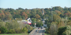
Attica | |
---|---|
Nickname: Johnson I.N | |
Coordinates: 40°17′08″N87°15′00″W / 40.28556°N 87.25000°W | |
Country | United States |
State | Indiana |
County | Fountain |
Township | Logan |
Government | |
• Mayor | Larry Grant[ citation needed ] |
Area | |
• Total | 1.80 sq mi (4.67 km2) |
• Land | 1.80 sq mi (4.67 km2) |
• Water | 0.00 sq mi (0.00 km2) |
Elevation | 640 ft (200 m) |
Population (2020) | |
• Total | 3,036 |
• Density | 1,682.93/sq mi (649.85/km2) |
Time zone | UTC-5 (EST) |
• Summer (DST) | UTC-4 (EDT) |
ZIP code | 47918 |
Area code | 765 |
FIPS code | 18-02620 |
GNIS ID | 2394018 [2] |
Website | attica-in |
Attica is a city in Logan Township, Fountain County, Indiana, United States.
Attica was laid out by George Hollingsworth and platted by David Stump in 1825. [3] The completion of the Wabash and Erie Canal through the town in 1847 brought a considerable amount of growth to the area, and ended (in Attica's favor) a long-standing rivalry with the neighboring communities of Rob Roy, Williamsport and Covington. [4]
Attica is the nearest town to the location where Paul Dresser is believed to have written the state song, "On the Banks of the Wabash, Far Away", and the bridge over the Wabash River bears his name.
The Attica Downtown Historic District, Attica Main Street Historic District, Brady Street Historic District, Marshall M. Milford House, and Old East Historic District are listed on the National Register of Historic Places. [5]
Attica is located along the Wabash River in Logan Township. U.S. Route 41, State Road 28, and State Road 55 intersect at Attica.
According to the 2010 census, Attica has a total area of 1.6 square miles (4.14 km2), all land. [6]
Census | Pop. | Note | %± |
---|---|---|---|
1860 | 1,713 | — | |
1870 | 2,273 | 32.7% | |
1880 | 2,150 | −5.4% | |
1890 | 2,320 | 7.9% | |
1900 | 3,005 | 29.5% | |
1910 | 3,335 | 11.0% | |
1920 | 3,392 | 1.7% | |
1930 | 3,700 | 9.1% | |
1940 | 3,760 | 1.6% | |
1950 | 3,862 | 2.7% | |
1960 | 4,341 | 12.4% | |
1970 | 4,262 | −1.8% | |
1980 | 3,841 | −9.9% | |
1990 | 3,457 | −10.0% | |
2000 | 3,491 | 1.0% | |
2010 | 3,245 | −7.0% | |
2020 | 3,036 | −6.4% | |
U.S. Decennial Census [7] |
As of the 2010 United States Census, there were 3,245 people, 1,308 households, and 843 families residing here. [8] The population density was 2,028.3 inhabitants per square mile (783.1/km2). There were 1,507 housing units at an average density of 942.0 per square mile (363.7/km2). [9] The racial makeup was 97.8% white, 0.3% Asian, 0.2% American Indian, 0.1% black or African American, 0.6% from other races, and 1.0% from two or more races. Those of Hispanic or Latino origin made up 2.4% of the population. [8] In terms of ancestry, 26.3% were German, 14.1% were English, 13.9% were Irish, and 12.3% were American. [10]
Of the 1,308 households, 32.0% had children under the age of 18 living with them, 47.2% were married couples living together, 12.4% had a female householder with no husband present, 35.6% were non-families, and 30.3% of all households were made up of individuals. The average household size was 2.45 and the average family size was 3.00. The median age was 38.9 years. [8]
The median income for a household was $34,804 and the median income for a family was $52,669. Males had a median income of $45,682 versus $24,574 for females. The per capita income for was $21,287. About 13.3% of families and 16.3% of the population were below the poverty line, including 26.0% of those under age 18 and 13.9% of those age 65 or over. [11]
The city has a free lending library, the Attica Public Library. [12]
Darke County is a county in the U.S. state of Ohio. As of the 2020 census, the population was 51,881. Its county seat and largest city is Greenville. The county was created in 1809 and later organized in 1817. It is named for William Darke, an officer in the American Revolutionary War. Darke County comprises the Greenville, OH Micropolitan Statistical Area, which is also included in the Dayton-Springfield-Sidney, OH Combined Statistical Area.
Wabash County is a county located in the northern central part of the U.S. state of Indiana. As of 2020, the population was 30,976. The county seat is Wabash.
Wabash County is a county located in the U.S. state of Illinois. According to the 2020 census, it had a population of 11,361. Its county seat is Mount Carmel. It is located in the southern portion of Illinois known locally as "Little Egypt".
Clark County is a county located in the southeastern part of U.S. state of Illinois, along the Indiana state line. As of the 2020 census, the population was 15,455. Its county seat is Marshall. The county was named for George Rogers Clark, an officer who served in the American Revolution.
Ulen is a town in Center Township, Boone County, in the U.S. state of Indiana. The population was 117 at the 2010 census. The town is surrounded by the city of Lebanon.
Delphi is a city in and the county seat of Carroll County, in the U.S. state of Indiana. Located twenty minutes northeast of Lafayette, it is part of the Lafayette, Indiana Metropolitan Statistical Area. The population was 2,893 at the 2010 census.
Covington is a city in, and the county seat of, Fountain County, Indiana, United States. The population was 2,645 at the 2010 census.
Gas City is a city in Grant County, Indiana, United States, along the Mississinewa River. The population was 5,965 at the 2010 census.
Shirley is a town in Brown Township, Hancock County and Greensboro Township, Henry County, Indiana, United States. The population was 830 at the 2010 census.
Huntington, known as the "Lime City", is the largest city in and the county seat of Huntington County, Indiana, United States. It is in Huntington and Union townships. It is also part of Fort Wayne, Indiana's metropolitan area. The population was 17,022 at the 2020 United States Census, down from 17,391 in the 2010 United States Census
Alamo is a town in Ripley Township, Montgomery County, in the U.S. state of Indiana. The population was 66 at the 2020 census, unchanged from 2010.
Linden is a town in Madison Township, Montgomery County, in the U.S. state of Indiana. The population was 711 at the 2020 census.
Mecca is a town in Wabash Township, Parke County, in the U.S. state of Indiana. The population was 335 at the 2010 census.
La Fontaine is a town in Liberty Township, Wabash County, in the U.S. state of Indiana. The population was 875 at the 2010 census. Its name means "The Fountain" in French.
Lagro is a town in Lagro Township, Wabash County, in the U.S. state of Indiana. The population was 415 at the 2010 census.
North Manchester is a town in Chester Township, Wabash County, in the U.S. state of Indiana. The population was 6,112 at the 2010 census.
Roann is a town in Paw Paw Township, Wabash County, in the U.S. state of Indiana. The population was 479 at the 2010 census.
Wabash is a city in Noble Township, Wabash County, in the U.S. state of Indiana. The population was 10,666 at the 2010 census. The city is situated along the Wabash River in the county seat of Wabash County.
Pine Village is a town in Adams Township, Warren County, in the U.S. state of Indiana. The population was 217 at the 2010 census.
West Lebanon is a town in Pike Township, Warren County, in the U.S. state of Indiana. The population was 723 at the 2010 census.