Washington County Memorial Airport

Last updated
Washington County Memorial Airport
Summary
Airport type Public
Owner Washington County
Serves Washington, Kansas
Elevation  AMSL 1,436 ft / 438 m
Coordinates 39°44′07″N097°02′51″W / 39.73528°N 97.04750°W / 39.73528; -97.04750 Coordinates: 39°44′07″N097°02′51″W / 39.73528°N 97.04750°W / 39.73528; -97.04750
Map
USA Kansas location map.svg
Airplane silhouette.svg
K38
Location of airport in Kansas
Runways
Direction LengthSurface
ftm
17/353,4061,038Concrete
Statistics (2010)
Aircraft operations 1,700
Based aircraft 3

Washington County Memorial Airport( FAA LID : K38) is a county-owned, public-use airport in Washington County, Kansas, United States. It is located five  nautical miles (6  mi, 9  km) south of the central business district of Washington, Kansas. [1]

Federal Aviation Administration United States Government agency dedicated to civil aviation matters

The Federal Aviation Administration (FAA) is a governmental body of the United States with powers to regulate all aspects of civil aviation in that nation as well as over its surrounding international waters. Its powers include the construction and operation of airports, air traffic management, the certification of personnel and aircraft, and the protection of U.S. assets during the launch or re-entry of commercial space vehicles. Powers over neighboring international waters were delegated to the FAA by authority of the International Civil Aviation Organization.

A location identifier is a symbolic representation for the name and the location of an airport, navigation aid, or weather station, and is used for manned air traffic control facilities in air traffic control, telecommunications, computer programming, weather reports, and related services.

Airport location where aircraft take off and land

An airport is an aerodrome with extended facilities, mostly for commercial air transport. Airports often have facilities to store and maintain aircraft, and a control tower. An airport consists of a landing area, which comprises an aerially accessible open space including at least one operationally active surface such as a runway for a plane to take off or a helipad, and often includes adjacent utility buildings such as control towers, hangars and terminals. Larger airports may have airport aprons, taxiway bridges, air traffic control centres, passenger facilities such as restaurants and lounges, and emergency services. In some countries, the US in particular, they also typically have one or more fixed-base operators, serving general aviation.

Contents

Facilities and aircraft

Washington County Memorial Airport covers an area of 23 acres (9 ha) at an elevation of 1,436 feet (438 m) above mean sea level. It has one runway designated 17/35 with a concrete surface measuring 3,406 by 60 feet (1,038 x 18 m). [1]

Acre unit of area

The acre is a unit of land area used in the imperial and US customary systems. It is traditionally defined as the area of one chain by one furlong, which is exactly equal to 10 square chains, ​1640 of a square mile, or 43,560 square feet, and approximately 4,047 m2, or about 40% of a hectare. Based upon the International yard and pound agreement of 1959, an acre may be declared as exactly 4,046.8564224 square metres. The acre is a statute measure in the United States and was formerly one in the United Kingdom and almost all countries of the former British Empire, although informal use continues.

Hectare metric unit of area

The hectare is an SI accepted metric system unit of area equal to a square with 100-metre sides, or 10,000 m2, and is primarily used in the measurement of land. There are 100 hectares in one square kilometre. An acre is about 0.405 hectare and one hectare contains about 2.47 acres.

Elevation Height of a geographic location above a fixed reference point

The elevation of a geographic location is its height above or below a fixed reference point, most commonly a reference geoid, a mathematical model of the Earth's sea level as an equipotential gravitational surface . The term elevation is mainly used when referring to points on the Earth's surface, while altitude or geopotential height is used for points above the surface, such as an aircraft in flight or a spacecraft in orbit, and depth is used for points below the surface.

For the 12-month period ending November 16, 2010, the airport had 1,700 general aviation aircraft operations, an average of 141 per month. At that time there were 3 aircraft based at this airport, all single-engine. [1]

General aviation civil use of aircraft excluding commercial transportation

General Aviation (GA) represents the 'private transport' and recreational flying component of aviation.

Aircraft engine Engine designed for use in powered aircraft

An aircraft engine is a component of the propulsion system for an aircraft that generates mechanical power. Aircraft engines are almost always either lightweight piston engines or gas turbines, except for small multicopter UAVs which are almost always electric aircraft.

Related Research Articles

Pangborn Memorial Airport airport

Pangborn Memorial Airport is a public use airport in Douglas County, Washington, United States. It is located four nautical miles (7 km) east of the central business district of Wenatchee, a city in Chelan County. The airport is owned by the Ports of Chelan and Douglas Counties.

John F. Kennedy Memorial Airport airport in Ashland, United States of America

John F. Kennedy Memorial Airport is a city and county owned public use airport located two nautical miles (4 km) southwest of the central business district of Ashland, a city in Ashland County, Wisconsin, United States. It is also known as JFK Memorial Airport.

Huron County Memorial Airport airport in Michigan, United States of America

Huron County Memorial Airport is a county-owned, public-use airport located one nautical mile (1.85 km) south of the central business district of Bad Axe, a city in Huron County, Michigan, United States. It is included in the Federal Aviation Administration (FAA) National Plan of Integrated Airport Systems for 2017–2021, in which it is categorized as a local general aviation facility.

Branch County Memorial Airport airport in Michigan, United States of America

Branch County Memorial Airport is a county-owned, public-use airport located three nautical miles (6 km) west of the central business district of Coldwater, a city in Branch County, Michigan, United States. It is included in the Federal Aviation Administration (FAA) National Plan of Integrated Airport Systems for 2017–2021, in which it is categorized as a local general aviation facility.

Frankfort Dow Memorial Field airport in Michigan, United States of America

Frankfort Dow Memorial Field is a public use airport located two nautical miles (3.7 km) southeast of the central business district of Frankfort, a city in Benzie County, Michigan, United States. It is owned by the Frankfort City-County Airport Authority. It is included in the Federal Aviation Administration (FAA) National Plan of Integrated Airport Systems for 2017–2021, in which it is categorized as a general aviation facility.

Gladwin Zettel Memorial Airport airport in Michigan, United States of America

Gladwin Zettel Memorial Airport is a public use airport located one nautical mile (2 km) southeast of the central business district of Gladwin, a city in Gladwin County, Michigan, United States. The airport is owned by the city and county. It is included in the Federal Aviation Administration (FAA) National Plan of Integrated Airport Systems for 2017–2021, in which it is categorized as a local general aviation facility.

Lea County–Zip Franklin Memorial Airport airport in New Mexico, United States of America

Lea County–Zip Franklin Memorial Airport is a county-owned, public-use airport in Lea County, New Mexico, United States. Located three nautical miles (6 km) west of the central business district of Lovington, New Mexico, it is also known as Lovington Airport. The airport is named for aviator Oliver Gene "Zip" Franklin. It is included in the National Plan of Integrated Airport Systems for 2011–2015, which categorized it as a general aviation facility.

Saratoga County Airport airport in New York, United States of America

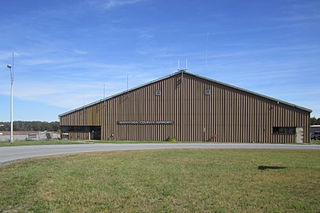
Saratoga County Airport is a county-owned, public-use airport located three nautical miles (6 km) southwest of the central business district of Saratoga Springs, a city in Saratoga County, New York, United States. It is included in the National Plan of Integrated Airport Systems for 2011–2015, which categorized it as a general aviation facility.

Prattville–Grouby Field airport in Alabama, United States of America

Prattville–Grouby Field is a public-use airport located three nautical miles southwest of the central business district of Prattville, a city in Autauga County, Alabama, United States. It is owned by the Prattville Airport Authority. It is also known as Prattville Airport or Autauga County Airport.

Richard I. Bong Airport airport in Wisconsin, United States of America

Richard I. Bong Airport is a city owned public use airport located three nautical miles (6 km) south of the central business district of Superior, a city in Douglas County, Wisconsin, United States. It is included in the Federal Aviation Administration (FAA) National Plan of Integrated Airport Systems for 2019–2023, in which it is categorized as a local general aviation facility.

Miami Homestead General Aviation Airport is a county-owned public-use airport in unincorporated Miami-Dade County, Florida, United States, located four nautical miles (7 km) northwest of the central business district of Homestead.

South Lewis County Airport airport in Washington, United States of America

South Lewis County Airport, also known as Ed Carlson Memorial Field, is a county-owned public-use airport in Lewis County, Washington, United States. It is located three nautical miles north of the central business district of Toledo, Washington.

Woltermann Memorial Airport airport in Columbus, Montana, United States

Woltermann Memorial Airport is a public use airport located southeast of Columbus, a city in Stillwater County, Montana, United States. Owned by the city and county, it was formerly known as Columbus Airport.

Eureka Municipal Airport (Kansas) airport in Kansas, United States of America

Eureka Municipal Airport, also known as Lt. William M. Milliken Airport, is a city-owned, public-use airport located two nautical miles (4 km) north of the central business district of Eureka, a city in Greenwood County, Kansas, United States. It is included in the National Plan of Integrated Airport Systems for 2011–2015, which categorized it as a general aviation facility.

Stanton County Municipal Airport airport in Kansas, United States of America

Stanton County Municipal Airport is a county-owned, public-use airport in Stanton County, Kansas, United States. It is located two nautical miles (4 km) northeast of the central business district of Johnson, Kansas, which is also known as Johnson City. This airport included in the National Plan of Integrated Airport Systems for 2011–2015, which categorized it as a general aviation facility.

Cottonwood Falls Airport airport in Kansas, United States of America

Cottonwood Falls Airport is a city-owned, public-use airport located one nautical mile (2 km) south of the central business district of Cottonwood Falls, a city in Chase County, Kansas, United States. It was formerly known as Chase County Airport.

Quincy Municipal Airport (Washington) airport in Washington, United States of America

Quincy Municipal Airport is a city-owned, public-use airport located two nautical miles (4 km) southeast of the central business district of Quincy, a city in Grant County, Washington, United States.

Norwich Airport (Kansas) airport in Kansas, United States of America

Norwich Airport is a city-owned, public-use airport located one nautical mile (2 km) east of the central business district of Norwich, a city in Kingman County, Kansas, United States.

James G. Whiting Memorial Field airport in Iowa, United States of America

James G. Whiting Memorial Field is a city-owned public-use airport located one nautical mile (2 km) north of the central business district of Mapleton, a city in Monona County, Iowa, United States. It is included in the National Plan of Integrated Airport Systems for 2011–2015, which categorized it as a general aviation facility.

Marion Municipal Airport (Kansas) airport in Kansas, United States of America

Marion Municipal Airport is a city-owned, public-use airport located two nautical miles (4 km) southeast of the central business district of Marion, a city in Marion County, Kansas, United States.

References

  1. 1 2 3 4 FAA Airport Master Record for K38 ( Form 5010 PDF ). Federal Aviation Administration. Effective November 15, 2012.
The National Map

The National Map is a collaborative effort of the United States Geological Survey (USGS) and other federal, state, and local agencies to improve and deliver topographic information for the United States. The purpose of the effort is to provide "...a seamless, continuously maintained set of public domain geographic base information that will serve as a foundation for integrating, sharing, and using other data easily and consistently".