Mission Ridge is an unincorporated community in northern Stanley County, South Dakota, United States. It lies along Highway 1806 north of the city of Fort Pierre, the county seat of Stanley County. Its elevation is 1,985 feet (605 m). Mission Ridge has a post office with the ZIP code of 57557.
Fairfield is an unincorporated community in northeastern Billings County, North Dakota, United States. It lies along U.S. Route 85 northeast of the city of Medora, the county seat of Billings County. Its elevation is 2,756 feet (840 m). Although it is unincorporated, it has a post office, with the ZIP code of 58627.
Cartwright is an unincorporated community in northwestern McKenzie County, North Dakota, United States.Notable residents include Tom Voll, a local river pirate. The community is named for Samuel George Cartwright, a rancher, trapper, and hunter who was the first settler in the area. It lies along North Dakota Highway 200 west of the city of Watford City, the county seat of McKenzie County. Its elevation is 1,906 feet (581 m). Although it is unincorporated, it has a post office, with the ZIP code of 58838.

Zahl is an unincorporated community in northwestern Williams County, North Dakota, United States. It lies along North Dakota Highway 50 north of the city of Williston, the county seat of Williams County. Its elevation is 2,014 feet (614 m). Although it is unincorporated, it has a post office, with the ZIP code of 58856.
Trenton is an unincorporated community in northwestern Williams County, North Dakota, United States. It lies along North Dakota Highway 1804 southwest of the city of Williston, the county seat of Williams County. Its elevation is 1,900 feet (579 m). Although it is unincorporated, it has a post office, with the ZIP code of 58853. The community lies 220 miles north-west of Bismarck
Roseglen is an unincorporated community in northwestern McLean County, North Dakota, United States. It lies along North Dakota Highway 37 northwest of the city of Washburn, the county seat of McLean County. Its elevation is 2,100 feet (640 m). Although it is unincorporated, it has a post office, with the ZIP code of 58775. Roseglen Township is served by the White Shield School District, which operates a K-12 public school program from one campus in Roseglen.

McGregor is an unincorporated community in northeastern Williams County, North Dakota. It lies along North Dakota Highway 40 northeast of the city of Williston, the county seat of Williams County. Its elevation is 2,218 feet (676 m). Although it is unincorporated, it has a post office, with the ZIP code of 58755.

Norwich is an unincorporated community in western McHenry County, North Dakota, United States. It lies along U.S. Route 2 southwest of the city of Towner, the county seat of McHenry County. Its elevation is 1,549 feet (472 m). It is unincorporated, and had a post office with the ZIP code of 58768. Though the post office closed May 4, 1996, the ZIP code is still valid for use.
Lefor is an unincorporated community in southern Stark County, North Dakota, United States. It lies southeast of the city of Dickinson, the county seat of Stark County. Its elevation is 2,592 feet (790 m). Lefor's post office closed November 2, 2002, but the town still has its own ZIP code of 58641.

Grassy Butte is an unincorporated community in southeastern McKenzie County, North Dakota, United States. It lies along U.S. Route 85 south of the city of Watford City, the county seat of McKenzie County. Its elevation is 2,661 feet (811 m). Although it is unincorporated, it has a post office, with the ZIP code of 58634.

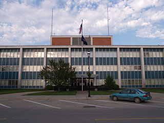
St. Anthony is an unincorporated community in southeastern Morton County, North Dakota, United States. It lies a short distance to the west of North Dakota Highway 6, south of the city of Mandan, the county seat of Morton County. Its elevation is 1,827 feet (557 m). Although it is unincorporated, it has the ZIP code of 58566. In 2018, the population was estimated to be less than 30.
Stirum is an unincorporated community in northwestern Sargent County, North Dakota, United States. It lies a short distance to the south of North Dakota Highway 13, northwest of the city of Forman, the county seat of Sargent County. Its elevation is 1,355 feet (413 m). Although it is unincorporated, it has a post office, with the ZIP code of 58069.

Arvilla is an unincorporated community in central Grand Forks County, North Dakota, United States. It lies along U.S. Route 2 west of the city of Grand Forks, the county seat of Grand Forks County. Its elevation is 1,004 feet (306 m). The community was first named Orange for Orange County, New York; it was renamed Arvilla for Arvilla Estella Hersey, the wife of a local farmer. Although it is unincorporated, it has a post office, with the ZIP code of 58214.
Maida is an unincorporated community in northern Cavalier County, North Dakota, United States. It lies along North Dakota Highway 1, north of the city of Langdon, the county seat of Cavalier County. Its elevation is 1,562 feet (476 m). Maida serves as a port of entry between Canada and the United States.
Mekinock is an unincorporated community in eastern Grand Forks County, North Dakota, USA. It lies northwest of the city of Grand Forks, the county seat of Grand Forks County. Its elevation is 860 feet (262 m). Although it is unincorporated, it has a post office, with the ZIP code of 58258.

Bremen is an unincorporated community in northeastern Wells County, North Dakota, United States. It lies northeast of the city of Fessenden, the county seat of Wells County. Its elevation is 1,549 feet (472 m). The post office has closed, and the residents of the small community use the post office and postal code of New Rockford in neighboring Eddy County.
Penn is an unincorporated community in western Ramsey County, North Dakota, United States. It lies along U.S. Route 2 northwest of the city of Devils Lake, the county seat of Ramsey County. Its elevation is 1,467 feet (447 m). The community was first named Lauren for the townsite owner, Lauren, and was later renamed Penn for English stockholders. Although it is unincorporated, it has a post office, with the ZIP code of 58362.

Kintyre is an unincorporated community in northeastern Emmons County, North Dakota, United States. It lies northeast of the city of Linton, the county seat of Emmons County. Its elevation is 2,756 feet (840 m). The community was originally named Campbell for Dugald and Hugh Campbell, brothers who ranched there; it is now named Kintyre for the Kintyre Peninsula in Argyll, Scotland. Although it is unincorporated, it has a post office, with the ZIP code of 58549.

Chaseley is an unincorporated community in southwestern Wells County, North Dakota, United States. It lies along North Dakota Highway 200 southwest of the city of Fessenden, the county seat of Wells County. Its elevation is 1,867 feet (569 m). It formerly had a post office, with the ZIP code of 58423.
Baldwin is an unincorporated community in western Burleigh County, North Dakota, United States. It lies along U.S. Route 83 north of the city of Bismarck, the county seat of Burleigh County. Its elevation is 1,939 feet (591 m). Although it is unincorporated, it has a post office, with the ZIP code of 58521.