
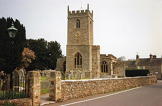
Wellington Without is a civil parish in Somerset, England.
Contents
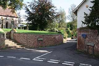
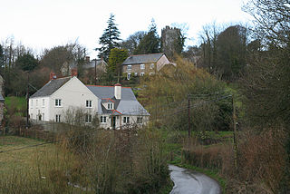
It lies south of Wellington and has a population of 727. [1] The parish includes the hamlet of Ford Street or Fordstreet.
Wellington Without is a civil parish in Somerset, England.
It lies south of Wellington and has a population of 727. [1] The parish includes the hamlet of Ford Street or Fordstreet.
The parish council has responsibility for local issues, including setting an annual precept (local rate) to cover the council's operating costs.
For local government purposes, since 1 April 2023, the parish comes under the unitary authority of Somerset Council. Prior to this, it was part of the non-metropolitan district of Somerset West and Taunton (formed on 1 April 2019) and, before this, the district of Taunton Deane (established under the Local Government Act 1972). From 1894-1974, for local government purposes, Wellington Without was part of Wellington Rural District. [2]
It is also part of the Taunton and Wellington county constituency represented in the House of Commons of the Parliament of the United Kingdom. It elects one Member of Parliament (MP) by the first past the post system of election.

Ashbrittle is a village and civil parish in Somerset, England, situated nine miles west of Taunton and close to the River Tone and the route of the Grand Western Canal. The village has a population of 225.
Bathealton is a village and civil parish in Somerset, England, situated 3 miles (4.8 km) west of Wellington and 8 miles (12.9 km) west of Taunton. The village has a population of 194.

Cheddon Fitzpaine is a village and civil parish in Somerset, England, situated on the Quantock Hills 2 miles (3.2 km) north of Taunton. The village is situated near the Bristol and Exeter Railway, the Bridgwater and Taunton Canal, and the River Tone and has a population of 1,929.
Chipstable is a village and civil parish in Somerset, England, situated beside Heydon Hill 10 miles (16.1 km) west of Taunton. The parish has a population of 309.

Corfe is a village and civil parish in Somerset, England, situated below the Blackdown Hills 4 miles (6.4 km) south of Taunton. The village has a population of 253.

Curland is a village and civil parish in Somerset, England, situated 6 miles (9.7 km) south of Taunton. The village has a population of 225. The parish includes the hamlet of Abbey Hill.

Fitzhead is a village and civil parish in Somerset, England, situated approximately 6 miles (9.7 km) north west of Taunton. The village has an estimated population of 264.

Langford Budville is a village and civil parish in Somerset, England, situated near the River Tone 2 miles (3.2 km) north-west of Wellington, 4.5 miles (7.2 km) from Wiveliscombe and 6 miles (9.7 km) west of Taunton. The parish includes the hamlets of Bindon, Lower Chipley, Lower Wellisford, Ramsey and Runnington. The parish has a population of 535.
Nynehead is a village and civil parish in Somerset, England, situated on the River Tone, 7 miles (11 km) south-west of Taunton and 1.5 miles (2 km) north-west of Wellington. The village has a population of 415.

Oake is a village and civil parish in Somerset, England, situated 5 miles (8.0 km) west of Taunton. The village has a population of 765.

Orchard Portman is a village and civil parish in Somerset, England, situated 2 miles (3.2 km) south of Taunton. The village has a population of 150.

Otterford is a village and civil parish in Somerset, England. It is situated on the Blackdown Hills, 7 miles (11.3 km) south of Taunton. The village has a population of 356.

Ruishton is a village and civil parish in Somerset, England, situated on the River Tone and A358 road 2 miles (3.2 km) east of Taunton. The village has a population of 1,473. The parish includes the hamlet of Henlade.

Sampford Arundel is a village and civil parish in Somerset, England. It is situated near Wellington and 10 miles (16.1 km) south west of Taunton. The village has a population of 268.

Stoke St Mary is a village and civil parish in Somerset, England, situated 2 miles (3.2 km) south east of Taunton.
Thornfalcon is a village and civil parish in Somerset, England, situated 4 miles (6.4 km) east of Taunton. The village has a population of 119. The parish includes the hamlet of Ash. The name comes from Thorn, and the personal name Fagun which was the Norman surname of Sir Gilbert of Thorn, whose family were lords of the manor until the 14th century.
Trull is a village, electoral ward and civil parish in Somerset, England, situated near Taunton. The parish, which includes Dipford and Staplehay, has a population of 2,288.

West Buckland is a village and civil parish in Somerset, England, situated 5 miles (8.0 km) south west of Taunton. The parish has a population of 1,189.

West Hatch is a hamlet and civil parish in Somerset, England, situated 5 miles (8.0 km) south east of Taunton. It has a population of 306.
Wellington was a rural district in Somerset, England, from 1894 to 1974.
![]() Media related to Wellington Without at Wikimedia Commons
Media related to Wellington Without at Wikimedia Commons
50°57′29″N3°13′37″W / 50.958°N 3.227°W
