
The Bridgwater and Taunton Canal is a canal in the south-west of England between Bridgwater and Taunton, opened in 1827 and linking the River Tone to the River Parrett. There were a number of abortive schemes to link the Bristol Channel to the English Channel by waterway in the 18th and early 19th centuries. These schemes followed the approximate route eventually taken by the Bridgwater and Taunton Canal, but the canal was instead built as part of a plan to link Bristol to Taunton by waterway.

The Taunton Stop Line was a World War II defensive line in southwest England. It was designed "to stop an enemy's advance from the west and in particular a rapid advance supported by armoured fighting vehicles which may have broken through the forward defences."

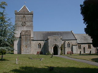
North Petherton is a town and civil parish in Somerset, England, situated on the edge of the eastern foothills of the Quantocks, and close to the edge of the Somerset Levels. The town has a population of 6,730 as of 2014. The parish includes Hamp, Melcombe, Shearston, Woolmersdon and Huntworth.
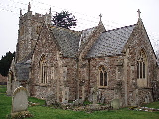
Puriton is a village and parish at the westerly end of the Polden Hills, in Somerset, England. The parish has a population of 1,968. The local parish church is dedicated to St Michael and All Angels. A chapel on Woolavington Road was converted to a private house some 20 years ago. The parish includes the hamlets of Dunball and Down End.
Chard is a town and a civil parish in the English county of Somerset. It lies on the A30 road near the Devon and Dorset borders, 15 miles (24 km) south west of Yeovil. The parish has a population of approximately 14,000 and, at an elevation of 121 metres (397 ft), Chard is the southernmost and one of the highest towns in Somerset. Administratively Chard forms part of the district of South Somerset.
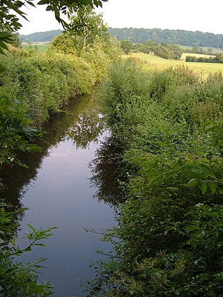
The Chard Canal was a 13.5 miles (21.7 km) tub boat canal in Somerset, England, that ran from the Bridgwater and Taunton Canal at Creech St. Michael, over four aqueducts, through three tunnels and four inclined planes to Chard. It was completed in 1842, was never commercially viable, and closed in 1868. The major engineering features are still clearly visible in the landscape.
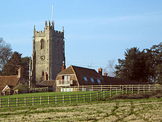
Durston is a village and civil parish in Somerset, England, situated on the A361 road 5 miles (8.0 km) north east of Taunton and 6 miles (9.7 km) south of Bridgwater. The parish lies on undulating ground between the lowest slopes of the Quantock Hills and the valley of the River Tone at the Curry and Hay Moors. The parish has a population of 136.

Ruishton is a village and civil parish in Somerset, England, situated on the River Tone and A358 road 2 miles (3.2 km) east of Taunton. The village has a population of 1,473. The parish includes the hamlet of Henlade.

West Monkton is a village and civil parish in Somerset, England, situated 2 miles (3.2 km) north east of Taunton. The parish includes the hamlets of Monkton Heathfield, Bathpool, and Burlinch and the western parts of Coombe and Walford, and had a population of 2,787 at the 2011 census.

Bawdrip is a village and civil parish in Somerset, England. The village is on the south side of the Polden Hills about 4 miles (6.4 km) north-east of Bridgwater. At the 2011 census the parish had a population of 506. The parish includes the hamlets of Bradney, Horsey and Knowle.

Lyng is a civil parish in Somerset, England, comprising the villages of West Lyng and East Lyng and the hamlet of Bankland.

Cogload Junction is a railway junction in Durston, Somerset, England. It is where the 1906-opened London to Penzance Line via Castle Cary joins the original line that runs via Bristol Temple Meads. A flyover was constructed in 1931 converting it into a flying junction.
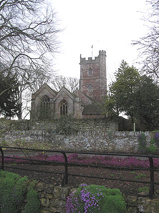
Spaxton is a small village and civil parish on the Quantocks in Somerset, South West England.
Enmore is a village and civil parish 2 miles (3 km) west of Bridgwater on the Quantock Hills in Somerset, England. The parish includes the hamlet of Bare Ash.

The Chard branch lines were two lines serving the town of Chard in Somerset, England. One was a northward branch, opened in 1863, from the Salisbury to Exeter main line, and the other, opened in 1866, ran south-eastwards from the Bristol – Taunton main line. Each branch had its own Chard passenger station at first, although the two lines connected in Chard.

The earliest known infrastructure for transport in Somerset is a series of wooden trackways laid across the Somerset Levels, an area of low-lying marshy ground. To the west of this district lies the Bristol Channel, while the other boundaries of the county of Somerset are along chains of hills that were once exploited for their mineral deposits. These natural features have all influenced the evolution of the transport network. Roads and railways either followed the hills, or needed causeways to cross the Levels. Harbours were developed, rivers improved, and linked to sources of traffic by canals. Railways were constructed throughout the area, influenced by the needs of the city of Bristol, which lies just to the north of Somerset, and to link the ports of the far south-west with the rest of England.

The Bristol to Exeter line is a major branch of the Great Western Main Line in the West of England and runs from Bristol, to Exeter, from where it continues as the Exeter to Plymouth line. It was one of the principal routes of the pre-1948 Great Western Railway which were subsequently taken over by the Western Region of British Railways and are now part of the Network Rail system.

The Hundred of North Petherton is one of the 40 historical Hundreds in the ceremonial county of Somerset, England, dating from before the Norman conquest. Although the Hundreds have never been formally abolished, their functions ended with the establishment of county courts in 1867 and the introduction of districts by the Local Government Act 1894. The name of the hundred derives from the name of the large royal estate that covered much of the area in 1086, recorded variously as Nortpetret in the Domesday Book, Nortpedret in Liber Exoniensis and Nort Peretu in the associated tax returns. This, in turn, was derived from the area's location to the northern end of the River Parrett.

Walford is a small village 3 miles (5 km) north east of Taunton in Somerset, England. Most of the village, including Walford Cross at the junction of the A38 and the A361, lies in the civil parish of Creech St Michael. The western part of the village, including Walford House, is in the civil parish of West Monkton. The village lies close to the A38 and the M5 motorway.


