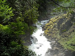
The Snoqualmie River is a 45-mile (72 km) long river in King County and Snohomish County in the U.S. state of Washington. The river's three main tributaries are the North, Middle, and South Forks, which drain the west side of the Cascade Mountains near the town of North Bend and join near the town of Snoqualmie just above the Snoqualmie Falls. After the falls the river flows north through rich farmland and the towns of Fall City, Carnation, and Duvall before meeting the Skykomish River to form the Snohomish River near Monroe. The Snohomish River empties into Puget Sound at Everett. Other tributaries of the Snoqualmie River include the Taylor River and the Pratt River, both of which enter the Middle Fork, the Tolt River, which joins at Carnation, and the Raging River at Fall City.

The Nooksack River is a river in western Whatcom County of the northwestern U.S. state of Washington, draining extensive valley systems within the North Cascades around Mount Shuksan, Mount Baker and the Twin Sisters, and a portion of Fraser Lowland south of the Canada–United States border.

The Sauk River is a tributary of the Skagit River, approximately 45 miles (72 km) long, in northwestern Washington in the United States. It drains an area of the high Cascade Range in the watershed of Puget Sound north of Seattle. The river is a popular destination for fly fishing. It is a National Wild and Scenic River.

The Skykomish River is a 29-mile (47 km) long river in the U.S. state of Washington which drains the west side of the Cascade Mountains in the southeast section of Snohomish County and the northeast corner of King County. The river starts with the confluence of the North Fork Skykomish River and South Fork Skykomish River approximately one mile west of Index, then flowing northwesterly towards Puget Sound. It is joined by the Sultan River and the Wallace River at Sultan. It then meets the Snoqualmie River to form the Snohomish River at Monroe. The Snohomish River continues along the river valley eventually dumping into Port Gardner Bay on Possession Sound.
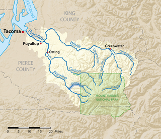
The Mowich River is a river in the U.S. state of Washington. Its watershed drains a portion of the western side of Mount Rainier, part of the Cascade Range. The river has two main headwater branches, the South Mowich River and the North Mowich River. The South Mowich is significantly larger and sometimes considered the main river. The Mowich and its tributaries drain several of Mount Rainier's glaciers. The upper portion of its watershed is contained within Mount Rainier National Park. The river flows into the Puyallup River in the foothills west of Mount Rainier.

The Sumas River is a river in the Fraser Lowland and a tributary of the Fraser River system, coursing across the international border between the Canadian province of British Columbia and the U.S. state of Washington.
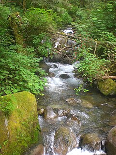
The Wallace River is a medium-sized river in Washington, United States. It is a tributary of the Skykomish River and joins near Sultan, just upstream from the mouth of the Sultan River. The Wallace River is 15 miles (24 km) long. Its drainage basin is 30 square miles (78 km2) in area.
The Cascade River is a river in the U.S. state of Washington. It is a tributary of the Skagit River which it joins at the city of Marblemount. It is a National Wild and Scenic River.
The Taylor River is a river in King County in Washington.
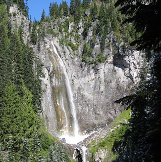
Van Trump Creek, also called Van Trump Falls Creek or the Van Trump Fork of the Nisqually River, is a creek in Pierce County, Washington. It is a tributary of the Nisqually River, joining the river just above the mouth of the Paradise River. The creek is known for having several well known waterfalls along its course.
The Miller River is a river in King County, Washington. Named for 1890s prospector John Miller, it is a tributary of the Skykomish River, which it joins near the community of Miller River. The Miller River is about 3.5 miles (5.6 km) long from the confluence of its main tributaries, the East Fork and West Fork. Miller River Campground is located just downriver from the confluence.

For the Canadian community, see Paradise River, Newfoundland and Labrador
Clear Creek is a creek in Snohomish County, Washington. It is a tributary of the Sauk River and enters the river just above the community of Darrington.
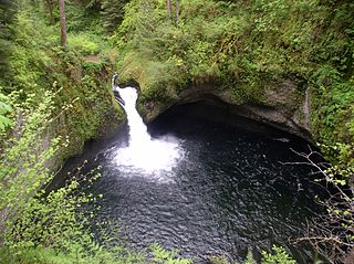
Eagle Creek is a tributary of the Columbia River in Multnomah and Hood River counties in the U.S. state of Oregon. It cuts through a narrow canyon in its 3,200 feet (980 m) descent to the Columbia River Gorge and is known for its concentration of 13 waterfalls in about 5 miles (8.0 km) distance. Eight major falls are on Eagle Creek and the East Fork Eagle Creek itself, while five are on its tributaries.
Mazama Falls, also referred to more simply as Wells Creek Falls, is a waterfall on Wells Creek in the U.S. state of Washington. At nearly 500 feet (150 m) high, it is said to be the largest waterfall in the Wells Creek watershed.
The Little Mashel River is a river in Pierce County, Washington. It is a tributary of the Mashel River, and enters the Mashel just 380 feet (116 m) downstream from the Eatonville, Washington, city limits. It is noted for its canyon and the three waterfalls.
The valley of the West Fork Foss River contains a fair amount of waterfalls. The river heads in a series of large lakes: Big Heart Lake, Angeline Lake, and Otter Lake- which form spectacular waterfalls as they plunge down to Delta Lake. On the valley walls downstream of Delta Lake, are found even more waterfalls.
Sulphide Creek is a 2.5-mile (4.0 km) glacial tributary of the Baker River in Whatcom County in the U.S. state of Washington, draining a steep and narrow canyon on the southeast flank of Mount Shuksan, inside North Cascades National Park. Although called a creek, it is river-like due to its high volume. The creek is fed by the "massive" Sulphide and Crystal glaciers above Sulphide Lake and it runs east collecting several small tributaries before flowing into the Baker River at elevation 869 feet (265 m). There are several very tall waterfalls occurring on the creek and its tributaries, the largest of which is Sulphide Creek Falls.

Wells Creek Falls is the generally used name for a waterfall on Wells Creek in the Mount Baker Wilderness in Washington. The falls are located several thousand feet above Wells Creek's confluence with Bar Creek.

The Ohanapecosh River is a 16-mile (26 km) river in the U.S. state of Washington.
