
The Werra, a river in central Germany, is the right-bank headwater of the Weser. "Weser" is a synonym in an old dialect of German. The Werra has its source near Eisfeld in southern Thuringia. After 293 kilometres (182 mi) the Werra joins the river Fulda in the town of Hann. Münden, forming the Weser. If the Werra is included as part of the Weser, the Weser is the longest river entirely within German territory at 744 kilometres (462 mi).

Eisenach is a town in Thuringia, Germany with 42,000 inhabitants, located 50 kilometres west of Erfurt, 70 km southeast of Kassel and 150 km northeast of Frankfurt. It is the main urban centre of western Thuringia and bordering northeastern Hessian regions, situated near the former Inner German border. A major attraction is Wartburg castle, which has been a UNESCO World Heritage Site since 1999.

The Wartburg is a castle originally built in the Middle Ages. It is situated on a precipice of 410 metres (1,350 ft) to the southwest of and overlooking the town of Eisenach, in the state of Thuringia, Germany. It was the home of St. Elisabeth of Hungary, the place where Martin Luther translated the New Testament of the Bible into German, the site of the Wartburg festival of 1817 and the supposed setting for the possibly legendary Sängerkrieg. It was an important inspiration for Ludwig II when he decided to build Neuschwanstein Castle.

Altenburg is a city in Thuringia, Germany, located 40 kilometres south of Leipzig, 90 kilometres west of Dresden and 100 kilometres east of Erfurt. It is the capital of the Altenburger Land district and part of a polycentric old-industrial textile and metal production region between Gera, Zwickau and Chemnitz with more than 1 million inhabitants, while the city itself has a population of 33,000. Today, the city and its rural county is part of the Central German Metropolitan Region.

Lindewerra is a municipality in the district of Eichsfeld in Thuringia, Germany. It is part of the Verwaltungsgemeinschaft Hanstein-Rusteberg. Before the fall of the Berlin Wall in 1989 Lindewerra was one of the few villages in the German Democratic Republic that could be observed directly from the West. After the fall of the Berlin Wall a bridge was built to connect the village to the Hessian bank of the Werra River.
Witzenhausen is a small town in the Werra-Meißner-Kreis in northeastern Hesse, Germany.

Greiz is a town in the state of Thuringia, Germany, and is the capital of the district of Greiz. Greiz is situated in eastern Thuringia, 100 kilometres (62 mi) east of the state capital Erfurt, on the White Elster river.

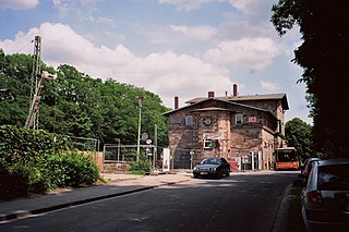
The Wanfried Agreement concerned a transfer of territory between the U.S. and Soviet occupation zones after World War II in Hesse, Germany, which took place after the determination of the main inner German border at the end of July 1945.

Solms is a town west of Wetzlar in the Lahn-Dill-Kreis, Hessen, Germany with around 13,500 inhabitants. In the constituent community of Burgsolms once stood the ancestral castle of the Counts and Princes of Solms.

Bad Köstritz is a town in the district of Greiz, in Thuringia, Germany. It is situated on the White Elster river, 7 km northwest of Gera. Bad Köstritz is known for the Köstritzer brewery and its Schwarzbier.

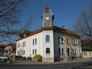
Bad Sooden-Allendorf is a spa town in the Werra-Meißner-Kreis in Hesse, Germany.
Großengottern is a village and a former municipality in the Unstrut-Hainich-Kreis district of Thuringia, Germany. Since 1 January 2019, it is part of the municipality of Unstrut-Hainich.
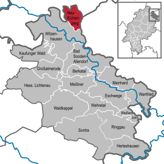
Neu-Eichenberg is a municipality in the Werra-Meißner-Kreis in Hesse, Germany.

Hohenroda is a municipality in Hersfeld-Rotenburg district in eastern Hesse, Germany lying right on the boundary with Thuringia.

Lippersdorf-Erdmannsdorf is a municipality in the district Saale-Holzland, in Thuringia, Germany.
The East Hesse Highlands describes a heavily wooded range of hills lying mainly in the German state of Hesse, but also extending a little way into Lower Saxony to the north, Thuringia to the east and Bavaria to the southeast. The region is sandwiched between the West Hesse Depression to the west, the Weser Uplands to the north, the Thuringian Basin to the northeast, the northwestern edge of the Thuringian Forest to the east, the Spessart to the south and the Wetterau to the southwest.
Oberrieden is a village in the northern part of Hesse, Germany. First recorded mention was in 1150. Since 1971 it belongs to the town of Bad Sooden-Allendorf.

Benndorf is a district of the town Frohburg in the Landkreis Leipzig district of Saxony, Germany. The former independent municipality became a district of Frohburg on 1 January 1997. Since 1948, the former independent municipality Bubendorf became part of Benndorf.

A Jugendburg, sometimes referred to in English as a youth castle, is a mediaeval castle in German-speaking countries that was converted during the 20th century into a public community centre or educational facility for young people. The sponsors of the original youth castles came mainly from the Wandervogel and Pfadfinder movement, or were at least linked to the youth movement.
Eichsfeld I is an electoral constituency represented in the Landtag of Thuringia. It elects one member via first-past-the-post voting. Under the current constituency numbering system, it is designated as constituency 1. It comprises the western part of the district of Eichsfeld, including its capital Heilbad Heiligenstadt.


