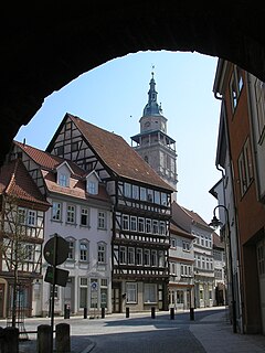
Bad Langensalza is a spa town of 17,500 inhabitants in the Unstrut-Hainich district, Thuringia, central Germany.

Arenshausen is a village in the Eichsfeld district of Thuringia, Germany.
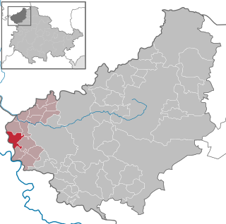
Bornhagen is a municipality in the district of Eichsfeld in Thuringia, Germany, located at the foot of the ruins of Hanstein Castle. The town district Rimbach is positioned directly south of the castle citadel at an elevation of 370 m. Bornhagen is located 22 km south of Göttingen, 85 km northwest of the state capital Erfurt and 270 km southwest of Berlin. It is the westernmost settlement in Thuringia but does not contain the westernmost point which is 75 km south near Geisa.
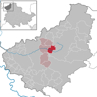
Wingerode is a municipality in the district of Eichsfeld in Thuringia, Germany. In 1996, Wingerode celebrated its 850th anniversary. It was founded in 1146.

Steinheuterode is a small municipality in the district of Eichsfeld in Thuringia, in the center of Germany.

Hildburghausen is a town in Thuringia in central Germany, capital of the district Hildburghausen.

Ohrdruf is a small town in the district of Gotha in the German state of Thuringia. It lies some 30 km southwest of Erfurt at the foot of the northern slope of the Thuringian Forest. The former municipalities Crawinkel, Gräfenhain and Wölfis were merged into Ohrdruf in January 2019.
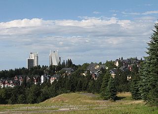
Oberhof is a town in the Schmalkalden-Meiningen district of Thuringia, Germany. Located in the Thuringian Forest mountain range, it is a winter sports center and health resort. With 1,625 inhabitants, it is visited by 144,000 tourists every year (2016). The town obtained its official city status in 1985.

Hermsdorf is a town in the Saale-Holzland district of the state of Thuringia in eastern Germany. It is especially known for the motorway junction "Hermsdorfer Kreuz" where the two German autobahns A 4 and A 9 meet.

Bad Berka is a German spa town, situated in the south of Weimar region in the state of Thuringia. With its almost 8,000 inhabitants Bad Berka is the second biggest city in Weimarer Land district. The river flowing through the town, which is embedded in new red sandstone, is called Ilm. Since 1 December 2008, the city has incorporated the former municipality of Gutendorf.

Bad Frankenhausen is a spa town in the German state of Thuringia. It is located at the southern slope of the Kyffhäuser mountain range, on an artificial arm of the Wipper river, a tributary of the Unstrut. Because of the nearby Kyffhäuser monument dedicated to Emperor Frederick Barbarossa, it is nicknamed Barbarossastadt. The municipality includes the villages of Seehausen, Udersleben, Esperstedt and Ichstedt and Ringleben.

Schleiz is a town in the district of Saale-Orla-Kreis in Thuringia, Germany. The former municipality Crispendorf was merged into Schleiz in January 2019, and Burgk in December 2019.

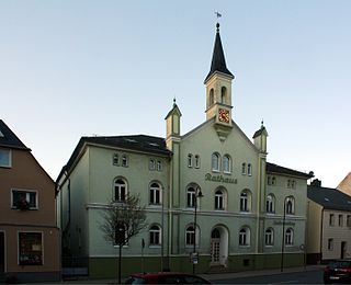
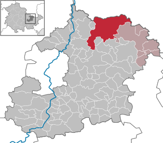
Lederhose is a municipality in the Greiz district of Thuringia, Germany. The town has a municipal association with Münchenbernsdorf. The name is a well-known example of an unusual place name as it is synonymous with the German term for Lederhosen, hence the coat of arms. The name of the village derives probably from the slavic name Ludorad and has no historical link to the piece of clothes. The national A9 expressway has an interchange named after the rather small village which makes the name appearing regularly in traffic reporting via radio.
Gefell is a town in the Saale-Orla-Kreis district, in Thuringia, Germany.

Hirschberg is a town in the Saale-Orla-Kreis district, in Thuringia, Germany. It is situated on the river Saale, 20 km south of Schleiz, 12 km northwest of Hof (Bavaria), and 25 km southwest of Plauen (Saxony).
Schkölen is a town in the Saale-Holzland district, in Thuringia, Germany. It is situated 12 km south of Naumburg. The village Zschorgula is part of the municipality.

Themar is a town in the district of Hildburghausen, in Thuringia, Germany. It is situated on the river Werra, 11 km northwest of Hildburghausen, and 14 km southwest of Suhl.

Gerstungen is a municipality in the Wartburgkreis district of Thuringia, Germany. In July 2018 the former municipalities of Marksuhl and Wolfsburg-Unkeroda were merged into Gerstungen.

Freienorla is located in the German state of Thuringia. Although quite small and obscure, the municipality is known locally for its Gothic church as well as its lower mill, a watermill facility thought to be built in the tenth century. The Orlabahn railroad has a station located in Freienorla. Neighboring towns include Jena and Eisenberg. Freienorla is located 145 miles from the capital of Berlin.

Probstzella is a municipality in the district Saalfeld-Rudolstadt, in Thuringia, Germany.


