The Kyffhäuserkreis is a district in the northern part of Thuringia, Germany. Neighboring districts are the districts Mansfeld-Südharz, Saalekreis und Burgenlandkreis in Saxony-Anhalt, and the districts Sömmerda, Unstrut-Hainich-Kreis and Eichsfeld.
Nordhausen is a Kreis (district) in the north of Thuringia, Germany. Neighboring districts are : Harz and Mansfeld-Südharz in Saxony-Anhalt; Kyffhäuserkreis and Eichsfeld in Thuringia; and Göttingen and Goslar in Lower Saxony.

Kirchworbis is a municipality in the district of Eichsfeld in Thuringia, Germany. Kirchworbis lies to the south of the Langenberg, a summit in the Ohm Hills.
Geisleden is a municipality in the district of Eichsfeld in Thuringia, Germany. It is located about 4 kilometres (2.5 mi) southeast of Heiligenstadt in the valley formed by the river Geislede. Other neighboring towns are Westhausen in the north, Kreuzebra to the east, and Heuthen toward the southeast.

Teistungen is a municipality in the district of Eichsfeld in Thuringia, Germany.

Sangerhausen is a town in Saxony-Anhalt, central Germany, capital of the district of Mansfeld-Südharz. It is situated southeast of the Harz, approx. 35 kilometres east of Nordhausen, and 50 km (31 mi) west of Halle (Saale). About 26,000 people live in Sangerhausen (2020).

Schmalkalden is a town in the Schmalkalden-Meiningen district, in the southwest of the state of Thuringia, Germany. It is on the southern slope of the Thuringian Forest at the Schmalkalde river, a tributary to the Werra. As of 31 December 2010, the town had a population of 19,978.
Eisenberg is a town in Thuringia, Germany. It is the capital of the district Saale-Holzland.

Blankenhain is a town in the Weimarer Land district, in Thuringia, Germany. It is 14 km south of Weimar.
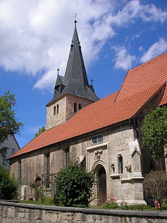
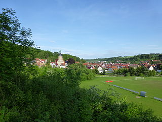
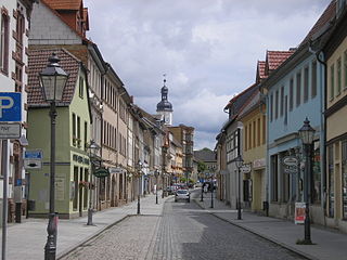
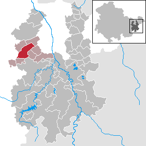
Bleicherode is a town in the district of Nordhausen, in Thuringia, Germany. It is situated on the river Wipper, 17 km southwest of Nordhausen. On 1 December 2007, the former municipality Obergebra was incorporated by Bleicherode. The former municipalities Etzelsrode, Friedrichsthal, Kleinbodungen, Kraja, Hainrode, Nohra, Wipperdorf and Wolkramshausen were merged into Bleicherode in January 2019. Every Thursday, there is a market held in the town.
Münchenbernsdorf is a town in the district of Greiz, in Thuringia, Germany. It is situated approximately 16 km southwest of Gera. The town is seat of a municipal association with eight members.

Gerstenberg is a municipality in the district of Altenburger Land, in Thuringia, Germany. Gerstenberg was first mentioned in a document in 1227. The line of knights "von Gerstenberg" died out in 1710. As early as 1181, a fortification was mentioned in the district of Pöschwitz. This later manor passed into civil ownership in 1798. Members of the families served the dukes of Saxe-Gotha and Saxe-Altenburg. After the expropriation in 1951, what was once the largest farm was just a residential property with MTS and a small new farmer.

Zimmernsupra is a municipality in the district of Gotha, in Thuringia, Germany.
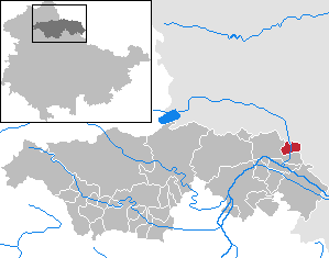
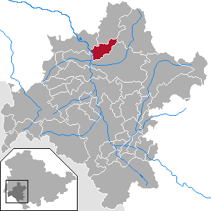
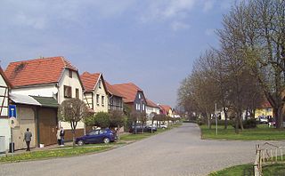
Mönchpfiffel-Nikolausrieth is a municipality on the river Helme in the district Kyffhäuserkreis, in Thuringia, Germany. The municipality was created in 1956 by the merging of the villages Monchpfiffel and Nikolausrieth.

Kaulsdorf is a municipality in the district Saalfeld-Rudolstadt, in Thuringia, Germany.

Altenbeuthen is a municipality in the district Saalfeld-Rudolstadt, in Thuringia, Germany.
Fambach is a municipality in the district Schmalkalden-Meiningen, in Thuringia, Germany. Since 1 December 2008 it has incorporated the former municipality of Heßles.

Höngeda is a village and quarter of the town of Mühlhausen in Thuringia, central Germany.
Bollstedt is a village and a quarter of the town of Mühlhausen in Thuringia, central Germany, situated on the left bank of the Unstrut.

Grabe is a village and a quarter of the town of Mühlhausen in Thuringia, central Germany. It consists of the settlements Kleingrabe and Großgrabe.


