Leinefelde-Worbis

Last updated
Leinefelde-Worbis
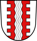
Wappen Leinefelde-Worbis.svg
Location of Leinefelde-Worbis within Eichsfeld district
Leinefelde-Worbis in EIC.svgBrehmeEffelderFreienhagenGernrodeKellaKellaKrombachLutterMackenrodeMarthRohrbergSchönhagenSteinbachSonnensteinWiesenfeld
Germany adm location map.svg
Red pog.svg
Leinefelde-Worbis
Thuringia location map.svg
Red pog.svg
Leinefelde-Worbis
Coordinates: 51°23′N10°20′E / 51.383°N 10.333°E / 51.383; 10.333
Country Germany
State Thuringia
District Eichsfeld
Subdivisions10
Government
   Mayor (202228) Christian Zwingmann [1]
Area
  Total110.18 km2 (42.54 sq mi)
Elevation
320 m (1,050 ft)
Population
 (2021-12-31) [2]
  Total19,986
  Density180/km2 (470/sq mi)
Time zone UTC+01:00 (CET)
  Summer (DST) UTC+02:00 (CEST)
Postal codes
37327, 37339
Dialling codes 03605, 036074
Vehicle registration EIC, HIG, WBS
Website www.leinefelde-worbis.de

Leinefelde-Worbis is a town in the district of Eichsfeld, in northwestern Thuringia, Germany. The town was formed on March 16, 2004, from the former independent towns Leinefelde and Worbis along with the municipalities of Breitenbach and Wintzingerode. In July 2018 the former municipality of Hundeshagen, and in January 2019 Kallmerode was merged into Leinefelde-Worbis. The population before the amalgamation was 14,387 for Leinefelde, 5,541 for Worbis, 1,021 for Breitenbach and 614 for Wintzingerode. The 10 parts of Leinefelde-Worbis are Leinefelde, Worbis, Breitenbach, Kirchohmfeld, Birkungen, Beuren, Hundeshagen, Kaltohmfeld, Wintzingrode, Kallmerode and Breitenholz.
Contents

Climate

Climate data for Leinefelde (1991–2020 normals)
MonthJanFebMarAprMayJunJulAugSepOctNovDecYear
Average high °C (°F)2.6
(36.7)
3.7
(38.7)
7.8
(46.0)
13.2
(55.8)
17.1
(62.8)
20.3
(68.5)
22.8
(73.0)
22.8
(73.0)
18.0
(64.4)
12.5
(54.5)
6.8
(44.2)
3.4
(38.1)
12.6
(54.7)
Daily mean °C (°F)0.3
(32.5)
0.9
(33.6)
4.0
(39.2)
8.4
(47.1)
12.2
(54.0)
15.3
(59.5)
17.5
(63.5)
17.4
(63.3)
13.4
(56.1)
8.9
(48.0)
4.4
(39.9)
1.2
(34.2)
8.6
(47.5)
Average low °C (°F)−2.2
(28.0)
−1.9
(28.6)
0.4
(32.7)
3.6
(38.5)
7.1
(44.8)
10.1
(50.2)
12.4
(54.3)
12.4
(54.3)
9.1
(48.4)
5.6
(42.1)
2.0
(35.6)
−1
(30)
4.8
(40.6)
Average precipitation mm (inches)58.2
(2.29)
45.6
(1.80)
54.4
(2.14)
41.8
(1.65)
67.9
(2.67)
63.0
(2.48)
82.3
(3.24)
62.6
(2.46)
58.7
(2.31)
51.8
(2.04)
55.8
(2.20)
59.9
(2.36)
697.5
(27.46)
Average precipitation days (≥ 0.1 mm)17.415.516.012.614.414.515.514.113.215.717.018.6184.1
Average snowy days (≥ 1.0 cm)10.912.35.91.00000002.88.241.1
Average relative humidity (%)87.083.379.272.073.975.073.371.878.784.688.388.779.6
Mean monthly sunshine hours 50.273.2120.4174.9206.1207.0212.7199.7152.1104.250.439.21,584.7
Source: World Meteorological Organization [3]

Transport

Leinefelde station is located on the Halle–Hann. Münden and the Gotha–Leinefelde railways.

Bear sanctuary

Since 1997 Worbis has become known for its bear sanctuary, the Alternativer Bärenpark Worbis, which is operated by the German animal welfare organisation Aktion Tier – Menschen für Tiere (formerly Deutsches Tierhilfswerk).[ citation needed ]

Museums

The Borderland Museum Eichsfeld in Teistungen, Thuringia, is a popular tourist attraction close to Leinefelde-Worbis. Museumsgebaude.jpg
The Borderland Museum Eichsfeld in Teistungen, Thuringia, is a popular tourist attraction close to Leinefelde-Worbis.

The Borderland Museum Eichsfeld, a Cold War history museum located only a few miles away from Leinefelde-Worbis, presents different topics of the history of the German division and the GDR on an area of 1,000 squaremetres. The exhibition is displayed in both German and English.

People

Leinefelde is the birthplace of Johann Carl Fuhlrott, the discoverer of Neanderthal man. It is also the birthplace of Johannes Krause, who determined the Denisovan are a distinct line of homo distinct from modern humans and Neanderthals. Fuhlrott and Krause, born nearly 180 years apart, were also professors at the University of Tübingen.

Worbis is the birthplace of Bernard Quaritch (1819-1899), the London second-hand bookseller and publisher, and of Barbara Saß-Viehweger (born 1943), a German politician, lawyer and civil law notary.

Related Research Articles

<span class="mw-page-title-main">Eichsfeld (district)</span> District in Thuringia, Germany

Eichsfeld is a district in Thuringia, Germany, and part of the historical region of Eichsfeld. It is bounded by the districts of Nordhausen, Kyffhäuserkreis and Unstrut-Hainich-Kreis, and by the states of Hesse and Lower Saxony.

Nordhausen is a Kreis (district) in the north of Thuringia, Germany. Neighboring districts are : Harz and Mansfeld-Südharz in Saxony-Anhalt; Kyffhäuserkreis and Eichsfeld in Thuringia; and Göttingen and Goslar in Lower Saxony.

Breitenbach may refer to:

<span class="mw-page-title-main">Dingelstädt</span> Town in Thuringia, Germany

Dingelstädt is a town in the district of Eichsfeld in Thuringia, Germany. It is situated on the upper course of the river Unstrut, 8 km (5 mi) south of Leinefelde-Worbis and 15 km (9 mi) northwest of Mühlhausen. The former municipalities Helmsdorf, Kefferhausen, Kreuzebra and Silberhausen were merged into Dingelstädt in January 2019. In January 2023 Dingelstädt absorbed the villages Bickenriede and Zella from the former municipality Anrode, and Beberstedt and Hüpstedt from the former municipality Dünwald.

<span class="mw-page-title-main">Heilbad Heiligenstadt</span> Town in Thuringia, Germany

Heilbad Heiligenstadt is a spa town in Thuringia, Germany. It is the capital of the Eichsfeld district.

Kallmerode is a village and a former municipality in the district of Eichsfeld in Thuringia, Germany. Since 1 January 2019, it is part of the town Leinefelde-Worbis.

<span class="mw-page-title-main">Niederorschel</span> Municipality in Thuringia, Germany

Niederorschel is a municipality in the district of Eichsfeld in Thuringia, Germany. The former municipalities Deuna, Gerterode, Hausen and Kleinbartloff were merged into Niederorschel in January 2019. It further includes the localities of Niederorschel, Oberorschel, and Rüdigershagen.

<span class="mw-page-title-main">Gernrode, Thuringia</span> Municipality in Thuringia, Germany

Gernrode is a municipality in the district of Eichsfeld in Thuringia, Germany. Its agricultural land is some of the most productive in the district and it therefore does not have any wooded areas.

<span class="mw-page-title-main">Bornhagen</span> Municipality in Thuringia, Germany

Bornhagen is a municipality in the district of Eichsfeld in Thuringia, Germany, located at the foot of the ruins of Hanstein Castle. The town district Rimbach is positioned directly south of the castle citadel at an elevation of 370 m. Bornhagen is located 22 km south of Göttingen, 85 km northwest of the state capital Erfurt and 270 km southwest of Berlin. It is the westernmost settlement in Thuringia but does not contain the westernmost point which is 75 km south near Geisa.

<span class="mw-page-title-main">Hohes Kreuz</span> Municipality in Thuringia, Germany

Hohes Kreuz is a municipality in the Eichsfeld in Thuringia, Germany. The municipality was created in 1991 by merging the municipalities of Bischhagen, Mengelrode, Siemerode, and Streitholz.

Hundeshagen is a village and a former municipality in the district of Eichsfeld in Thuringia, Germany. Since July 2018, it is part of the town Leinefelde-Worbis.

<span class="mw-page-title-main">Teistungen</span> Municipality in Thuringia, Germany

Teistungen is a municipality in the district of Eichsfeld in Thuringia, Germany.

<span class="mw-page-title-main">Wüstheuterode</span> Municipality in Thuringia, Germany

Wüstheuterode is a municipality in the district of Eichsfeld in Thuringia, Germany.

<span class="mw-page-title-main">Wachstedt</span> Municipality in Thuringia, Germany

Wachstedt is a municipality in the district of Eichsfeld in Thuringia, Germany.

<span class="mw-page-title-main">Eichsfeld</span>

The Eichsfeld is a historical region in the southeast of the state of Lower Saxony and northwest of the state of Thuringia in the south of the Harz mountains in Germany. Until 1803 the Eichsfeld was for centuries part of the Archbishopric of Mainz, which is the cause of its current position as a Catholic enclave in the predominantly Protestant north of Germany. Following German partition in 1945, the West German portion became Landkreis Duderstadt. A few small transfers of territory between the American and Soviet zones of occupation took place in accordance with the Wanfried Agreement.

<span class="mw-page-title-main">Wheel of Mainz</span> Coat of arms of Mainz

The Wheel of Mainz or Mainzer Rad, in German, was the coat of arms of the Archbishopric of Mainz and thus also of the Electorate of Mainz (Kurmainz), in Rhineland-Palatinate, Germany. It consists of a silver wheel with six spokes on a red background. The wheel can also be found in stonemasons' carvings and similar objects. Currently, the City of Mainz uses a double wheel connected by a silver cross.

<span class="mw-page-title-main">Ohm Hills</span>

The Ohm Hills are a small range of hills up to 533.4 m above sea level (NN) high and about 50 km² in area. They are part of the Lower Eichsfeld region and are located in the county of Eichsfeld, North Thuringia, Germany.

<span class="mw-page-title-main">Leinefelde station</span>

Leinefelde station is a major railway junction in the German state of Thuringia and is the most important station in Eichsfeld. It is located in the town of Leinefelde in the Thuringian municipality of Leinefelde-Worbis in the Eichsfeld district. The Halle–Kassel and Gotha–Leinefelde railways meet there and in the past the now closed Leinefelde–Wulften and Leinefelde–Treysa railways also connected with the station. The latter route was part of the Kanonenbahn between Berlin and Metz.

Eichsfeld I is an electoral constituency represented in the Landtag of Thuringia. It elects one member via first-past-the-post voting. Under the current constituency numbering system, it is designated as constituency 1. It comprises the western part of the district of Eichsfeld, including its capital Heilbad Heiligenstadt.

Eichsfeld II is an electoral constituency represented in the Landtag of Thuringia. It elects one member via first-past-the-post voting. Under the current constituency numbering system, it is designated as constituency 2. It comprises the eastern part of the district of Eichsfeld.

References

  1. Gewählte Bürgermeister - aktuelle Landesübersicht, Freistaat Thüringen, accessed 10 November 2022.
  2. "Bevölkerung der Gemeinden, erfüllenden Gemeinden und Verwaltungsgemeinschaften in Thüringen Gebietsstand: 31.12.2021" (in German). Thüringer Landesamt für Statistik. June 2022.
  3. "World Meteorological Organization Climate Normals for 1991–2020". World Meteorological Organization Climatological Standard Normals (1991–2020). National Oceanic and Atmospheric Administration. Archived from the original on 12 October 2023. Retrieved 12 October 2023.