Banyuwangi Regency is a regency of East Java province in Indonesia. This regency also known as the sun rise of Java because it is located at the easternmost end of Java Island. The town of Banyuwangi serves as a port for ferry services between Java and Bali. The regency is surrounded by mountains and forests to the west; by sea to the east and south - is separated by the Strait of Bali from Bali. With an area of 5,782.5 km2, this regency is by far the largest on the island of Java. The regency is a tourist destination, and subject to ongoing development as an international tourist destination with relevant infrastructure. Banyuwangi regency has been declared a taman bumi, or national geological park (Geopark) in 2018.
The Sula Islands Regency is one of the regencies in North Maluku province of Indonesia. It was originally formed on 25 February 2003, when it encompassed the three large islands comprising the Sula Archipelago, together with minor adjacent islands. However, the largest and most westerly of the three, Taliabu, was split off from the Sula Islands Regency on 14 December 2012 to form a separate regency.

Pacitan Regency is a regency located in the southwestern corner of East Java Province, with Central Java Province on its western border. Located between 7.55° - 8.17°S and 110.55° - 111.25°E. The borders of Pacitan Regency are with Wonogiri Regency in the west and north, Ponorogo Regency and Trenggalek Regency in the east, and the Indian Ocean in the south. It covers an area of 1,389.87 km2 and had a population of 540,881 at the 2010 census and 586,110 at the 2020 census; the official estimate as at mid 2023 was 597,390. The capital of Pacitan Regency is the town of Pacitan. The majority of citizens in Pacitan speak Javanese as their first language, while speaking Indonesian as a second language.

Trenggalek Regency is a regency (kabupaten) in East Java, Indonesia.

Sorong Regency is a regency of the Southwest Papua province of Indonesia. It covers an area of 13,075.28 km2, and had a population of 70,619 at the 2010 Census, and 118,679 at the 2020 Census; the official estimate as of mid-2023 was 129,963. Its administrative centre is the town of Aimas. Sorong Regency surrounds Sorong City (Kota) on the landward side; the city is administratively independent of the Regency and is not included in the above statistics; Sorong City has an airport, Sorong Airport, which also serves the Regency.

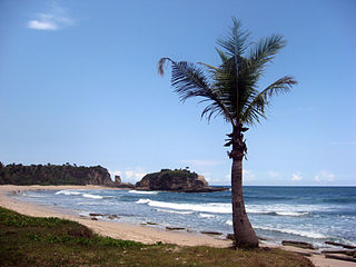
Palabuhanratu or Pelabuhan Ratu is a district and fishing town which serves as the regency seat of Sukabumi Regency. It is at the southwest coast of Palabuhanratu Bay, West Java facing the Indian Ocean. It is a four-hour drive from Bandung and up to a 12-hour drive from Indonesia's capital Jakarta due to traffic jams in Ciawi, Cicurug, Cibadak and Pelabuhan Ratu gate, whose residents love to visit the bay 'Teluk Palabuhanratu', once named 'Wijnkoopersbaai' by the Dutch. The bay is shaped like a horseshoe and has enormous waves that can be very treacherous. The Sundanese locals say that the Indian Ocean is the home of Nyai Loro Kidul who reigns along the southern coast of Java.

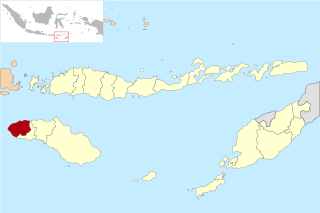
Southwest Sumba Regency is a regency on Sumba Island in East Nusa Tenggara province of Indonesia. Established on 2 January 2007 out of parts of West Sumba Regency, the regency has its seat (capital) in Tambolaka. Its population was 283,818 in the 2010 decennial census and had risen to 303,650 at the 2020 census; the official estimate as at mid 2022 was 322,073 (comprising 164,825 males and 157,248 females

Tambrauw Regency is a regency of Southwest Papua Province, Indonesia, in the Bird's Head Peninsula of Papua Island. It was created on 29 October 2008 from what had been an eastern part of Sorong Regency, originally as part of the province of West Papua. Much of the regency is located on the Tamrau Mountains that the local government declarated Tambrauw as a "conservation regency".

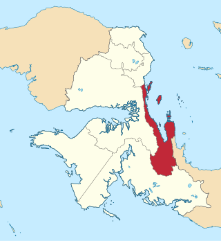
Teluk Wondama Regency or Wondama Bay Regency is a regency of West Papua province of Indonesia. It covers a land area of 4,844.035 km2, and had a population of 26,321 at the 2010 Census and 41,644 at the 2020 Census; the official estimate as at mid 2023 was 44,534. The administrative centre lies in the small town of Rasiei.

Bikar is a small town and district in the Tambrauw Regency of Southwest Papua, Indonesia. The town is located on the northern coast of the Bird's Head Peninsula, also known as the Vogelkop Peninsula. Bikar is the second-least populous district in Tambrauw, with a population of 2.372 at the 2020 Census. Suyam Village is administrative centre.
Fef a district in Tambrauw Regency, Southwest Papua, Indonesia. It is the capital of the Tambrauw Regency and the administrative center of the Tambrauw Regency. It had a population of 428 as of 2010 and 966 at the 2020 Census.
Wilhem Roumbouts is a District in Tambrauw Regency in Southwest Papua, Indonesia. Its district capital is Tabamsere.

Southwest Papua is the 38th province of Indonesia to be created, and was split off from West Papua on 8 December 2022. Despite being named southwest, it is a misnomer and this province is actually located in the northwest edge of Papua. The province comprises the Greater Sorong area which consists of Sorong City, Sorong Regency, South Sorong Regency, Maybrat Regency, Tambrauw Regency, and Raja Ampat Regency. The Bill (RUU) on the Establishment of the Southwest Papua Province was passed into law and therefore it became the 38th province in Indonesia with effect from 8 December 2022.
The province of Southwest Papua in Indonesia is divided into regencies. The regencies are turn are divided administratively into districts, also known in Indonesian as distrik or kecamatan.


