| Wessonneau River | |
|---|---|
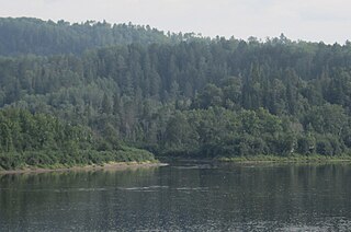
 The rock legend Steamboat on the river in the Saint-Maurice Wildlife Reserve | |
| Location | |
| Country | |
| Province | |
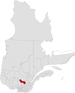
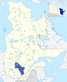
| Region | Mauricie |
| Physical characteristics | |
| Source | |
| ⁃ location | Zec Chapeau-de-Paille |
| Mouth | |
⁃ location | Mauricie administrative region |
⁃ coordinates | 47°12′46″N72°53′59″W / 47.21278°N 72.89972°W Coordinates: 47°12′46″N72°53′59″W / 47.21278°N 72.89972°W |
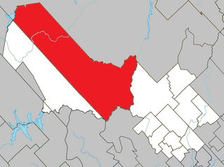
The Wessonneau River flows north-east in the Mekinac Regional County Municipality in Mauricie, in Quebec, in Canada, on the west bank of the Saint-Maurice River. The watershed of the river is administered by:
Mauricie is a traditional and current administrative region of Quebec. La Mauricie National Park is contained within the region, making it a prime tourist location. The region has a land area of 35,855.22 km² and a 2006 census population of 258,928 residents. Its largest cities are Trois-Rivières and Shawinigan.

Quebec is one of the thirteen provinces and territories of Canada. It is bordered to the west by the province of Ontario and the bodies of water James Bay and Hudson Bay; to the north by Hudson Strait and Ungava Bay; to the east by the Gulf of Saint Lawrence and the province of Newfoundland and Labrador; and to the south by the province of New Brunswick and the US states of Maine, New Hampshire, Vermont, and New York. It also shares maritime borders with Nunavut, Prince Edward Island, and Nova Scotia. Quebec is Canada's largest province by area and its second-largest administrative division; only the territory of Nunavut is larger. It is historically and politically considered to be part of Central Canada.

Canada is a country in the northern part of North America. Its ten provinces and three territories extend from the Atlantic to the Pacific and northward into the Arctic Ocean, covering 9.98 million square kilometres, making it the world's second-largest country by total area. Its southern border with the United States, stretching some 8,891 kilometres (5,525 mi), is the world's longest bi-national land border. Canada's capital is Ottawa, and its three largest metropolitan areas are Toronto, Montreal, and Vancouver.
Contents
- Zec Wessonneau for the northern part of the basin;
- Zec Chapeau-de-Paille and Zec du Gros-Brochet, which are located in the western part of the watershed;
- Wildlife Reserve of Saint-Maurice, south of the river Wessonneau.

The ZEC Wessonneau is a "zone d'exploitation contrôlée" (ZEC), located on the west bank of the Saint-Maurice River, in the La Tuque, in the region the Mauricie, in Quebec (Canada). This public hunting and fishing area is managed by the "Association chasse et pêche Fléchée Inc".
The ZEC du Gros-Brochet is a "zone d'exploitation contrôlée" (ZEC), located in the region of Mauricie, in Quebec, in Canada. This public hunting and fishing area is managed by the "Association Sportive du Gros-Brochet Inc".