
Snaresbrook is a district of East London in the London Borough of Redbridge. It is located 8 miles east of Charing Cross.

Walthamstow is a district of north east London, England, within the ceremonial county of Greater London and the ancient county of Essex. Situated 7+1⁄2 miles northeast of Charing Cross, Walthamstow borders Chingford to the north, Snaresbrook and South Woodford to the east, Leyton and Leytonstone to the south, and Tottenham to the west. At the 2011 census, Walthamstow had a population of approximately 109,424.

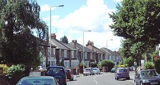
Leytonstone is an area in east London, England, within the London Borough of Waltham Forest. Situated 7 miles (11 km) north-east of Charing Cross, it adjoins Wanstead to the east, Forest Gate to the south-east, Stratford to the south-west, Leyton to the west, and Walthamstow to the north-west.

Essex is a county in the East of England which originated as the ancient Kingdom of Essex and one of the seven kingdoms, or heptarchy, that went on to form the Kingdom of England.

Leyton and Wanstead is a constituency created in 1997 and represented in the House of Commons of the UK Parliament since 2010 by John Cryer of the Labour Party.

Leyton was a local government district in southwest Essex, England, from 1873 to 1965. It included the neighbourhoods of Leyton, Leytonstone and Cann Hall. It was suburban to London, forming part of the London postal district and Metropolitan Police District. It now forms the southernmost part of the London Borough of Waltham Forest in Greater London.

Walthamstow was a local government district in southwest Essex, England from 1873 to 1965, around the town of Walthamstow. It was within the London suburbs, forming part of the London postal district and Metropolitan Police District. Its former area now corresponds to the central part of the London Borough of Waltham Forest in Greater London.
Cann Hall is a ward, and former civil parish, in the south of Leytonstone in the London Borough of Waltham Forest. It is north of Stratford and Forest Gate, east of Leyton, and west of Wanstead Flats, the southernmost tip of Epping Forest.
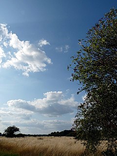
Wanstead Flats is the southernmost portion of Epping Forest covering Leytonstone and Wanstead, London. The flats and by extension the forest ends at Forest Gate directly to the south. It now falls wholly within the boundaries of London Borough of Redbridge and London Borough of Waltham Forest, though until 1994 two parts of it were in the London Borough of Newham - one of these was the section between Aldersbrook Road and Capel Road east of the junction between Aldersbrook Road and St Margaret's Road, whilst the other was the strip running along Capel Road between its junctions with Centre Road and Ridley Road. As part of Epping Forest, the flats is managed by the City of London Corporation.
The London Government Act 1963 is an Act of the Parliament of the United Kingdom, which created Greater London and a new local government structure within it. The Act significantly reduced the number of local government districts in the area, resulting in local authorities responsible for larger areas and populations. The upper tier of local government was reformed to cover the whole of the Greater London area and with a more strategic role; and the split of functions between upper and lower tiers was recast. The Act classified the boroughs into inner and outer London groups. The City of London and its corporation were essentially unreformed by the legislation. Subsequent amendments to the Act have significantly amended the upper tier arrangements, with the Greater London Council abolished in 1986, and the Greater London Authority introduced in 2000. As of 2016, the London boroughs are more or less identical to those created in 1965, although with some enhanced powers over services such as waste management and education.

Wanstead and Woodford was a local government district from 1934 to 1965 in southwest Essex, England. A merger of two former urban districts, it was suburban to London and part of the Metropolitan Police District.
Woodford Bridge is part of the East London suburb of Woodford, in the London Borough of Redbridge. It is located on an old road between Chigwell and Leytonstone.
Wanstead and Woodford was a constituency in north-east London, represented in the House of Commons of the Parliament of the United Kingdom. It elected one Member of Parliament (MP) by the first past the post system of election. It existed between 1964 and 1997.
Becontree was an ancient hundred in the south west of the county of Essex, England. Its area has been entirely absorbed by the growth of London; with its name reused in 1921 for the large Becontree estate of the London County Council. Its former area now corresponds to the London Borough of Newham, the London Borough of Barking and Dagenham and parts of the London Borough of Waltham Forest and the London Borough of Redbridge. Its early extent also included parts of what is now the London Borough of Havering.
The Royal Commission on Local Government in Greater London, also known as the Herbert Commission, was established in 1957 and published its report in 1960. The report made recommendations for the overhaul of the administration of the capital. They were modified and implemented by the London Government Act 1963.

Woodford is a suburban town in east London, England, within the ceremonial county of Greater London and the ancient county of Essex. It is divided into the neighbourhoods of Woodford Green, Woodford Bridge, Woodford Wells, and South Woodford. The town is situated 9.5 miles (15.3 km) north-east of Charing Cross.
Holloway Down was a village, historically in Essex and now part of Leytonstone in the London Borough of Waltham Forest. The village was sited at the junction of Union Lane and Leytonstone Road It is most notable as the location of the West Ham Union Workhouse, While the village has been replaced by Victorian terraces and shops, buildings from the workhouse remain; which have been converted into housing and part of North East London NHS Foundation Trust.
Wanstead Sewage Works, also known as Redbridge (Southern) Sewage Works or Empress Sewage Works, was a municipal sewage treatment works located on a site bounded by the River Roding to the east and Wanstead Park to the north, in the south eastern corner of the parish of Wanstead, in the London Borough of Redbridge, historically within the county of Essex, England. It was in operation from 1 March 1884 to December 1977.
The South Essex League was a football league that was held in Essex and East London.