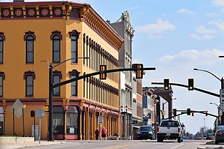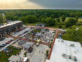
Delaware County is a county in the east central portion of the U.S. state of Indiana. As of 2020, the population was 111,903. The county seat is Muncie.

Blackford County is located in the east central portion of the U.S. state of Indiana. The county is named for Judge Isaac Blackford, who was the first speaker of the Indiana General Assembly and a long-time chief justice of the Indiana Supreme Court. Created in 1838, Blackford County is divided into four townships, and its county seat is Hartford City. Two incorporated cities and one incorporated town are located within the county. The county is also the site of numerous unincorporated communities and ghost towns. Occupying only 165.58 square miles (428.9 km2), Blackford County is the fourth smallest county in Indiana. As of the 2020 census, the county's population was 12,112. Based on population, the county is the 8th smallest county of the 92 in Indiana. Although no interstate highways are located in Blackford County, three Indiana state roads cross the county, and an additional state road is located along the county's southeast border. The county has two railroad lines. A north–south route crosses the county, and intersects with a second railroad line that connects Hartford City with communities to the west.

Albany is a town in Delaware and Randolph counties in the U.S. state of Indiana, along the Mississinewa River. The population was 2,295 at the 2020 census. It is part of the Muncie, IN Metropolitan Statistical Area.

Chesterfield is a town in the U.S. state of Indiana which lies in Union Township, Madison County, and Salem Township, Delaware County. The population was 2,490 at the 2020 census. It is part of the Indianapolis–Carmel–Anderson metropolitan statistical area.

Muncie is an incorporated city and the seat of Delaware County, Indiana, United States. Previously known as Buckongahelas Town, named after the legendary Delaware Chief, it is located in East Central Indiana, about 50 miles (80 km) northeast of Indianapolis. At the 2020 United States Census, the city's population was 65,195, down from 70,085 in the 2010 Census. It is the principal city of the Muncie Metropolitan Statistical Area, which encompasses all of Delaware County. The city is also included in the Indianapolis–Carmel–Muncie, IN Combined Statistical Area.

Yorktown is a town in Mount Pleasant Township, Delaware County, Indiana, United States. The population was 11,548 at the 2020 census. It is part of the Muncie, Indiana Metropolitan Statistical Area.

Modoc is a town in Union Township, Randolph County, in the U.S. state of Indiana. The population was 196 at the 2010 census.

The Indianapolis metropolitan area is an 11-county metropolitan area in the U.S. state of Indiana. Its principal cities are Indianapolis, Carmel, Greenwood, and Anderson. Other primary cities with populations of more than 50,000 include Fishers, Noblesville, and Westfield. Located in Central Indiana, it is the largest metropolitan area entirely within Indiana and the seventh largest in the American Midwest.

State Road 332 (SR 332) is a part of the Indiana State Road that runs between Interstate 69 (I–69) and Muncie in US state of Indiana. The 7.64 miles (12.30 km) of SR 332 that lie within Indiana serve as a minor highway. None of the highway is listed on the National Highway System. Various sections are rural four-lane divided highway and urban four-lane highway. The highway passes through farmland, residential and commercial properties.

Union Township is one of eleven townships in Randolph County, Indiana, which contains the towns of Modoc and Losantville. As of the 2010 census, its population was 2,142 and it contained 960 housing units.

Indiana's 5th congressional district is a congressional district in the U.S. state of Indiana comprising Hamilton, Madison, Delaware, Grant, and Tipton counties, as well as the large majority of Howard County. Much of its population is located in the northern suburbs of Indianapolis, including the cities of Carmel, Noblesville, and Fishers, while other population centers include Muncie, Kokomo, Anderson, and Marion. The district is predominantly white and is the wealthiest congressional district in Indiana, as measured by median income.
Delaware County Regional Airport is in Delaware County, Indiana three miles northwest of Muncie. Owned by the Delaware County Airport Authority, it was formerly Delaware County Airport and Johnson Field. The National Plan of Integrated Airport Systems for 2011–2015 categorized it as a general aviation facility.

Center Township is one of twelve townships in Delaware County, Indiana. According to the 2010 census, its population was 69,199 and it contained 31,368 housing units.

Hamilton Township is one of twelve townships in Delaware County, Indiana. According to the 2010 census, its population was 12,169 and it contained 18,785 housing units.

Harrison Township is one of twelve townships in Delaware County, Indiana. According to the 2020 census, its population was 3,463 and it contained 1,462 housing units.

Liberty Township is one of twelve townships in Delaware County, Indiana. According to the 2010 census, its population was 4,414 and it contained 1,997 housing units.

Mount Pleasant Township is one of twelve townships in Delaware County, Indiana. According to the 2010 census, its population was 14,102 and it contained 6,157 housing units. The school system is Yorktown Community Schools in Yorktown.

The Carnegie Library is a historic Carnegie library located at Muncie, Indiana, United States. The building houses the Local History & Genealogy collection and an open computer lab. The facility also provides wireless access and a meeting room for local groups to reserve. It is one of four branches that make up the Muncie Public Library System. The building was made possible through a financial donation to the City of Muncie by Andrew Carnegie to expand their library system throughout the community. The foundation for Carnegie Library was built in 1902 and the building opened to the public in 1904. It has been in continuous use as a library since its opening. The building is located in downtown Muncie at the intersection of Jackson and Jefferson.

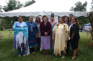
The Munsee are a subtribe and one of the three divisions of the Lenape. Historically, they lived along the upper portion of the Delaware River, the Minisink, and the adjacent country in New York, New Jersey, and Pennsylvania. They were prominent in the early history of New York and New Jersey, being among the first Indigenous peoples of that region to encounter European colonizers.
Medford is an unincorporated community in Delaware County, Indiana. It is located about 5 miles to the southeast of Muncie.


