The Russian Mennonites are a group of Mennonites who are the descendants of Dutch and North German Anabaptists who settled in the Vistula delta in West Prussia for about 250 years and established colonies in the Russian Empire beginning in 1789. Since the late 19th century, many of them have emigrated to countries which are located throughout the Western Hemisphere. The rest of them were forcibly relocated, so very few of their descendants currently live in the locations of the original colonies. Russian Mennonites are traditionally multilingual but Plautdietsch is their first language as well as their lingua franca. In 2014, there were several hundred thousand Russian Mennonites: about 200,000 live in Germany, 74,122 live in Mexico, 150,000 in Bolivia, 40,000 live in Paraguay, 10,000 live in Belize, tens of thousands of them live in Canada and the US, and a few thousand live in Argentina, Uruguay, and Brazil.

Steinbach is the third-largest city in the province of Manitoba, Canada, and with a population of 17,806, the largest community in the Eastman region. The city, located about 58 km (36 mi) southeast of the provincial capital of Winnipeg, is bordered by the Rural Municipality of Hanover to the north, west, and south, and the Rural Municipality of La Broquerie to the east. Steinbach was first settled by Plautdietsch-speaking Mennonites from Ukraine in 1874, whose descendants continue to have a significant presence in the city today. Steinbach is found on the eastern edge of the Canadian Prairies, while Sandilands Provincial Forest is a short distance east of the city.

The Rural Municipality of Hanover is a rural municipality (RM) in southeastern Manitoba, Canada, located southeast of Winnipeg in Division No. 2.

Altona is a town in southern Manitoba, Canada, about 100 km south-west of Winnipeg and 158 km north of Grand Forks, North Dakota. The population at the 2021 Census was 4,390 residents. Old Altona was founded in 1880 by Plautdietsch-speaking Mennonites from the Russian Empire. It is surrounded by the Municipality of Rhineland. Much of the surrounding area is devoted to farming and agriculture-based business.
Reinfeld is an Unincorporated Urban Community (UUC) in the Rural Municipality of Stanley in the Pembina Valley region of Manitoba, Canada, about one km east of Winkler. Mainly a Mennonite community, its relative vicinity to Winkler makes it a possible candidate to become a suburb in the future.
Kleefeld is a local urban district located in the Rural Municipality of Hanover, Manitoba, Canada.
The Rural Municipality of Bifrost is a former rural municipality (RM) in the Canadian province of Manitoba.
Old Kildonan is the northernmost city ward of Winnipeg, Manitoba. Before the City of Winnipeg Act of 1972, it was an independent unincorporated municipality called the Municipality of Old Kildonan; prior to that, from 1914, it was a subdivision of the Rural Municipality of Kildonan.

A block settlement is a particular type of land distribution which allows settlers with the same ethnicity to form small colonies. This settlement type was used throughout western Canada between the late 19th and early 20th centuries. Some were planned and others were spontaneously created by the settlers themselves. As a legacy of the block settlements, the three Prairie Provinces have several regions where ancestries other than British are the largest, unlike the norm in surrounding regions.
Menno Colony is a Mennonite settlement located in the central part of the Chaco region, in northwest Paraguay, occupying an area of 7500 km2 (2900 mi2). It was founded in 1926 by Plautdietsch-speaking descendants of Russian Mennonites who emigrated from Canadian provinces of Manitoba and Saskatchewan. Neighbouring Mennonite settlements are Fernheim Colony and Neuland Colony. The main settlement of the colony is Loma Plata. Menno is the largest of the Mennonite colonies in Paraguay.
Rosenort, Manitoba, is an unincorporated community recognized as a local urban district within the Rural Municipality of Morris about 17 kilometres from the town of Morris and about 47 kilometres south of Winnipeg.
New Iceland is the name of a region on Lake Winnipeg in Manitoba founded by Icelandic settlers in 1875.
The Rural Municipality of Rhineland is a former rural municipality (RM) in the Canadian province of Manitoba. Since 1876, the area made up part of the Mennonite West Reserve. The R.M. of Rhineland was originally incorporated as a rural municipality on February 14, 1880 and later absorbed the neighbouring RM of Douglas in January 1891. It ceased on January 1, 2015 as a result of its provincially mandated amalgamation with the towns of Gretna and Plum Coulee to form the Municipality of Rhineland.

Blumenort is a local urban district in the Canadian province of Manitoba. It is located in the Rural Municipality of Hanover, 4.1 kilometres north of the city of Steinbach. It was founded in 1874 by Plautdietsch-speaking Mennonite farmers from the Russian Empire. Today, its economy is based on agriculture and the service industry.

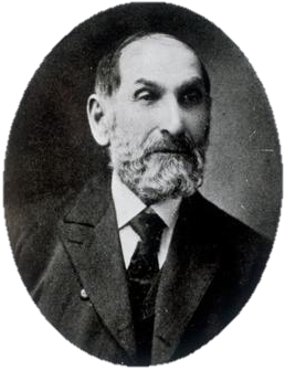
Jacob Yost Shantz was a Mennonite farmer, businessman, and industrialist from Ontario, Canada. He played a significant role in the urban development of Berlin, Ontario, where he held a succession of civic roles over a period of almost three decades, culminating in a term as mayor in 1882. Over the span of his life, Berlin was transformed from a rural agricultural settlement known as Ebytown into a bustling manufacturing centre; this was a change mirrored by Shantz, who began his adult life as a farmer and sawmiller, and ended it as a prominent local industrialist.

Neubergthal is an unincorporated rural community and a National Historic Site of Canada in the Municipality of Rhineland, Manitoba, Canada. Neubergthal was founded in 1876 as a Mennonite community with Russian Mennonite settlers who came from the Bergthal Colony in Russia. The historic site encompassed six sections of land and the village was laid out in traditional long narrow farmsteads. The village is famous for its traditional Mennonite housebarns and other historic buildings.

The Municipality of Bifrost-Riverton is a rural municipality (RM) in the Canadian province of Manitoba, and is one of the northernmost rural municipalities in the Interlake Region.

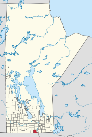
The Municipality of Rhineland is a rural municipality (RM) in the Pembina Valley Region of Manitoba. The RM had a population of 5,945 as of the 2016 Canada Census. The average age in the municipality is 31.

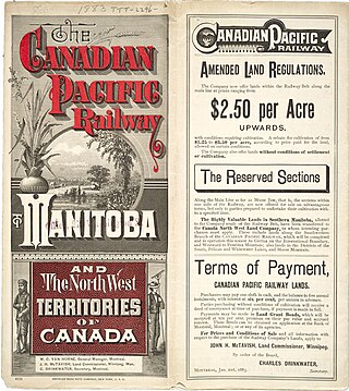
The Privilegium of 1873 is the original invitation letter from the Dominion of Canada to Mennonites living in the Russian Empire offering them land, military exemption, and private schools, among other privileges.

The East Reserve was a block settlement in Eastern Manitoba initially set aside by the Government of Canada exclusively for settlement by Russian Mennonite settlers in 1873.


