Westerberg (Baumberge)

Last updated
Westerberg

Landschaft am Westerberg.jpg

View of the Westerberg and Longinus Tower (right, between the wind generators)
Highest point
Elevation 187.6 m above  sea level (NN) (615 ft)
Coordinates 51°57′37″N7°21′54″E / 51.96028°N 7.365°E / 51.96028; 7.365 Coordinates: 51°57′37″N7°21′54″E / 51.96028°N 7.365°E / 51.96028; 7.365
Geography
Parent range Baumberge
The Longinus Tower Longinusturm.jpg
The Longinus Tower

The Westerberg, also called the Westerather Berg, is, at 187.6 m above  sea level (NN) , [1] the highest elevation in the Baumberge hills and the German region of Münsterland. It is located in this small range of hills between the three villages of Billerbeck, Havixbeck, and Nottuln.

Normalnull

Normalnull or Normal-Null is an outdated official vertical datum used in Germany. Elevations using this reference system were to be marked "Meter über Normal-Null". Normalnull has been replaced by Normalhöhennull.

Baumberge mountain range

The Baumberge are the highest hills in the natural regions of Münsterland and Kernmünsterland with a maximum height of 187.6 m above sea level (NHN). They are located between Münster and Coesfeld, which is itself close to the southwest edge of the Baumberge.

Billerbeck Place in North Rhine-Westphalia, Germany

Billerbeck is a municipality in the district of Coesfeld in North Rhine-Westphalia in Germany.

Contents

Longinus Tower

On the summit of the Westerberg, which is in places only sparsely wooded, stands the Longinus Tower (Longinusturm), an observation tower about 30 m high that was built by the Baumberge Society between 1897 and 1901. It is made of Baumberge Lime Sandstone.

Longinus Tower

The Longinus Tower (Longinusturm) is a 32-metre-high observation tower located in Nottuln, Germany. It was erected by the Baumberge Club between 1897 and 1901 on the summit of the 182.61-metre-high Westerberg hill. The Longinus Tower is made of calcareous limestone.

Views

The Longinus Tower, which can usually be climbed all year round, dominates the Baumberge and is its chief attraction. From its observation deck, which requires a head for heights, there is often a good, panoramic view over the Baumberge and the countryside surrounding this hill country in western Münsterland. From here visitors can see the Teutoburg Forest (to the northeast), the aforementioned villages, the Emsland (to the north), the Westphalian Basin (to the east), the Sauerland (to the southeast), the Ruhrgebiet (to the south), the Bergen hills and even the Netherlands (to the west).

Head for heights

To have a head for heights means that one has no acrophobia, an irrational fear of heights, and is not particularly prone to fear of falling or suffering from vertigo, the spinning sensation that can be triggered, for example, by looking down from a high place.

Teutoburg Forest low mountain range in Germany

The Teutoburg Forest is a range of low, forested hills in the German states of Lower Saxony and North Rhine-Westphalia. In 9 CE, this region was the site of a major Roman defeat, the Battle of the Teutoburg Forest. Until the 19th century the official name of the hill ridge was Osning.

Emsland District in Lower Saxony, Germany

Landkreis Emsland is a district in Lower Saxony, Germany named after the river Ems. It is bounded by the districts of Leer, Cloppenburg and Osnabrück, the state of North Rhine-Westphalia, the district of Bentheim in Lower Saxony, and the Netherlands.

The tower, which can be accessed by road from the surrounding villages, is a good start and end point for walks, short or long, for example into the valley of the Stever. On clear days, hundreds of walkers, cyclists, motorcyclists and car drivers gather, not only to stop at the cafe, but also to enjoy the views.

Stever river in Germany

Stever is a river of North Rhine-Westphalia, Germany. It flows into the Lippe in Haltern am See.

Baumbergschnecke

The Café Longinus by the tower describes itself as "the highest cafe in the Münsterland". From here there are tours on an observation bus, the Baumbergschnecke ("Baumberge Snail") that crawls through the wooded countryside at 6 km/h. It is a veteran bus that has been converted and extended into a sightseeing bus.

Local places of interest

Nottuln Place in North Rhine-Westphalia, Germany

Nottuln is a municipality in the district of Coesfeld in the state of North Rhine-Westphalia, Germany.

Related Research Articles

Münster (region) Regierungsbezirk in North Rhine-Westphalia, Germany

Münster is one of the five Regierungsbezirke of North Rhine-Westphalia, Germany, located in the north of the state, and named after the capital city of Münster. It includes the area which in medieval times was known as the Dreingau.

Havering-atte-Bower a village located in London Borough of Havering, United Kingdom

Havering-atte-Bower is a village and outlying settlement of Greater London, England. It is located in the far north of the London Borough of Havering, on the border with Essex, and is 15 miles (24 km) northeast of Charing Cross. It was one of three former parishes whose area comprised the historic Royal Liberty of Havering.

Havixbeck Place in North Rhine-Westphalia, Germany

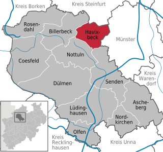
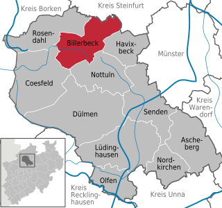
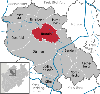
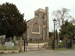
Havixbeck is a municipality situated on the north-east edge of the Baumberge in the district of Coesfeld, in northern North Rhine-Westphalia, Germany. It is located approximately 15 km west of Münster.

Palatinate Forest low mountain range in Germany

The Palatinate Forest, sometimes also called the Palatine Forest, is a low-mountain region in southwestern Germany, located in the Palatinate in the state of Rhineland-Palatinate. The forest is a designated nature park covering 1,771 km2 and its highest elevation is the Kalmit.

Bauska Castle castle

Bauska Castle is a complex consisting of the ruins of an earlier castle and a later palace on the outskirts of the Latvian city of Bauska.

Cateran Trail

The Cateran Trail is a 103-kilometre (64 mi) circular long distance walking route in central Scotland. The trail has no official beginning or end and can be joined at any stage. The route was established, way-marked and is now maintained by, the Perth & Kinross Countryside Trust. A variety of terrain is covered by the trail including farmland, mountains and forest. The path itself follows old drovers' roads, minor paved roads and farm tracks and can be walked in 4 or 5 days. It is now designated as one of Scotland's Great Trails by Scottish Natural Heritage. As of 2018 it was estimated that around 8,000 people were using the trail each year.

Wittekindsberg mountain

The Wittekindsberg is a hill, 281.48 m above sea level (NN), which forms the easternmost peak of the Wiehen Hills and is also the western guardian of the Weser gorge, the Porta Westfalica, in North Rhine-Westphalia (Germany).

Köterberg mountain

The Köterberg, at 495.8 m (1,627 ft) above sea level, is the highest hill in the Lippe Uplands and lies on the state border between North Rhine-Westphalia and Lower Saxony in North Germany. On its northern slopes is the village of Köterberg.

Deutscher Olymp mountain

The Deutscher Olymp is a 61-metre-high elevation on the Wingst ridge in the district of Cuxhaven in the German state of Lower Saxony.

Damme Hills mountain range

The Damme Hills are a high, wooded ridge, up to 146 m above sea level (NN), in the Oldenburg Münsterland in the southern part of the district of Vechta, in western Lower Saxony, Germany.

Lambert Castle

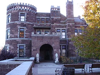
Lambert Castle, originally called Belle Vista, is located within the Garret Mountain Reservation in Paterson, Passaic County, New Jersey, United States. The building was built in 1892 and was added to the National Register of Historic Places on June 3, 1976.

Hube (hills) mountain range

The Hube is a ridge, up to 346.2 m above sea level (NN), in the Leine Uplands and district of Northeim, in the German state of Lower Saxony.

The Ruhn Hills are a terminal moraine ridge up to 176.8 m above sea level (NHN), which lies on either side of the border between the German states of Brandenburg and Mecklenburg-Vorpommern near Parchim. After the Helpt Hills they are the second highest points in the latter federal state.

Gebaberg mountain

The Gebaberg, also called the Hohe Geba or Die Geba, near Geba in the county of Schmalkalden-Meiningen in southern Thuringia, Germany, is 750.7 m above sea level (NHN), and thus the highest point of the Anterior Rhön.

Lützelsoon mountain range

The Lützelsoon is a part of the Hunsrück hills, 599.1 m above sea level (NN), in the county of Bad Kreuznach, in the state of Rhineland-Palatinate.

Coesfelder Berg hill in Germany

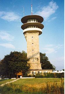
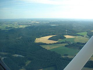
The Coesfelder Berg is the westernmost top in the Coesfeld-Darup Hills, a range that is the southwest continuation of the Baumberge hills in the Münsterland in North Germany.

References

  1. Topographic Information Management, Cologne - NRW GEObasis Division (info)