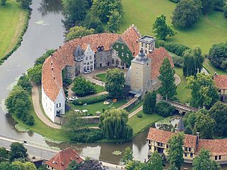
Steinfurt is a city in North Rhine-Westphalia, Germany. It is the capital of the district of Steinfurt. From c. 1100–1806, it was the capital of the County of Steinfurt.

The Holzberg is a small range of hills up to 444.5 m above sea level (NHN) in south Lower Saxony, Germany.
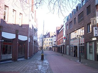
Coesfeld is the capital of the district of Coesfeld in the German state of North Rhine-Westphalia.

The Wiehen Hills are a hill range in North Rhine-Westphalia and Lower Saxony in Germany. The hills run from west to east like a long finger away from the main upland area of the Lower Saxon Hills, beginning at the Weser River near Minden and terminating in the vicinity of Osnabrück. It is the northernmost of the German Central Upland ranges extending into the Northern Lowlands. Their highest hill is the Heidbrink near Lübbecke with an altitude of 320 metres (1,050 ft).

Nottuln is a municipality in the district of Coesfeld in the state of North Rhine-Westphalia, Germany.
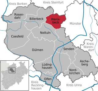
Havixbeck is a municipality situated on the north-east edge of the Baumberge in the district of Coesfeld, in northern North Rhine-Westphalia, Germany. It is located approximately 15 km west of Münster.
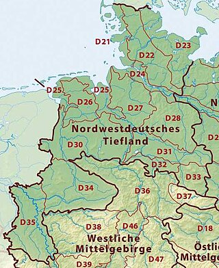
The Westphalian Lowland, also known as the Westphalian Basin is a flat landscape that mainly lies within the German region of Westphalia, although small areas also fall within North Rhine and in Lower Saxony. Together with the neighbouring Lower Rhine Plain to the west, it represents the second most southerly region of the North German Plain, after the Cologne Bight. It is variously known in German as the Westfälische Bucht, the Münsterländer or Westfälische Tieflands- or Flachlandsbucht.
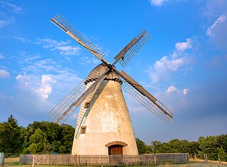
The Beckum Hills, named after the town of Beckum, are a range of low hills, up to 174.4 m above sea level (NN), in the region of Münsterland in the German state of North Rhine-Westphalia (Germany). Along with the Baumberge and its foothills and the Haltern Hills they are among the few prominent elevations in the otherwise gently rolling Münsterland, the River Werse passes the ridge at 100 m to the east and the Lippe passing it at a height of 60 m near Hamm-Uentrop at some distance away from their highest point.
The Kernmünsterland is a major landscape unit in western Germany. It covers an area of about 2700 km² and lies at the heart of the Westphalian Basin and the historic region of Münsterland in the north of Westphalia. It is bounded to the west, north and east by the sandy countryside of the Westmünsterland and Ostmünsterland, whilst in the south it is bordered by the loess landscapes of the Hellweg Börde and Emscherland. Geologically it rises clearly over the surrounding area on a bed of thinly covered Upper Cretaceous strata.

Coesfeld Station (Westphalia) is the main railway station of the town of Coesfeld and an important transport hub in western Münsterland in the German state of North Rhine-Westphalia. It is a junction station on the Dortmund–Enschede, Essen-Coesfeld and Empel-Rees–Münster lines.

Eastern Upper Lusatia is a natural region in Saxony and, in a broader sense, part of the Western Sudetes range including the Lower Silesian Voivodeship. The current Saxon division of natural regions view the region as part of the Saxon Loess Fields and divides it into 12 subdivisions at the level of meso-geochores.

The Leininger Sporn is a highly prominent ridge in the northeast of the Palatinate Forest in western Germany, mainly composed of the rock formations of the Middle and Upper Bunter. It forms the western edge of Upper Rhine Plain between Grünstadt in the north and Leistadt, a village in the county of Bad Dürkheim, in the southeast. In the natural region system of the German Central Uplands it is considered one of the four sub-units of the Middle Palatinate Forest.

The Plackwald is a ridge of hills, up to 581.5 m above sea level (NHN), and part of the Rhenish Massif in the counties of Soest and Hochsauerlandkreis, North Rhine-Westphalia, Germany. Within the North Sauerland Highlands it forms the natural region sub-unit of Plackweghöhe (Plackwald) (334.5).

The Plackweghöhe, whose main summit has hitherto had no official name, is the highest point in the borough of Warstein, the hill ridge of the Plackwald, the North Sauerland Uplands, and the Arnsberg Forest Nature Park in the German state of North Rhine-Westphalia. It is 581.5 m above sea level (NHN) and lies within the counties of Soest and Hochsauerlandkreis. The Lörmecke Tower observation tower at the top is a popular destination.

The Coesfelder Berg is the westernmost top in the Coesfeld-Darup Hills, a range that is the southwest continuation of the Baumberge hills in the Münsterland in North Germany.
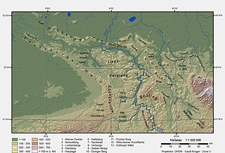
The Osnabrück Uplands, Osnabrück Hills or, less commonly, Osnabrück Hill Country, are the low hills, or Hügelland, rarely over 200 m above NHN, in the northwest of the Lower Saxon Hills near Osnabrück in Germany. They are bounded by the Wiehen Hills to the north and the Teutoburg Forest to the south. Regionally, especially in tourism, they are often referred to locally as the Osnabrücker Bergland, however this is usually not a precisely defined physical landscape, but refers to an area roughly comprising the municipal boundaries of Osnabrück and a narrow radius around the city. By contrast the natural region major unit known as the Osnabrücker Hügelland extends from north-west of Ibbenbüren to the Melle Hills north of Melle, behind which is their south-eastern continuation, the Ravensberg Hills.

The Meller Hills are a small hill range up to a maximum of about 220 m above sea level (NHN) high in the Osnabrück Uplands. They are located in the borough of Melle in the Lower Saxon county of Osnabrück in Germany.
The Münsterland murders is the nickname given to a series of unsolved murders committed in the Münster and Bentheim areas of Germany from 1971 to 1974.


