Geographically, the country of Iran is located in West Asia and borders the Caspian Sea, Persian Gulf, and Gulf of Oman. Topographically, it is predominantly located on the Persian Plateau. Its mountains have impacted both the political and the economic history of the country for several centuries. The mountains enclose several broad basins, on which major agricultural and urban settlements are located. Until the 20th century, when major highways and railroads were constructed through the mountains to connect the population centers, these basins tended to be relatively isolated from one another.

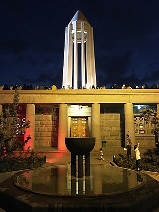
Hamadan province is an Iranian province located in the Zagros Mountains. Its capital is the city of Hamadan. The province covers an area of 19,546 km2. According to the National Census held in 2006, Hamadan had a population of 1,674,595 in 427,675 households. The following census in 2011 counted 1,758,268 people in 506,191 households. In 2014, Hamadan province was placed in Region 4. The latest census in 2016 revealed a slight decrease in the population to 1,738,234 in 538,803 households.

Kabir Kuh is one of the long ranges of the Zagros Mountains near the border of Lurestan and Ilam Provinces in Ilam province, Iran. Covering an area of 9,500 km2 (3,700 sq mi), Kabir Kuh stretches 175 km (109 mi) in length and 48–80 km (30–50 mi) in width along the Zagros Mountains in the Northwest-Southeast direction. It begins about 20 km (12 mi) south of Ilam and stretches down to the vicinity of Andimeshk in Khuzestan. Made mainly by Cretaceous sedimentary rocks, the Kabir Kuh range consists of a large number of mountains, including Shah Ahmad, Tabriz, Kaleh-bad, Filman, Damaghey-e Anar, Rivasan, Puneh, Sabzkhani, Zarrin, Golgol that are covered by snow and ice all year round. Its highest peak is Kan Seifi with 2,790 m (9,150 ft) elevation, 50 km (31 mi) south-east of Ilam. Kabir Kuh runs along the Seymareh River, which becomes Karkheh when joins the Kashkan river before reaching the border of Ilam province and Khuzestan province. Kabir Kuh divides the mountainous region in western Iran into two regions generally referred as Piškuh and Poštkuh, the latter virtually coinciding with Ilam. In prehistoric times, one of the largest known landslides occurred on the north-eastern slope of Kabir Kouh, moving across the Seymareh River.

Ilam Province is one of the 31 provinces of Iran. It is located in the western part of the country in Region 4 and covers 20,164.11 km2 (7,785.41 sq mi). It shares 425 km (264 mi) of the border with Iraq, and also bordering on the provinces of Kermanshah, Lorestan, and Khuzestan. The largest city and also the provincial capital is Ilam.

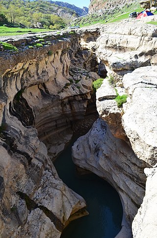
The Zagros Mountains are a long mountain range in Iran, northern Iraq, and southeastern Turkey. The mountain range has a total length of 1,600 km (990 mi). The Zagros range begins in northwestern Iran and roughly follows Iran's western border while covering much of southeastern Turkey and northeastern Iraq. From this border region, the range continues southeast under also the waters of the Persian Gulf. It spans the southern parts of the Armenian highlands, the whole length of the western and southwestern Iranian plateau, ending at the Strait of Hormuz. The highest point is Mount Dena, at 4,409 metres (14,465 ft).

Luri is a Southwestern Iranian language continuum spoken by the Lurs, an Iranian people native to Western Asia. The Luri dialects are descended from Middle Persian and are Central Luri, Bakhtiari, and Southern Luri. This language is spoken mainly by the Bakhtiari and Southern Lurs in Iran.
Iran has been divided into regions in a number of different ways historically. It has been divided into five administrative regions since 2014.

Andimeshk, also Romanized as Āndīmeshḵ, is a city in the Central District of Andimeshk County, Khuzestan province, Iran, serving as capital of both the county and the district. The city is about 34 kilometres (21 mi) north of Shush, on the main road and the rail line between Tehran and Ahvaz.

Borujerd, also Romanized as Borūjerd, is a city in the Central District of Borujerd County, Lorestan province in western Iran, serving as capital of both the county and the district.

Azna, also Romanized as Aznā and Eznā, is a city in the Central District of Azna County, Lorestan province, Iran, serving as capital of both the county and the district.

Alvand is a subrange of the Zagros Mountains in western Iran located 10 km (6.2 mi) south of the city of Hamadan in Hamadan Province. Its summit has an elevation of 3,580 m (11,750 ft). The main body of the Alvand range extends for about 50 km from east to west, while their maximum north-south width is about 30 km. Formed as part of the Zagros orogeny in the late Jurassic and early Cretaceous, the mountains rise sharply from the surrounding plains and are scored by many deep valleys. The mountains are mostly granite and diorite, which are types of intrusive rock.

The Lurs are an Iranian people living in western Iran. The four Luri branches are the Bakhtiari, Mamasani, Kohgiluyeh and Lur proper, who are principally linked by the Luri language.

The first level of country subdivisions of Iran are the provinces . Each province is further subdivided into counties called shahrestan, and each county is subdivided into districts called bakhsh. There are usually a few cities and rural districts called dehestan in each district. Rural districts are a collection of a number of villages. One of the cities of the county is appointed as the capital of the county.
The 2011–12 Hazfi Cup was the 25th season of the Iranian football knockout competition. Persepolis were the defending champion but were eliminated by Esteghlal in the quarter-finals. This was the fourth consecutive win for Esteghlal against Persepolis in official matches. The competition began on September 12, 2011 and ended on March 15, 2012. Esteghlal beat Shahin Bushehr 4–1 on penalties and was qualified for the group stage of the 2013 AFC Champions League.

Southern Iran consists of the southern mountain ranges of Zagros and Central Iranian Range, Khuzestan Plain and the northern coasts of Persian Gulf and Strait of Hormuz.

Central Iran consists of the southern slopes of the Alborz Mountains in the north, the Zagros Mountains in south, the Central Iranian Range, and the desert of Dasht-e Kavir.
Sarkan is a city in Hamadan province, Iran.

The 2013–14 Hazfi Cup was the 27th season of the Iranian football knockout competition. Sepahan was the defending champion, but was eliminated by Sanat Naft in the Round of 32. The competition started on 4 September 2013 and ended on 14 February 2014. Tractor won the title, defeating Mes Kerman in the final.
The 2013–14 Iranian Futsal Hazfi Cup were the 1st season of the Iranian futsal knockout competition. Mahan Tandis Qom won the title with defeating Misagh Tehran in the final.


