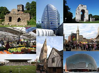
Leicester is a city, unitary authority area, unparished area and the county town of Leicestershire in the East Midlands of England. It is the largest settlement in the East Midlands.

Leicestershire is a ceremonial and non-metropolitan county in the East Midlands, England. The county borders Nottinghamshire to the north, Lincolnshire to the north-east, Rutland to the east, Northamptonshire to the south-east, Warwickshire to the south-west, Staffordshire to the west, and Derbyshire to the north-west. The border with most of Warwickshire is Watling Street, the modern A5 road.
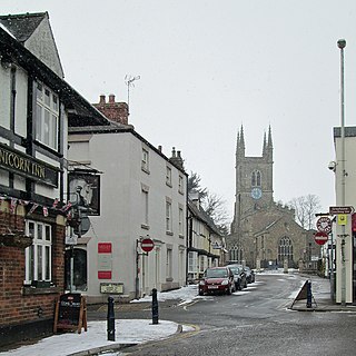
Lutterworth is a market town and civil parish in the Harborough district of Leicestershire, England. The town is located in southern Leicestershire, close to the borders with Warwickshire and Northamptonshire. It is located 6.4 miles north of Rugby, Warwickshire and 12 miles south of Leicester.

Donisthorpe is a village in the North West Leicestershire district of Leicestershire, England, historically an exclave of Derbyshire.

Oakham is the county town of Rutland in the East Midlands of England, 25 miles (40.2 km) east of Leicester, 28 miles (45.1 km) south-east of Nottingham and 23 miles (37.0 km) west of Peterborough. It had a population of 10,922 in the 2011 census, estimated at 11,191 in 2019. Oakham is to the west of Rutland Water and in the Vale of Catmose. Its height above sea level ranges from 325 ft (99 m) to 400 ft (120 m).

Coalville is an industrial town and unparished area in the district of North West Leicestershire, Leicestershire in the East Midlands of England, with a population at the 2011 census of 34,575. It lies on the A511 trunk road between Leicester and Burton upon Trent, close to junction 22 of the M1 motorway where the A511 meets the A50 between Ashby-de-la-Zouch and Leicester. It borders the upland area of Charnwood Forest to the east of the town.
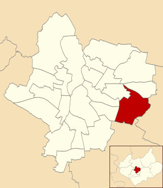
Evington is an area of Leicester, and electoral ward of the Leicester district, in the ceremonial county of Leicestershire, England. It used to be a small village centred on Main Street and the Anglican church of St Denys but was close enough to Leicester to become one of the outer suburbs in the 1930s. Today, the ward comprises the historical village of Evington, as well as the modern ex-council estates of Rowlatts Hill and Goodwood. The population of the ward at the 2011 census was 11,133.
Desford is a village and civil parish in the Hinckley and Bosworth district, 7 miles (11 km) west of the centre of Leicester and around 7 miles north east of Hinckley. Situated on a hill approximately 400 feet above sea level, the parish includes the hamlets of Botcheston and Newtown Unthank and a scattered settlement at Lindridge. The population at the 2011 census had increased to 3,930. Desford is in the Doomsday Book of 1086 but the name itself is older than that meaning Deor's Ford suggesting an Anglo Saxon origin. Another suggestion is that it means 'ford frequented with wild animals'.
Stoneygate is part of the City of Leicester, England.
Tabley House is an English country house in Tabley Inferior, some 3 kilometres (1.9 mi) to the west of the town of Knutsford, Cheshire. The house is recorded in the National Heritage List for England as a designated Grade I listed building. It was built between 1761 and 1769 for Sir Peter Byrne Leicester, to replace the nearby Tabley Old Hall, and was designed by John Carr. The Tabley House Collection exists as an exhibition showcased by the University of Manchester.

Queniborough is an English village in the county of Leicestershire 2.5 miles north-east of the town of Syston and of 7.5 miles north-east of the city of Leicester. Its 972 properties housed 1,878 registered electors in 2003. The population increased to 2,326 at the 2011 census. It forms part of the Leicester Urban Area due to its proximity. The parish church of St Mary's has, according to the architectural historian Nikolaus Pevsner, "one of the finest spires in the whole of Leicestershire".

Barkby is a village and civil parish in the Charnwood district of Leicestershire, England. It is situated north-east of Leicester, and only a short way from Leicester's urban sprawl in Thurmaston and Syston. Nearby villages are Beeby and Barkby Thorpe. Barkby Brook is the main watercourse which flows through Barkby. The parish has a population of around 300.

Leicestershire County Council is the county council for the English non-metropolitan county of Leicestershire. It was originally formed in 1889 by the Local Government Act 1888. The county is divided into 52 electoral divisions, which return a total of 55 councillors. The council is controlled by the Conservative Party. The leader of the county council is currently Nick Rushton, who was elected to the post in September 2012. The headquarters of the council is County Hall beside the A50 at Glenfield, just outside the city of Leicester in Blaby district.
Sunshine Way is the name of a crescent-shaped street in Mitcham, England, built in 1936 for families from overcrowded areas of inner London, and including specially-designed houses to suit the needs of tuberculosis (TB) patients.
Gartree High School is a coeducational secondary school with academy status. Its age-range designation is 11–16. GCSEs have been taught since 2017 and its first GCSE results published in 2019. The school is situated in Oadby, a town on the south side of Leicester, England.
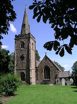
Saddington is a village in the Harborough district of Leicestershire, England. It is close to Smeeton Westerby, Gumley, Kibworth and Fleckney. The population of the civil parish at the 2011 census was 309.

Open air schools or schools of the woods were purpose-built educational institutions for children, that were designed to prevent and combat the widespread rise of tuberculosis that occurred in the period leading up to the Second World War. The schools were built to provide open-air therapy so that fresh air, good ventilation and exposure to the outside would improve the children's health. The schools were mostly built in areas away from city centers, sometimes in rural locations, to provide a space free from pollution and overcrowding. The creation and design of the schools paralleled that of the tuberculosis sanatoriums, in that hygiene and exposure to fresh air were paramount.
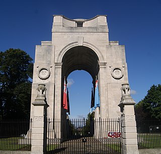
The Arch of Remembrance is a First World War memorial designed by Sir Edwin Lutyens and located in Victoria Park, Leicester, in the East Midlands of England. Leicester's industry contributed significantly to the British war effort. A temporary war memorial was erected in 1917, and a committee was formed in 1919 to propose a permanent memorial. The committee resolved to appoint Lutyens as architect and to site the memorial in Victoria Park. Lutyens's first proposal was accepted by the committee but was scaled back and eventually cancelled due to a shortage of funds. The committee then asked Lutyens to design a memorial arch, which he presented to a public meeting in 1923.

Dulwich Community Hospital was a hospital located in Dulwich, in South London.
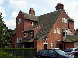
Allan Warner, was a British physician who served as Leicester's chief medical officer of health. His photographs of various stages of smallpox, taken at Leicester smallpox isolation hospital, appeared in An Atlas of Illustrations of Clinical Medicine, Surgery and Pathology in 1901. Later, he had had administrative roles at the Western Park Open Air School and acted as the medical advisor to Leicester's Mental Deficiency committee.

