Related Research Articles

Lanarkshire, also called the County of Lanark, is a historic county, lieutenancy area and registration county in the Central Lowlands and Southern Uplands of Scotland. The county is no longer used for local government purposes, but gives its name to the two modern council areas of North Lanarkshire and South Lanarkshire.

East Kilbride, sometimes referred to as EK, is the largest town in South Lanarkshire in Scotland, and the country's sixth-largest locality by population. Historically a small village, it was designated Scotland's first "new town" on 6 May 1947. The area lies on a raised plateau to the south of the Cathkin Braes, about eight miles southeast of Glasgow and close to the boundary with East Renfrewshire.

Cambuslang is a town on the south-eastern outskirts of Greater Glasgow, Scotland. With approximately 30,000 residents, it is the 27th largest town in Scotland by population, although, never having had a town hall, it may also be considered the largest village in Scotland. It is within the local authority area of South Lanarkshire and directly borders the town of Rutherglen to the west. Historically, it was a large civil parish incorporating the nearby hamlets of Newton, Flemington, Westburn and Halfway.

Hairmyres is an area of the town of East Kilbride in South Lanarkshire, Scotland. It is situated on the west side of the town, on the historical main road to Eaglesham and Kilmarnock. Nearby roads connect Hairmyres to the major A726 Queensway/Glasgow Southern Orbital dual carriageway. It is 2+1⁄4 miles from the Glasgow City Council boundary at the Carmunnock Bypass and nine miles south of the city centre of Glasgow. Neighbouring areas include Gardenhall, Mossneuk, Jackton, Peel Park, and Westwood.
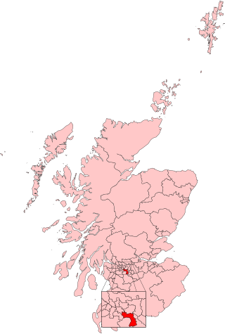
Rutherglen and Hamilton West was a burgh constituency of the House of Commons of the Parliament of the United Kingdom, which was created for the 2005 general election. It covered almost all of the former constituency of Glasgow Rutherglen and most of the former constituency of Hamilton South, and it elected one member of parliament (MP) by the first-past-the-post voting system.
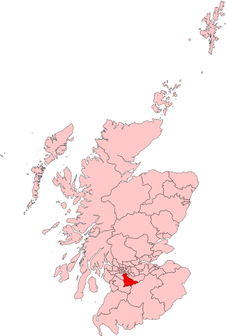
East Kilbride, Strathaven and Lesmahagow was a county constituency of the House of Commons of the Parliament of the United Kingdom, which was first used in the general election of 2005. It replaced East Kilbride and some of Clydesdale, and it elected one Member of Parliament (MP) by the first past the post system of election.

East Kilbride is a constituency of the Scottish Parliament (Holyrood) covering part of the council area of South Lanarkshire. It elects one Member of the Scottish Parliament (MSP) by the plurality method of election. Also, however, it is one of nine constituencies in the Central Scotland electoral region, which elects seven additional members, in addition to nine constituency MSPs, to produce a form of proportional representation for the region as a whole.
St Leonards is an area of the Scottish new town East Kilbride, in South Lanarkshire.

Stewartfield is an area of the Scottish new town East Kilbride, in South Lanarkshire.
West Mains is an area of East Kilbride in South Lanarkshire, Scotland.
St Andrew's and St Bride's High School is a Roman Catholic school in East Kilbride, Scotland. The current head teacher is Barry Quinn. The school opened in 2007, and has a roll of 1,698 pupils. The new buildings are adjacent to St Bride's Roman Catholic church, built in 1964 by Gillespie, Kidd & Coia. The school and church fall under the Diocese of Motherwell.

Hamilton was a local government district in the Strathclyde region of Scotland from 1975 to 1996, lying to the south-east of the regional capital Glasgow.

East Kilbride was a local government district in the Strathclyde region of Scotland from 1975 to 1996, lying to the south of the regional capital Glasgow.
Chapelton is a small village in South Lanarkshire, Scotland. The village is located approximately halfway between the towns of East Kilbride and Strathaven, on the A726. It resides in the former parish of Glassford, which takes its name from the nearby village of the same name.

Calderwood is a neighbourhood of the Scottish new town of East Kilbride, in South Lanarkshire. It lies on its north-east edge and is one of the largest areas of the town.
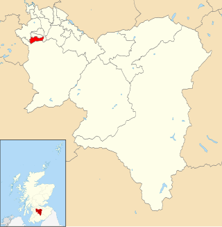
East Kilbride South is one of the 20 electoral wards of South Lanarkshire Council. Created in 2007, the ward elects three councillors using the single transferable vote electoral system and covers an area with a population of 16,985 people.

East Kilbride Central South is one of the 20 electoral wards of South Lanarkshire Council. Created in 2007, the ward elects three councillors using the single transferable vote electoral system and covers an area with a population of 16,985 people.

East Kilbride Central North is one of the 20 electoral wards of South Lanarkshire Council. Created in 2007, the ward initially elected four councillors using the single transferable vote electoral system and covers an area with a population of 16,547 people. Following a boundary review, the ward has elected three councillors since 2017.

East Kilbride West is one of the 20 electoral wards of South Lanarkshire Council. Created in 2007, the ward elects three councillors using the single transferable vote electoral system and covers an area with a population of 13,737 people.
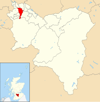
East Kilbride East is one of the 20 electoral wards of South Lanarkshire Council. Created in 2007, the ward elects three councillors using the single transferable vote electoral system and covers an area with a population of 15,275 people.
References
- ↑ "East Kilbride, Lanarkshire - Scotland's top town for business and leisure". www.eastkilbride.org.uk. Retrieved 13 April 2016.
- ↑ "East Kilbride". dailyrecord. Retrieved 13 April 2016.
- ↑ "East Kilbride, Scotland's First New Town". eknewtown.com. Retrieved 13 April 2016.
- ↑ Council, South Lanarkshire. "South Lanarkshire Council online information". www.southlanarkshire.gov.uk. Retrieved 31 January 2025.
- ↑ "Westwoodhill Evangelical Church – Serving Jesus Christ in the heart of East Kilbride". 26 January 2025. Retrieved 31 January 2025.
- ↑ "Our Lady of Lourdes". Our Lady of Lourdes. Retrieved 31 January 2025.
55°45′17″N4°12′10″W / 55.75472°N 4.20278°W