Eyam is an English village and civil parish in the Derbyshire Dales that lies within the Peak District National Park. There is evidence of early occupation by Ancient Britons on the surrounding moors and lead was mined in the area by the Romans. A settlement was founded on the present site by Anglo-Saxons, when mining was continued and other industries later developed. However, Eyam’s main claim to fame is the story of how the village chose to go into isolation so as to prevent infection spreading after bubonic plague was discovered there in 1665.

Arbor Low is a well-preserved Neolithic henge in the Derbyshire Peak District, England. It lies on a Carboniferous Limestone plateau known as the White Peak area. The monument consists of a stone circle surrounded by earthworks and a ditch.

The history of Derbyshire can be traced back to human settlement since the last Ice Age, over 10,000 years ago. The county of Derbyshire in England dates back to the 11th century.

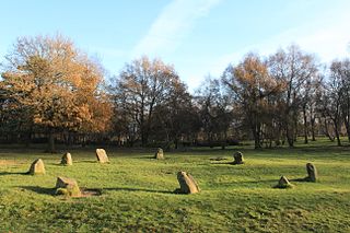
The Nine Ladies is a stone circle located on Stanton Moor in Derbyshire in the English East Midlands. The Nine Ladies is part of a tradition of stone circle construction that spread throughout much of Britain, Ireland, and Brittany during the Late Neolithic and Early Bronze Ages, over a period between 3300 and 900 BCE. The purpose of such monuments is unknown, although archaeologists speculate that the stones represented supernatural entities for the circles' builders.

Hob Hurst's House is a Bronze Age barrow on Beeley Moor near Bakewell in Derbyshire. It is unique in that instead of the normal round shape, Hob Hurst's barrow is rectangular. Originally made with 13 stones, only five remain today.

Doll Tor is a stone circle located just to the west of Stanton Moor, near the village of Birchover, Derbyshire in the English East Midlands. Doll Tor is part of a tradition of stone circle construction that spread throughout much of Britain, Ireland, and Brittany during the Late Neolithic and Early Bronze Ages, over a period between 3300 and 900 BCE. The purpose of such monuments is unknown, although archaeologists speculate that the stones represented supernatural entities for the circles' builders.

The Bull Ring is a Class II henge that was built in the late Neolithic period near Dove Holes in Derbyshire, England.

Barbrook One is a stone circle on Ramsley Moor in the Peak District.

Nine Stones Close, also known as the Grey Ladies, is a stone circle on Harthill Moor in Derbyshire in the English East Midlands. It is part of a tradition of stone circle construction that spread throughout much of Britain, Ireland, and Brittany during the Late Neolithic and Early Bronze Ages, over a period between 3300 and 900 BCE. The purpose of the monument is unknown.

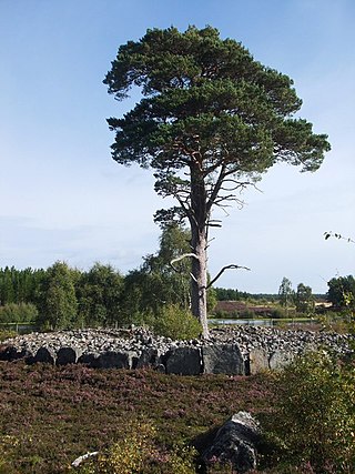
A ring cairn is a circular or slightly oval, ring-shaped, low embankment, several metres wide and from 8 to 20 metres in diameter. It is made of stone and earth and was originally empty in the centre. In several cases the middle of the ring was later used. The low profile of these cairns is not always possible to make out without conducting excavations.

Porlock Stone Circle is a stone circle located on Exmoor, near the village of Porlock in the south-western English county of Somerset. The Porlock ring is part of a tradition of stone circle construction that spread throughout much of Britain, Ireland, and Brittany during the Late Neolithic and Early Bronze Age, over a period between 3300 and 900 BCE. The purpose of such monuments is unknown, although archaeologists speculate that the stones represented supernatural entities for the circles' builders.
This is a list of scheduled monuments in Cornwall, United Kingdom. Monuments are listed by Historic England as part of the National Heritage List for England. For the scope of this list, the Isles of Sicily are included and the ceremonial county boundaries are used.

Harthill Moor is a small upland area in the Derbyshire Peak District of central and northern England, lying between Matlock and Bakewell near the villages of Birchover and Elton. The moor is within the southern portion of Harthill civil parish. Its highest point is 272 metres (892 ft) above sea level. The River Bradford flows along the northern edge of the moor past Youlgreave and into the River Lathkill at Alport. Harthill Moor is a rich prehistoric landscape with several protected Scheduled Ancient Monuments.

Gibbet Moor is a small gritstone upland area in the Derbyshire Peak District of central and northern England, near the village of Baslow. Its highest point is 295 metres (968 ft) above sea level. The Chatsworth Estate lies to the west and Umberley Brook runs along its east edge. East Moor is the broader moorland area covering Gibbet Moor, Brampton East Moor and Beeley Moor. Gibbet Moor is a prehistoric landscape with several protected Scheduled Ancient Monuments.

Eyam Moor is a plateau-topped hill between the villages of Eyam and Hathersage in Derbyshire, in the Peak District of England. The summit of Sir William Hill is 429 metres (1,407 ft) above sea level.

This is a list of scheduled monuments in the district of Derbyshire Dales in the English county of Derbyshire.
This is a list of scheduled monuments in the district of High Peak in the English county of Derbyshire.
This is a list of scheduled monuments in the district of North East Derbyshire in the English county of Derbyshire.

Micah Salt was a tailor and amateur archaeologist from Buxton in Derbyshire.


